Chase, Kansas
| Chase, Kansas | |
|---|---|
| City | |
 Location within Rice County and Kansas | |
 KDOT map of Rice County (legend) | |
| Coordinates: 38°21′20″N 98°20′55″W / 38.35556°N 98.34861°WCoordinates: 38°21′20″N 98°20′55″W / 38.35556°N 98.34861°W | |
| Country | United States |
| State | Kansas |
| County | Rice |
| Township | Lincoln |
| Area[1] | |
| • Total | 0.29 sq mi (0.75 km2) |
| • Land | 0.29 sq mi (0.75 km2) |
| • Water | 0 sq mi (0 km2) |
| Elevation | 1,716 ft (523 m) |
| Population (2010)[2] | |
| • Total | 477 |
| • Estimate (2015)[3] | 460 |
| • Density | 1,600/sq mi (640/km2) |
| Time zone | Central (CST) (UTC-6) |
| • Summer (DST) | CDT (UTC-5) |
| ZIP code | 67524 |
| Area code | 620 |
| FIPS code | 20-12650 [4] |
| GNIS feature ID | 0475794 [5] |
Chase is a city in Rice County, Kansas, United States. It is approximately seventy-three miles northwest of Wichita. As of the 2010 census, the city population was 477.[6] Chase was founded in 1880.[7]
History

For millennia, the land now known as Kansas was inhabited by Native Americans. In 1803, most of modern Kansas was secured by the United States as part of the Louisiana Purchase. In 1854, the Kansas Territory was organized, then in 1861 Kansas became the 34th U.S. state. In 1867, Rice County was founded.
In 1878, Atchison, Topeka and Santa Fe Railway and parties from Marion County and McPherson County chartered the Marion and McPherson Railway Company.[8] In 1879, a branch line was built from Florence to McPherson, in 1880 it was extended to Lyons, in 1881 it was extended to Ellinwood.[9] The line was leased and operated by the Atchison, Topeka and Santa Fe Railway. The line from Florence to Marion, was abandoned in 1968.[10] In 1992, the line from Marion to McPherson was sold to Central Kansas Railway. In 1993, after heavy flood damage, the line from Marion to McPherson was abandoned. The original branch line connected Florence, Marion, Canada, Hillsboro, Lehigh, Canton, Galva, McPherson, Conway, Windom, Little River, Mitchell, Lyons, Chase, Ellinwood.
Chase was laid out in 1880 when the railroad was extended to that point.[11] The city was named after a railroad official.[12] The first post office in Chase was established in 1881.[13]
Geography
Chase is located at 38°21′20″N 98°20′55″W / 38.35556°N 98.34861°W (38.355682, -98.348743).[14] According to the United States Census Bureau, the city has a total area of 0.29 square miles (0.75 km2), all of it land.[1]
Climate
The climate in this area is characterized by hot, humid summers and generally mild to cool winters. According to the Köppen Climate Classification system, Chase has a humid subtropical climate, abbreviated "Cfa" on climate maps.[15]
Demographics
| Historical population | |||
|---|---|---|---|
| Census | Pop. | %± | |
| 1890 | 358 | — | |
| 1910 | 263 | — | |
| 1920 | 286 | 8.7% | |
| 1930 | 278 | −2.8% | |
| 1940 | 825 | 196.8% | |
| 1950 | 961 | 16.5% | |
| 1960 | 922 | −4.1% | |
| 1970 | 800 | −13.2% | |
| 1980 | 753 | −5.9% | |
| 1990 | 577 | −23.4% | |
| 2000 | 490 | −15.1% | |
| 2010 | 477 | −2.7% | |
| Est. 2015 | 460 | [3] | −3.6% |
| U.S. Decennial Census | |||
2010 census
As of the census[2] of 2010, there were 477 people, 196 households, and 133 families residing in the city. The population density was 1,644.8 inhabitants per square mile (635.1/km2). There were 225 housing units at an average density of 775.9 per square mile (299.6/km2). The racial makeup of the city was 94.8% White, 0.4% African American, 0.6% Asian, 0.6% from other races, and 3.6% from two or more races. Hispanic or Latino of any race were 7.8% of the population.
There were 196 households of which 33.2% had children under the age of 18 living with them, 46.9% were married couples living together, 11.2% had a female householder with no husband present, 9.7% had a male householder with no wife present, and 32.1% were non-families. 27.6% of all households were made up of individuals and 16.3% had someone living alone who was 65 years of age or older. The average household size was 2.43 and the average family size was 2.89.
The median age in the city was 38.4 years. 27.5% of residents were under the age of 18; 9% were between the ages of 18 and 24; 21% were from 25 to 44; 24.9% were from 45 to 64; and 17.6% were 65 years of age or older. The gender makeup of the city was 50.5% male and 49.5% female.
2000 census
As of the census[4] of 2000, there were 490 people, 195 households, and 138 families residing in the city. The population density was 1,671.5 people per square mile (652.4/km²). There were 222 housing units at an average density of 757.3 per square mile (295.6/km²). The racial makeup of the city was 94.49% White, 0.41% Native American, 3.06% from other races, and 2.04% from two or more races. Hispanic or Latino of any race were 6.73% of the population.
There were 195 households out of which 30.8% had children under the age of 18 living with them, 59.0% were married couples living together, 7.2% had a female householder with no husband present, and 29.2% were non-families. 24.6% of all households were made up of individuals and 11.3% had someone living alone who was 65 years of age or older. The average household size was 2.51 and the average family size was 3.03.
In the city the population was spread out with 29.0% under the age of 18, 6.1% from 18 to 24, 24.7% from 25 to 44, 24.5% from 45 to 64, and 15.7% who were 65 years of age or older. The median age was 39 years. For every 100 females there were 87.0 males. For every 100 females age 18 and over, there were 87.1 males.
The median income for a household in the city was $32,361, and the median income for a family was $39,688. Males had a median income of $28,000 versus $20,139 for females. The per capita income for the city was $13,972. About 8.2% of families and 10.7% of the population were below the poverty line, including 17.5% of those under age 18 and 8.6% of those age 65 or over.
See also
References
- 1 2 "US Gazetteer files 2010". United States Census Bureau. Archived from the original on 2012-01-24. Retrieved 2012-07-06.
- 1 2 "American FactFinder". United States Census Bureau. Retrieved 2012-07-06.
- 1 2 "Annual Estimates of the Resident Population for Incorporated Places: April 1, 2010 to July 1, 2015". Retrieved July 2, 2016.
- 1 2 "American FactFinder". United States Census Bureau. Archived from the original on 2013-09-11. Retrieved 2008-01-31.
- ↑ "US Board on Geographic Names". United States Geological Survey. 2007-10-25. Retrieved 2008-01-31.
- ↑ "2010 City Population and Housing Occupancy Status". U.S. Census Bureau. Archived from the original on July 21, 2011. Retrieved September 26, 2011.
- ↑ Kansas State Historical Society (1916). Biennial Report of the Board of Directors of the Kansas State Historical Society. Kansas State Printing Plant. p. 273.
- ↑ Marion County Kansas : Past and Present; Sondra Van Meter; MB Publishing House; LCCN 72-92041; 344 pages; 1972.
- ↑ Fourth Annual Report of the Board of Railroad Commissioners for the Year Ending December 1, 1886 in State of Kansas; Kansas Publishing House; 1886. Books.google.com. Retrieved 2012-05-20.
- ↑ "Railway Abandonment 1968". Abandonedrails.com. 1968-10-14. Retrieved 2012-05-20.
- ↑ History of the State of Kansas: Containing a Full Account of Its Growth from an Uninhabited Territory to a Wealthy and Important State. A. T. Andreas. 1883. p. 760.
- ↑ Capace, Nancy (1 June 2000). Encyclopedia of Kansas. North American Book Dist LLC. p. 150. ISBN 978-0-403-09312-0.
- ↑ "Kansas Post Offices, 1828-1961". Kansas Historical Society. Archived from the original on October 9, 2013. Retrieved 22 June 2014.
- ↑ "US Gazetteer files: 2010, 2000, and 1990". United States Census Bureau. 2011-02-12. Retrieved 2011-04-23.
- ↑ Climate Summary for Chase, Kansas
Further reading
- USA
- The Story of the Marking of the Santa Fe Trail by the Daughters of the American Revolution in Kansas and the State of Kansas; Almira Cordry; Crane Co; 164 pages; 1915. (Download 4MB PDF eBook)
- The National Old Trails Road To Southern California, Part 1 (LA to KC); Automobile Club Of Southern California; 64 pages; 1916. (Download 6.8MB PDF eBook)
External links
| Wikimedia Commons has media related to Chase, Kansas. |
- City
- Schools
- USD 401, local school district
- Maps
- Chase City Map, KDOT
Municipalities and communities of Rice County, Kansas, United States | ||
|---|---|---|
| Cities | 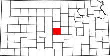 | |
| Unincorporated communities | ||
| Townships | ||