Chamarajanagar district
| Chamarajanagar District ಚಾಮರಾಜನಗರ ಜಿಲ್ಲೆ | |
|---|---|
| district | |
|
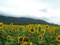
Flower farms on Kerala road | |
| Coordinates: 12°00′N 77°18′E / 12°N 77.3°ECoordinates: 12°00′N 77°18′E / 12°N 77.3°E | |
| Country | India |
| State | Karnataka |
| Headquarters | Chamarajanagar |
| Talukas | Yelandur, Gundlupet, Chamarajanagar, Kollegal, Hanur |
| Area | |
| • Total | 5,101 km2 (1,970 sq mi) |
| Population (2001) | |
| • Total | 965,462 |
| • Density | 189/km2 (490/sq mi) |
| Languages | |
| • Official | Kannada |
| Time zone | IST (UTC+5:30) |
| PIN | 571 313 |
| Telephone code | 08226 |
| ISO 3166 code | IN-KL |
| Vehicle registration | KA-10 |
| Website |
chamrajnagar |


Chamarajanagar is the southernmost district in the state of Karnataka, India. It was carved out of the original larger Mysore District in the year 1998. Chamarajanagar town is the headquarters of this district.[1]
It is the third least populous district in Karnataka (out of 30), after Kodagu and Bangalore Rural.[2]
History
Chamarajanagar was earlier known as Arikottara. Chamaraja Wodeyar, the Wodeyar king of Mysooru was born here and hence this place was renamed after him. The Vijaya Parsvanath Basadi, a holy Jain shrine was constructed by Punisadandanayaka, the commander of the Hoysala king Gangaraja in the year 1117 A.D.
Geography
Being the southernmost district of Karnataka, Chamarajanagar district borders the state of Tamil Nadu and Kerala. Specifically, it borders Mysooru district of Karnataka to the west and north, Mandya and Ramanagara districts of Karnataka to the north-east, Dharmapuri district of Tamil Nadu to the east, Salem and Erode districts of Tamil Nadu to the south-east, Nilgiris district of Tamil Nadu to the south and Wayanad district of Kerala to the south-west.
National Highway 209 starts from Bengaluru in Karnataka and ends at NH 7 north of Dindigul in Tamil Nadu pass through the district at Kollegal and ends up at Punajur, the western ghats near the Tamil Nadu - Karnataka border.
Most of the district lies in the leeward region of the Nilgiris and consists of mainly semi-arid rain-dependent flatlands along with forested hills.
Demographics
According to the 2011 census Chamarajanagar district has a population of 1,020,962,[2] roughly equal to the nation of Cyprus[3] or the US state of Montana.[4] This gives it a ranking of 441st in India (out of a total of 640).[2] The district has a population density of 200 inhabitants per square kilometre (520/sq mi) .[2] Its population growth rate over the decade 2001-2011 was 5.75%.[2] Chamarajanagar has a sex ratio of 989 females for every 1000 males,[2] and a literacy rate of 61.12%.[2]
Having a large percentage of forest cover, the district also has a high population of forest-dwelling tribals; prominent among them are the Soligas, Yeravas, Jenu Kurubas and Betta Kurubas. These tribals have their own dialect and their total population is said to be around 82,000.
Bandit Veerappan
Since much of the southern area of the district is dense forest, it provided good refuge to the notorious bandit Veerappan, responsible for the death of over a hundred policemen. He was shot dead in an encounter with the specially formed Special Task Force (STF) on 18 October 2004, in Dharmapuri district, Tamil Nadu. He had been on the run for over two decades. The presence of illegal quarrying for black stone imposes a great threat to the forests in the region.
Tourist attractions
The main tourist attractions are Biligiriranga Hills, Male Mahadeshwara Hills and Shivasamudram falls. Bandipur national park also attracts many visitors. Gopalaswamy Hills in Gundlupet also attracts many visitors.
Image gallery
 Lunch at Gundlupet
 Dargah at Sathyagala
 Rama Mandhira, Badanaguppe
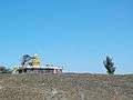 B.R.Hills
 Chamarajanagar Railway Station
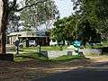 Bandipur Tiger Reserve
See also
References
- ↑ http://chamrajnagar.nic.in/home.html
- 1 2 3 4 5 6 7 "District Census 2011". Census2011.co.in. 2011. Retrieved 2011-09-30.
- ↑ US Directorate of Intelligence. "Country Comparison:Population". Retrieved 2011-10-01.
Cyprus 1,120,489 July 2011 est.
- ↑ "2010 Resident Population Data". U. S. Census Bureau. Archived from the original on 19 October 2013. Retrieved 2011-09-30.
Montana 989,415
External links
| Wikivoyage has a travel guide for Chamarajanagar (district). |
| Wikimedia Commons has media related to Chamarajanagar district. |
- Mystery Trails - Eco-tourism in Chamarajanagar
- List of cities and Tourism places in Chamarajanagar
- Maps Of India - Map of Chamarajanagar district

District HQ: Chamarajanagar | |
| Villages and Towns |
|
| Overviews | |
|---|---|
| History |
|
| Geography |
|
| Culture | |
| Literature | |
| Noted poets |
|
| People and Society | |
| Tourism |
|
| Awards | |