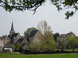
Champteussé-sur-Baconne
| Champteussé-sur-Baconne | ||
|---|---|---|
 | ||
| ||
 Champteussé-sur-Baconne | ||
|
Location within Pays de la Loire region  Champteussé-sur-Baconne | ||
| Coordinates: 47°40′07″N 0°39′14″W / 47.6686°N 0.6539°WCoordinates: 47°40′07″N 0°39′14″W / 47.6686°N 0.6539°W | ||
| Country | France | |
| Region | Pays de la Loire | |
| Department | Maine-et-Loire | |
| Arrondissement | Segré | |
| Canton | Châteauneuf-sur-Sarthe | |
| Intercommunality | communauté de commune du Lion d'Angers | |
| Government | ||
| • Mayor | Jean-Pierre BOUVET | |
| Area1 | 11.48 km2 (4.43 sq mi) | |
| Population (2006[1])2 | 222 | |
| • Density | 19/km2 (50/sq mi) | |
| Time zone | CET (UTC+1) | |
| • Summer (DST) | CEST (UTC+2) | |
| INSEE/Postal code | 49067 / 49220 | |
| Elevation |
24–77 m (79–253 ft) (avg. 27 m or 89 ft) | |
|
1 French Land Register data, which excludes lakes, ponds, glaciers > 1 km² (0.386 sq mi or 247 acres) and river estuaries. 2 Population without double counting: residents of multiple communes (e.g., students and military personnel) only counted once. | ||

Champteussé-sur-Baconne is a former commune in the Maine-et-Loire department of western France. On 1 January 2016, it was merged into the new commune of Chenillé-Champteussé.[2]
See also
References
- ↑ populations légales 2006 sur le site de l’INSEE
- ↑ Arrêté préfectoral Archived February 15, 2016, at the Wayback Machine. 21 December 2015
| Wikimedia Commons has media related to Champteussé-sur-Baconne. |
This article is issued from Wikipedia - version of the 11/19/2016. The text is available under the Creative Commons Attribution/Share Alike but additional terms may apply for the media files.