Champ-de-Mars (Montreal Metro)
Champ-de-Mars | |||||||||||
|---|---|---|---|---|---|---|---|---|---|---|---|
 | |||||||||||
| Location |
940, rue Sanguinet, Montreal Quebec, Canada | ||||||||||
| Coordinates | 45°30′36″N 73°33′23″W / 45.51000°N 73.55639°WCoordinates: 45°30′36″N 73°33′23″W / 45.51000°N 73.55639°W | ||||||||||
| Operated by | Société de transport de Montréal | ||||||||||
| Connections | |||||||||||
| Construction | |||||||||||
| Depth | 6.1 metres (20 feet), 59th deepest | ||||||||||
| Architect | Adalbert Niklewicz | ||||||||||
| History | |||||||||||
| Opened | 14 October 1966 | ||||||||||
| Traffic | |||||||||||
| Passengers | 1,883,727 entrances in 2013, 48th of 68 | ||||||||||
| Services | |||||||||||
| |||||||||||
Champ-de-Mars is a station on the Orange Line of the Montreal Metro rapid transit system, operated by the Société de transport de Montréal (STM). It is located in Old Montreal in the borough of Ville-Marie in Montreal, Quebec, Canada.[1] The station opened on October 14, 1966, as part of the original network of the Metro.
Overview
Designed by Adalbert Niklewicz, it is a normal side platform station, built in open cut due to the presence of weak Utica shale in the surrounding rock. Its entrance is located near a series of tunnels that cross the Autoroute Ville-Marie, giving access to Old Montreal.
Architecture and art

One of the most important artworks in the Metro, a set of stained glass windows by noted Quebec artist Marcelle Ferron, illuminates the mezzanine of this station. These windows, one of the artist's masterpieces and her most famous work, were given by the Government of Quebec in 1968. They were the first work of non-figurative art to be commissioned for the Metro, representing the first official entrance of Automatist art in the system.
Origin of the name
This station is named for Champ-de-Mars, a public park facing Montreal City Hall. The name is the French term for a military parade ground. It was formerly crossed by the city's fortifications, demolished in the 19th century, the foundations of which can still be seen. It was later turned into a parking lot, which was replaced by a park in 1980s.
Connecting bus routes
| Société de transport de Montréal | |||
|---|---|---|---|
| Route | Service Times | Map | Schedule |
| |
All-day before 8:00PM | Map | Schedule |
| |
All-day | Map | Schedule |
| |
Overnight | Map | Schedule |
Nearby points of interest
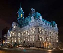
- Montreal City Hall
- Old Montreal
- Old Port
- Bonsecours Market
- Chapelle Notre-Dame-de-Bon-Secours
- Place Jacques-Cartier
- Château Ramezay
- Sir George-Étienne Cartier National Historic Site
- Édifice Lucien-Saulnier(former courthouse)
- Complexe Chaussegros-de-Léry (City of Montreal)
- Palais de justice (Montreal)
- Édifice Jacques-Viger
References
- ↑ Champ-de-Mars Metro Station Archived May 27, 2013, at the Wayback Machine.
External links
- Champ-de-Mars Station - Official page
- Champ-de-Mars Station - Archive.org
- Montreal by Metro, metrodemontreal.com - photos, information, and trivia
- Metro Map