Chalchuapa
| Chalchuapa | |
|---|---|
 Chalchuapa Location in El Salvador | |
| Coordinates: 13°59′N 89°41′W / 13.983°N 89.683°W | |
| Country |
|
| Department | Santa Ana Department |
| Population (2005) | |
| • Total | 72,728 |
Chalchuapa is a town and a municipality located in the Santa Ana department of El Salvador. The city of Chalchuapa is in a wide valley at 650 meters above sea level, and watered by the Pampe River.
Overview
It is settled 15 kilometers west from Santa Ana city, in the valley of, Cuscachapa. The 'El Trapiche' pool is in the countryside of the city, filled with fresh and transparent waters; and the Mayan structure of Casa Blanca, which exhibits the immortal rock over where General Justo Rufino Barrios from Guatemala was fatally wounded and murdered in the bloody battle of April 2, 1885. It also possesses an old-fashioned church of pure colonial style. It is a beautiful architectonic jewel consecrated to the patron of the city of Santiago Apostol whose lyric representation crowns the dome of the Catholic Church on a horseback.
Chalchuapa, which in Nahuatl means 'Río de Jadeitas' or Jade's River, was the most remarkable emporium of the civilization of the Pok'omames, town of the Mayan-quiche or Mayan family. It also constitutes some of the most important archaeological areas of the country, with five ceremonial centers: Tazumal, Pampe, Trapiche, Casa Blanca, and Las Victorias; also, Cuzcachapa Lagoon. These Pre-Columbine vestiges are scattered in an area of 6 square km.
The ruins of Tazumal include a main pyramidal structure of 23 meters height (the inferior structures are still buried) located in a block and forming two truncated pyramids to the west. It has eight pilasters with chiseled figures. Northernmost, there are other complex constructions and a memorial dance grounds with ladders. The 'Ball Game' field, almost totally destroyed, used to be located in the current cemetery area.
In the western flank of Ku or Teocali, there is a monolith carved in basaltic rock called “Estela de Tazumal” of 2.65 meters height and 1.16 meters wide. It represents a richly adorned character, showing on the side hieroglyphical inscriptions that are possibly chronological, but different from the classical of the Mayan culture.
Coordinates: 13°59′N 89°41′W / 13.983°N 89.683°W
Capital: Santa Ana | ||
| Municipalities | 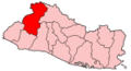 | |