Châtillon-Saint-Jean
| Châtillon-Saint-Jean | |
|---|---|
|
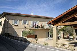
Town hall | |
 Châtillon-Saint-Jean | |
|
Location within Auvergne-Rhône-Alpes region  Châtillon-Saint-Jean | |
| Coordinates: 45°05′20″N 5°07′54″E / 45.0889°N 5.1317°ECoordinates: 45°05′20″N 5°07′54″E / 45.0889°N 5.1317°E | |
| Country | France |
| Region | Auvergne-Rhône-Alpes |
| Department | Drôme |
| Arrondissement | Valence |
| Canton | Romans-sur-Isère-2 |
| Intercommunality | Pays de Romans |
| Government | |
| • Mayor (2008–2015) | Daniel Ardin |
| Area1 | 8.82 km2 (3.41 sq mi) |
| Population (2008)2 | 1,189 |
| • Density | 130/km2 (350/sq mi) |
| Time zone | CET (UTC+1) |
| • Summer (DST) | CEST (UTC+2) |
| INSEE/Postal code | 26087 / 26750 |
| Elevation |
192–343 m (630–1,125 ft) (avg. 194 m or 636 ft) |
|
1 French Land Register data, which excludes lakes, ponds, glaciers > 1 km² (0.386 sq mi or 247 acres) and river estuaries. 2 Population without double counting: residents of multiple communes (e.g., students and military personnel) only counted once. | |
Châtillon-Saint-Jean is a commune in the Drôme department in southeastern France.
Population
| Historical population | ||
|---|---|---|
| Year | Pop. | ±% |
| 1911 | 786 | — |
| 1962 | 669 | −14.9% |
| 1968 | 672 | +0.4% |
| 1975 | 680 | +1.2% |
| 1982 | 754 | +10.9% |
| 1990 | 790 | +4.8% |
| 1999 | 888 | +12.4% |
| 2008 | 1,189 | +33.9% |
See also
References
| Wikimedia Commons has media related to Châtillon-Saint-Jean. |
This article is issued from Wikipedia - version of the 10/28/2016. The text is available under the Creative Commons Attribution/Share Alike but additional terms may apply for the media files.