Châtel-Guyon
| Châtel-Guyon | ||
|---|---|---|
|
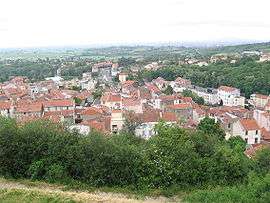
Centre-ville de Châtel-Guyon | ||
| ||
 Châtel-Guyon | ||
|
Location within Auvergne-Rhône-Alpes region  Châtel-Guyon | ||
| Coordinates: 45°55′24″N 3°03′54″E / 45.9233°N 3.065°ECoordinates: 45°55′24″N 3°03′54″E / 45.9233°N 3.065°E | ||
| Country | France | |
| Region | Auvergne-Rhône-Alpes | |
| Department | Puy-de-Dôme | |
| Arrondissement | Riom | |
| Canton | Châtel-Guyon[1] | |
| Intercommunality | Communauté de communes Volvic Sources et Volcans | |
| Government | ||
| • Mayor (2014–2020) | Frédéric Bonnichon[2] (UMP) | |
| Area1 | 14.06 km2 (5.43 sq mi) | |
| Population (2013)2 | 6,131 | |
| • Density | 440/km2 (1,100/sq mi) | |
| Time zone | CET (UTC+1) | |
| • Summer (DST) | CEST (UTC+2) | |
| INSEE/Postal code | 63103 / 63140 | |
| Elevation | 374–721 m (1,227–2,365 ft) | |
| Website | www.chatel-guyon.fr | |
|
1 French Land Register data, which excludes lakes, ponds, glaciers > 1 km² (0.386 sq mi or 247 acres) and river estuaries. 2 Population without double counting: residents of multiple communes (e.g., students and military personnel) only counted once. | ||

Châtel-Guyon is a commune in the Puy-de-Dôme department in Auvergne-Rhône-Alpes in central France.
Prior to 1 July 2007 it was known as Châtelguyon.[3]
See also
References
- ↑ "Décret 2014-210 du 21 février 2014 portant délimitation des cantons dans le département du Puy-de-Dôme" [2014-210 decree delimiting cantons of Puy-de-Dôme department]. Légifrance (in French). 21 February 2014. Retrieved 24 October 2016.
- ↑ "List of Mayors of Puy-de-Dôme" (PDF). Prefecture of Puy-de-Dôme. 9 April 2014. Archived from the original (PDF) on 6 October 2014. Retrieved 24 October 2016.
- ↑ (French) Châtel-Guyon on INSEE website
| Wikimedia Commons has media related to Châtel-Guyon. |
This article is issued from Wikipedia - version of the 11/24/2016. The text is available under the Creative Commons Attribution/Share Alike but additional terms may apply for the media files.