Ceva
| Ceva | |
|---|---|
| Comune | |
| Città di Ceva | |
 | |
 Ceva Location of Ceva in Italy | |
| Coordinates: IT 44°23′N 08°02′E / 44.383°N 8.033°ECoordinates: IT 44°23′N 08°02′E / 44.383°N 8.033°E | |
| Country | Italy |
| Region | Piedmont |
| Province / Metropolitan city | Cuneo (CN) |
| Frazioni | Bertini, Infermiera, Malpotremo, Mollere, Poggi San Siro, Poggi Santo Spirito, Pratolungo. |
| Government | |
| • Mayor | Alfredo Vizio (Lista Civica) |
| Area | |
| • Total | 42 km2 (16 sq mi) |
| Elevation | 385 m (1,263 ft) |
| Population (December 31, 2004) | |
| • Total | 5,795 |
| • Density | 140/km2 (360/sq mi) |
| Demonym(s) | Cebani |
| Time zone | CET (UTC+1) |
| • Summer (DST) | CEST (UTC+2) |
| Postal code | 12073 |
| Dialing code | 0174 |
| Patron saint |
Madonna del Rosario, Santa Lucia[1] |
| Website | Official website |
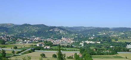
Ceva, the ancient Ceba, is a small Italian town in the province of Cuneo, region of Piedmont, 49 kilometres (30 mi) east of Cuneo. It lies on the right bank of the Tanaro on a wedge of land between that river and the Cevetta stream.
History
In the pre-Roman period the territory around Ceva was inhabited by the branch of the mountain Ligures known as Epanterii.
The upper Val Tanaro was Romanized in the second century BC and it is known that the area was organized around a municipium. However, it is not certain that this was Ceba: Mombasiglio is also regarded as a candidate. In the first century AD Columella referred to a particular breed of cattle raised here, and Pliny the Elder praised its sheep’s milk cheese in his Natural History. The town is on the site of the old Roman road from Augusta Taurinorum via Pollentia to the coast and it is probable that there was a market here from which the cheese produced in the region was exported with Rome via the Ligurian ports of Vada Sabatia (the modern Vado Ligure) and/or Albingaunum (Albenga).
In the Middle Ages it was the seat of a small marquisate, which lasted until the late 15th century when it was acquired by Savoy. Ceva was home to a fortress defending the confines of Piedmont towards Liguria, but the fortifications on the rock above the town were demolished in 1800 by the French, to whom it had been ceded in 1796.
Ceva was heavily damaged by a flood of the Tanaro, Cevetta and Bovina rivers.
Main sights
The 16th century castle of the Pallavicino stands in an area of green parkland between the Tanaro and the Cevetta and comprises two small palaces: the original, red palazzina rossa and the later, white palazzina bianca. Remains of the 16th century fort are also present.
The Duomo of Ceva, also known as the Collegiata dell'Assunzione della Beata Vergine Maria, was completed in 1605.
Twin towns — Sister cities
Ceva is twinned with:
-
 Le Val, France (1992)
See also
Notes
- ↑ regione.piemonte.it :: Comunità Montana Valli Mongia, Cevetta e Langa Cebana Archived January 2, 2007, at the Wayback Machine.
Sources
![]() This article incorporates text from a publication now in the public domain: Chisholm, Hugh, ed. (1911). "Ceva". Encyclopædia Britannica. 5 (11th ed.). Cambridge University Press. p. 777.
This article incorporates text from a publication now in the public domain: Chisholm, Hugh, ed. (1911). "Ceva". Encyclopædia Britannica. 5 (11th ed.). Cambridge University Press. p. 777.
External links
-
 Media related to Ceva at Wikimedia Commons
 - Pliny on the cheese of Ceba in Book 11 of the Natural History:
- at Perseus (English)
- at LacusCurtius (Search for ‘Cebanum’) (Latin)