Central City, South Dakota
| Central City, South Dakota | |
|---|---|
| City | |
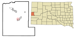 Location in Lawrence County and the state of South Dakota | |
| Coordinates: 44°22′2″N 103°46′11″W / 44.36722°N 103.76972°WCoordinates: 44°22′2″N 103°46′11″W / 44.36722°N 103.76972°W | |
| Country | United States |
| State | South Dakota |
| County | Lawrence |
| Founded | 1877[1] |
| Area[2] | |
| • Total | 0.15 sq mi (0.39 km2) |
| • Land | 0.15 sq mi (0.39 km2) |
| • Water | 0 sq mi (0 km2) |
| Elevation | 4,892 ft (1,491 m) |
| Population (2010)[3] | |
| • Total | 134 |
| • Estimate (2012[4]) | 133 |
| • Density | 893.3/sq mi (344.9/km2) |
| Time zone | Mountain (MST) (UTC-7) |
| • Summer (DST) | MDT (UTC-6) |
| ZIP code | 57754 |
| Area code(s) | 605 |
| FIPS code | 46-11140[5] |
| GNIS feature ID | 1261434[6] |
Central City is a city in Lawrence County, South Dakota, United States. The population was 134 at the 2010 census.
History
Central City was founded in 1877.[1] It was named after Central City, Colorado, by a settler from there.[7] It began as a mining town during the Black Hills Gold Rush days. There was once a quarrel over mining boundaries that resulted in a deliberate explosion of the nearby Comstock Mine and the death of one man. A miners' sit-down strike occurred and a cavalry unit from Fort Meade led by Seth Bullock was called in to end it.[8]
Geography
Central City is located at 44°22′2″N 103°46′11″W / 44.36722°N 103.76972°W (44.367211, -103.769652).[9]
According to the United States Census Bureau, the city has a total area of 0.15 square miles (0.39 km2), all of it land.[2]
Climate
| Climate data for Central City, South Dakota | |||||||||||||
|---|---|---|---|---|---|---|---|---|---|---|---|---|---|
| Month | Jan | Feb | Mar | Apr | May | Jun | Jul | Aug | Sep | Oct | Nov | Dec | Year |
| Record high °F (°C) | 69 (21) |
66 (19) |
74 (23) |
84 (29) |
88 (31) |
96 (36) |
99 (37) |
98 (37) |
96 (36) |
84 (29) |
74 (23) |
65 (18) |
99 (37) |
| Average high °F (°C) | 36 (2) |
37 (3) |
43 (6) |
52 (11) |
61 (16) |
71 (22) |
79 (26) |
78 (26) |
68 (20) |
55 (13) |
43 (6) |
35 (2) |
54.8 (12.8) |
| Average low °F (°C) | 17 (−8) |
18 (−8) |
23 (−5) |
31 (−1) |
40 (4) |
49 (9) |
56 (13) |
55 (13) |
45 (7) |
34 (1) |
24 (−4) |
16 (−9) |
34 (1) |
| Record low °F (°C) | −27 (−33) |
−32 (−36) |
−17 (−27) |
−5 (−21) |
9 (−13) |
24 (−4) |
36 (2) |
33 (1) |
15 (−9) |
−5 (−21) |
−16 (−27) |
−33 (−36) |
−33 (−36) |
| Average precipitation inches (mm) | 1.34 (34) |
1.65 (41.9) |
2.58 (65.5) |
3.55 (90.2) |
4.64 (117.9) |
3.57 (90.7) |
2.76 (70.1) |
2.09 (53.1) |
1.99 (50.5) |
3.04 (77.2) |
1.83 (46.5) |
1.51 (38.4) |
30.55 (776) |
| Source: The Weather Channel (Historical Monthly Averages) [10] | |||||||||||||
Demographics
| Historical population | |||
|---|---|---|---|
| Census | Pop. | %± | |
| 1880 | 1,008 | — | |
| 1890 | 519 | −48.5% | |
| 1910 | 296 | — | |
| 1920 | 199 | −32.8% | |
| 1930 | 198 | −0.5% | |
| 1940 | 302 | 52.5% | |
| 1950 | 218 | −27.8% | |
| 1960 | 247 | 13.3% | |
| 1970 | 188 | −23.9% | |
| 1980 | 177 | −5.9% | |
| 1990 | 185 | 4.5% | |
| 2000 | 149 | −19.5% | |
| 2010 | 134 | −10.1% | |
| Est. 2015 | 130 | [11] | −3.0% |
2010 census
As of the census[3] of 2010, there were 134 people, 66 households, and 37 families residing in the city. The population density was 893.3 inhabitants per square mile (344.9/km2). There were 78 housing units at an average density of 520.0 per square mile (200.8/km2). The racial makeup of the city was 94.0% White, 1.5% Native American, 0.7% from other races, and 3.7% from two or more races. Hispanic or Latino of any race were 0.7% of the population.
There were 66 households of which 18.2% had children under the age of 18 living with them, 34.8% were married couples living together, 12.1% had a female householder with no husband present, 9.1% had a male householder with no wife present, and 43.9% were non-families. 33.3% of all households were made up of individuals and 9.1% had someone living alone who was 65 years of age or older. The average household size was 2.03 and the average family size was 2.41.
The median age in the city was 48.7 years. 11.9% of residents were under the age of 18; 5.9% were between the ages of 18 and 24; 23.2% were from 25 to 44; 45.6% were from 45 to 64; and 13.4% were 65 years of age or older. The gender makeup of the city was 47.8% male and 52.2% female.
2000 census
As of the census[5] of 2000, there were 149 people, 67 households, and 39 families residing in the city. The population density was 1,033.0 people per square mile (410.9/km²). There were 76 housing units at an average density of 526.9 per square mile (209.6/km²). The racial makeup of the city was 99.33% White and 0.67% Asian.
There were 67 households out of which 19.4% had children under the age of 18 living with them, 53.7% were married couples living together, 4.5% had a female householder with no husband present, and 40.3% were non-families. 32.8% of all households were made up of individuals and 7.5% had someone living alone who was 65 years of age or older. The average household size was 2.22 and the average family size was 2.80.
In the city the population was spread out with 19.5% under the age of 18, 5.4% from 18 to 24, 33.6% from 25 to 44, 33.6% from 45 to 64, and 8.1% who were 65 years of age or older. The median age was 43 years. For every 100 females there were 112.9 males. For every 100 females age 18 and over, there were 118.2 males.
The median income for a household in the city was $21,250, and the median income for a family was $31,250. Males had a median income of $23,750 versus $18,438 for females. The per capita income for the city was $12,870. There were 10.5% of families and 15.9% of the population living below the poverty line, including 17.4% of under eighteens and 21.4% of those over 64.
References
- 1 2 "SD Towns" (PDF). South Dakota State Historical Society. Archived from the original (PDF) on 2010-02-10. Retrieved 2010-02-11.
- 1 2 "US Gazetteer files 2010". United States Census Bureau. Archived from the original on 2012-01-24. Retrieved 2012-06-21.
- 1 2 "American FactFinder". United States Census Bureau. Retrieved 2012-06-21.
- ↑ "Population Estimates". United States Census Bureau. Archived from the original on 2013-06-17. Retrieved 2013-05-29.
- 1 2 "American FactFinder". United States Census Bureau. Archived from the original on 2013-09-11. Retrieved 2008-01-31.
- ↑ "US Board on Geographic Names". United States Geological Survey. 2007-10-25. Retrieved 2008-01-31.
- ↑ Mitchell, Steven T. (16 December 2010). Nuggets to Neutrinos: The Homestake Story. Xlibris Corporation. p. 333. ISBN 978-1-4568-3947-5.
- ↑ Parker, Watson, and Hugh K. Lambert. Black Hills Ghost Towns. First ed. Vol. 1. Chicago, IL: The Swallow Press Incorporated, 1974. 69. 1 vols. Print.
- ↑ "US Gazetteer files: 2010, 2000, and 1990". United States Census Bureau. 2011-02-12. Retrieved 2011-04-23.
- ↑ "Climate Statistics for Central City, SD". Retrieved September 30, 2013.
- ↑ "Annual Estimates of the Resident Population for Incorporated Places: April 1, 2010 to July 1, 2015". Retrieved July 2, 2016.
- ↑ "Census of Population and Housing". Census.gov. Archived from the original on May 11, 2015. Retrieved June 4, 2015.
Municipalities and communities of Lawrence County, South Dakota, United States | ||
|---|---|---|
| Cities | 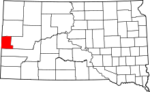 | |
| Township | ||
| CDPs | ||
| Other unincorporated communities | ||
| Ghost towns | ||