Castleblayney
| Castleblayney Castleblaney Baile na Lorgan | |
|---|---|
| Town | |
|
Muckno Street in Castleblayney town centre | |
 Castleblayney Location in Ireland | |
| Coordinates: 54°07′12″N 6°44′17″W / 54.120°N 6.738°WCoordinates: 54°07′12″N 6°44′17″W / 54.120°N 6.738°W | |
| Country | Ireland |
| Province | Ulster |
| County | County Monaghan |
| Elevation | 104 m (341 ft) |
| Population (2011)[1] | |
| • Town | 3,634 |
| • Urban | 1,752 |
| • Environs | 1,882 |
| Irish Grid Reference | H824199 |

| Historical population | ||
|---|---|---|
| Year | Pop. | ±% |
| 1831 | 1,828 | — |
| 1841 | 2,134 | +16.7% |
| 1851 | 2,077 | −2.7% |
| 1861 | 1,822 | −12.3% |
| 1871 | 1,809 | −0.7% |
| 1881 | 1,810 | +0.1% |
| 1891 | 1,721 | −4.9% |
| 1901 | 1,576 | −8.4% |
| 1911 | 1,692 | +7.4% |
| 1926 | 1,550 | −8.4% |
| 1936 | 1,725 | +11.3% |
| 1946 | 1,769 | +2.6% |
| 1951 | 2,173 | +22.8% |
| 1956 | 2,143 | −1.4% |
| 1961 | 2,127 | −0.7% |
| 1966 | 2,083 | −2.1% |
| 1971 | 2,395 | +15.0% |
| 1981 | 3,473 | +45.0% |
| 1986 | 3,035 | −12.6% |
| 1991 | 2,938 | −3.2% |
| 1996 | 2,808 | −4.4% |
| 2002 | 2,936 | +4.6% |
| 2006 | 3,124 | +6.4% |
| 2011 | 3,634 | +16.3% |
| [2][3][4][5][6] | ||
Castleblayney (/ˌkæ.səl.ˈbleɪ.niː/; Irish: Baile na Lorgan, formerly Caisleán Mathghamhna, also spelled Castleblaney) is a town in County Monaghan, Ireland. The town has a population of 3,634 according to the 2011 census. Castleblayney is near the border with County Armagh in Northern Ireland, and lies on the N2 road from Dublin to Derry. The modern Irish name for the town, Baile na Lorgan, means 'Town of the Long Low Ridge'.[7]
Geography
The town lies above the western shore of Lough Muckno, the largest lake in County Monaghan. The River Fane flows eastwards from the lake to the Irish Sea at Dundalk in County Louth. As the Irish name of the lake ('the place where pigs swim') suggests, the area is associated with the Black Pig's Dyke, also known locally in parts of Counties Cavan and Monaghan as the Worm Ditch, an ancient Iron Age boundary of Ulster.
A few miles to the north-east is the highest elevation in County Monaghan, 'Mullyash', at altitude 317 m (1,034 ft). Markets and fair days were held in the town since the 17th century, but these have faded away in recent decades. Beyond the town there are a variety of proposed natural heritage sites.
History
17th and 18th centuries
The town of Castleblayney originated in the Tudor conquest of Gaelic Ulster in the Nine Years' War of 1594–1603. In 1611 the Crown granted forfeited lands in the area previously owned by the MacMahon chieftains to Edward Blayney, 1st Baron Blayney of Montgomeryshire in Wales for his service to Queen Elizabeth I. He became Baron of Monaghan and, later, the first Baron Blayney. King James I had already granted him appropriated Augustinian church land (or 'termon') at Muckno Friary on the northeastern side of the lake in the Churchill area (Mullandoy) in 1606/7. The small town 'founded' by Sir Edward Blayney in 1611 or 1612 is recorded as being called Castleblayney at least as early as 1663.[7][8]
Muckno is also the name given to the Roman Catholic parish (St. Mary's, Castleblayney and St Patrick's, Oram, just three miles north-east of the town) and Church of Ireland parish (St Maeldoid's), of the Diocese of Clogher. This covers most of the areas around the lough and town. Originally the parish of Muckno was restricted to the area to the east and north of the lake and the Derrycreevey River, i.e. the Oram area. With the establishment of the Church of Ireland church and the Blayney seat on the southern side of the lake, the area of the new town became part of Muckno. The Roman Catholic parish followed a similar pattern at the end of the Penal Laws period. Prior to this, the area now covered by the town was part of Clontibret parish.
Following the arrival of the Blayney family the nucleus of the town developed around the original Blayney Castle, above the western shore overlooking the lough. The old monastic and parish church site fell into disrepair and largely disappeared, though it was used as a graveyard that has recently seen some restoration. For the first hundred years the 'town' was little more than a vulnerable, besieged fortification due to the widespread instability, insurgency and wars throughout Britain and Ireland for much of the 17th century.
The piecemeal settlement of English and even some French Huguenot incomers, all of the Protestant faith in contrast to the continuing Catholicism of most of the native population, was followed by a significant influx of largely Ulster-Scots settlers after 1690 when greater security prevailed.
Population displacement and settlement, along with gradual urban and commercial development, the crossroads location, the anglicizing National Schools system and the Famine – as well as the incorporation of the town into the rail network (1849) – all helped hasten the decline of the vernacular Irish spoken in the area. However, in rural districts to the south and south-east of the town – particularly Lisdoonan and the barony of Farney as well as parts of neighbouring south Armagh – the language was quite widely spoken among country people and written by local scribes until the mid-19th century. Some native speakers of Irish remained into the 20th century. Old Irish music and songs have been recovered in recent times.
In 1762 a demonstration occurred in the town accompanied by a threatening military presence. This was connected with the 'Oakboys' movement that was active in the county. The protest was about compulsory work – to repair public roads as well as private roads and avenues in demesnes owned by the gentry – that was exacted from agricultural labourers for no wages.
11th Baron Blayney
The modern planned town – reminiscent of Plantation towns with its characteristic wide main street and with long, narrow individual gardens to the rear and out of sight – dates from c. 1830. The modern town was largely laid out under the direction of Andrew Blayney, 11th Baron Blayney (1770–1834), who inherited the family peerage and the large Blayney Estate as an adolescent in 1784.[8] By about 1800 the then young Lord Blayney had ordered and implemented major reforms in Castleblayney, greatly improving the prosperity and appearance of the town.[9] Educated in France and Germany, the 11th Lord Blayney is famous for his distinguished military career, eventually rising to the rank of Lieutenant General, having served in the West Indies, South America, southern Africa and the Napoleonic Wars as commander of the 89th Foot, popularly known as 'Blayney's Bloodhounds'. As a peer, he was very active in the suppression of the revolt of the United Irishmen in 1798.
It was the 11th Lord Blayney who had the modern Blayney Castle (also known as Castle Blayney) constructed around the year 1800.[10] In 1799 Lord Blayney commissioned Robert Woodgate, a former student of Sir John Soane, to design the new Blayney Castle.[11] Woodgate, a distinguished young architect, had first come over to Ireland in 1791 to supervise Soane's plans for Baronscourt, the new country house of John Hamilton, 1st Marquess of Abercorn, near Newtownstewart in County Tyrone.[11] The new Blayney Castle was built in a restrained late Georgian style.[10] It is thought that this new 'castle' (in reality a country house), located in the townland of Onomy, was built close to the site of the original Blayney Castle, of which nothing now survives above ground.[7][11] The house built for the 11th Lord Blayney was later, in the 1850s and early 1860s, substantially altered and enlarged for Henry Thomas Hope and his wife.[12]
Blayney Castle, renamed Hope Castle in the early 1850s, stands in a demesne or park on the eastern edge of Castleblayney town itself. It is thought that this demesne pre-dates the current 'castle'; that large parts of it had already been laid out by the early 1770s.[13] The demesne was substantially improved for the 11th Lord Blayney by William Sawrey Gilpin in the early 1830s.[14] Alas, this once fine demesne has greatly deteriorated since it came into public ownership in the 1980s.[14] Almost all of the large Italianate Victorian extension to Hope Castle was demolished by Monaghan County Council in the 1980s.[15]
Relatively enlightened, socially progressive, and professedly committed to the welfare and improvement of the people and county of Monaghan, the 11th Lord Blayney also provided for the erection in Castleblayney of the current church buildings of the Catholic, Anglican and Presbyterian churches, being tolerant in religion if traditionalist in politics and strongly supportive of Empire and the Anglo-Irish 'Ascendancy'. He also had a Market House built, on to which the Courthouse was later superimposed in the quasi-centre of the town. It and the former Alms Houses (1876), which were interdenominationally managed, are the only civic buildings of any architectural merit in the town. As for older dwellings, a row of formerly Muckno Estate workers' cottages in Church St, possibly of Continental style, is of fine design and quality (apart from modern PVC windows). Some more substantial bourgeois houses in the square close to the Castle gates have Georgian echoes. The courthouse will soon undergo major refurbishment and restoration. About 40 structures and buildings are designated as being of 'regional or local importance'.
In the early 1840s, what is now St Mary's Hospital was erected as a Workhouse for the very poor. In the course of the year 1849, following the dire effects of the Famine, it catered for up to 2000 inmates in an extreme state of destitution and misery. Its own graveyard is nearby. In later times, the Workhouse became a 'County Home' for the infirm.
Hope family and after
In 1853 The Rt Hon. Cadwallader, 12th Baron Blayney, sometime MP for Monaghan, sold Blayney Castle and what remained of the Blayney Estate to Henry Thomas Hope from Deepdene in Surrey, a former MP at Westminster. The 12th Baron was the last Baron Blayney. The Castle was renamed 'Hope Castle', as it is still called. Hope gave the Georgian castle with its splendid prospect a Victorian makeover that the present prettified building retains, externally at least. 'Castle' has always been a misnomer, since it was more of a 'Big House', mansion or manor house than a castle.
After his death in 1862, Hope's wife Anne inherited the estate. Soon after 1887 the Castle and demesne fell to the next heir, Hope's grandson Francis Pelham-Clinton-Hope, 8th Duke of Newcastle-under-Lyne, known as Lord Francis Hope (1866–1941), who was famous for having sold the renowned family heirloom, the 'Hope Diamond'. Rather like his father The 6th Duke of Newcastle-under-Lyne, Lord Francis lived very extravagantly and, despite his once vast family fortune, was declared bankrupt in 1896. After 1916 Lord Francis no longer resided in the Castle or in Ireland. He succeeded his elder brother to become the 8th Duke in 1928.
Hope Castle was leased between 1900 and 1904 to Field Marshal Prince Arthur, 1st Duke of Connaught and Strathearn, a son of Queen Victoria.[15] The Duke served during those years as the commander of British military forces in Ireland, whose official residence was the Master's House at the Royal Hospital, in Kilmainham, Dublin. The Duke leased Hope Castle from the Pelham-Clinton-Hope family as his private country residence during these years.
Francis Hope sold off both the castle and the estate in 1928,[15] shortly after succeeding to the dukedom. What remained of the estate was subsequently broken up and used, in part, for local political patronage. During 'The Emergency' (World War II), the old woods on the Black Island in Lough Muckno were comprehensively despoiled by the Éire government, so that for several decades the island was a wilderness and environmental eyesore. The woods were only reinstated in recent times as a valuable amenity.
Between 1919 and 1921, during the Anglo-Irish military hostilities over independence, the Castle was used as a barracks by the British Army. For some time afterwards it functioned as a hospital, and from 1943 to 1974 it was occupied by Franciscan nuns who also managed an adjacent guesthouse. In the 1980s Monaghan County Council purchased both Hope Castle and its surrounding demesne or park. It then proceeded in the 1980s to demolish the large Italianate Victorian extension to the castle.[15] The council also allowed the remaining Woodgate interiors to be ripped out at this time.[15]
After some years of neglect, the castle has been used for catering and hotel purposes set in what is now a Leisure Park with golf course, though the location and lough suffer from being in management and conservation limbo. The current Castleblayney Golf Club adopted the Blayney family coat of arms, with its three nags' heads. In October 2010 the Castle was burnt down in an arson attack.
Rail services in the town ceased on New Year's Day 1960. Recent decades have seen some incomers from Eastern Europe and beyond settling permanently or temporarily arising out of European Union obligations.
Council
The modern town of Castleblayney is administered by Monaghan County Council. It forms part of the Carrickmacross-Castleblayney Municipal District which elects six of the eighteen members of the Council.
For over one hundred and sixty years the town had its own local or Town council until May 2014. Town government began in Castleblayney on 17 May 1853 when 21 Town Commissioners were elected on foot of a proclamation by His Excellency The 3rd Earl of St Germans, Lord Lieutenant of Ireland, dated 10 April 1853. In 1865 the Town Commissioners voted to bring the town under the Town Improvement (Ireland) Act 1847 and in 1899 the nine Town Commissioners were replaced by an Urban District Council, re-designated as a Town Council under the Local Government Act 2001. The Local Government Reform Act 2014 brought town government to an end replaced it with the integrated municipal district (town and rural areas) and county system.
Facilities
- Castleblayney opened a Community Enterprise Centre in 1987.
- One shopping centre is located in the town; SuperValu is the anchor tenant.
Transport
- A new €120m by-pass from Castleblayney to Clontibret opened on 5 November 2007, linking Castleblayney directly to the M1 Motorway and to Dublin. The bypass consists of 16 kilometres of 2+1 carriageway.
- The town is served by Bus Éireann, Ulsterbus and several private coach companies.
- Castleblayney is no longer served by railway. Castleblayney railway station opened on 15 February 1849, closed to passengers on 14 October 1957, and finally closed altogether on 1 January 1960.[16]
People
- The 11th Baron Blayney (see above)
- General Eoin O'Duffy (1892–1944) was born at Caraghdoo, Laragh, near Lough Egish, south of Castleblayney.
- Clare Sheridan, sculptress.
- Thomas Hughes, awarded the Victoria Cross.
- Prince Arthur, 1st Duke of Connaught and Strathearn. A son of Queen Victoria, Commander-in-Chief of the British Army in Ireland from 1900 to 1904, when he also rented Hope Castle in Castleblayney as a residence outside Dublin.
- James McMahon Graham, who after emigrating to the United States became an attorney in Illinois.
- Hugh Keenan was born in Castleblayney; after emigrating to Pittsburgh he became a lawyer, and served as US Consul in Dublin from 1847 to 1850, and in Cork from 1854 to 1859. He is buried in the town.
International relations
Twin towns — Sister cities
Castleblayney is twinned with Nogent-sur-Vernisson in the Loiret department of France. It is also twinned with Marseillan in southern France.
Sport
There is two soccer clubs located in Castleblayney, Blayney Academy FC formed in 2010 and Blayney Rovers FC. The local Gaelic Athletic Association club, Castleblayney Faugh's GAC, was founded in November 1905.
Education
The town has two second-level schools, Our Lady's Castleblayney and Castleblayney College. The latter is a co-educational school with plans for a new €5 million extension.
There are five national schools in Castleblayney: Scoil na gCailíní, Scoil Mhuire na mBuachaillí, Convent Junior School, The Central School and Gaelscoil Lorgan.
See also
References
Footnotes
- ↑ "Census 2011 – Volume 1 – Population Classified by Area" (PDF). Central Statistics Office Census 2011 Reports. Central Statistics Office Ireland. April 2011. Archived from the original (PDF) on 7 June 2011. Retrieved 21 June 2011.
- ↑ Census for post 1821 figures.
- ↑ http://www.histpop.org
- ↑ "Archived copy". Archived from the original on 17 February 2012. Retrieved 2014-02-09.
- ↑ Lee, JJ (1981). "On the accuracy of the Pre-famine Irish censuses". In Goldstrom, J. M.; Clarkson, L. A. Irish Population, Economy, and Society: Essays in Honour of the Late K. H. Connell. Oxford, England: Clarendon Press.
- ↑ Mokyr, Joel; O Grada, Cormac (November 1984). "New Developments in Irish Population History, 1700–1850". The Economic History Review. 37 (4): 473–488. doi:10.1111/j.1468-0289.1984.tb00344.x.
- 1 2 3 Patrick McKay, A Dictionary of Ulster Place-Names, p. 37. The Institute of Irish Studies, The Queen's University of Belfast, Belfast, 1999.
- 1 2 Kevin V. Mulligan, The Buildings of Ireland: South Ulster (popularly known as the Pevsner Guide to South Ulster), p. 229. Yale, London, 2013.
- ↑ Mulligan (2013), pp. 229-230.
- 1 2 Mulligan(2013), pp. 236–237.
- 1 2 3 Mulligan (2013), p. 236.
- ↑ Mulligan (2013), pp. 237-239.
- ↑ Mulligan (2013), pp. 239-240.
- 1 2 Mulligan (2013), p. 240.
- 1 2 3 4 5 Mulligan (2013), p. 239.
- ↑ "Castleblayney station" (PDF). Railscot - Irish Railways. Retrieved 16 September 2007.
Reference works
- Borderlands: Essays on the History of the Ulster-Leinster Border, ed. by Raymond Gillespie and Harold O'Sullivan (Belfast, 1989).
- Gary Carville, 'On the Way: The Journey of the People of Muckno', with 'A Survey of the Placenames of Muckno' by Bishop Joseph Duffy, (Castleblayney: 2011).
- Peter Collins & A.P.W. Malcomson, The Blayney of Castleblayney Papers in The Public Record Office of Northern Ireland. For outline of holdings with survey of family and estate history, see Website: https://web.archive.org/web/20070608125101/http://www.proni.gov.uk:80/records/private/blayney.htm#top(1998).
- Patrick J. Duffy, Landscapes of South Ulster—A Parish Atlas of the Diocese of Clogher (Belfast, 1993).
- Charles Laverty, 'The old name of Castleblayney', in: County Louth Archaeological and Historical Journal, vol. I/4 (1907), 29-33.
- Samuel Lewis, A Topographical Dictionary of Ireland (London, 1837. 1842).
- Peadar Livingstone, The Monaghan Story, Clogher Historical Society (Enniskillen, 1980)
- Oxford Dictionary of National Biography (on Andrew Blayney, Clare Sheridan, Eoin O'Duffy, and Samuel Hemphill).
- Photographic Memories: a pictorial history of Castleblayney, Castleblayney Heritage Group Millennium Publication (Castleblayney, 1999).
- Evelyn P. Shirley, The History of the County of Monaghan (London 1869). Reprint 1988.
External links
| Wikimedia Commons has media related to Castleblayney. |
Places in County Monaghan | ||
|---|---|---|
| Towns | 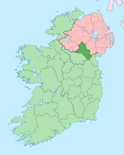 | |
| Villages and townlands | ||
| Landforms | ||
| ||