Castets-en-Dorthe
| Castets-en-Dorthe | |
|---|---|
|
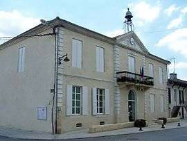
Town hall | |
 Castets-en-Dorthe | |
|
Location within Nouvelle-Aquitaine region  Castets-en-Dorthe | |
| Coordinates: 44°33′46″N 0°09′07″W / 44.5628°N 0.1519°WCoordinates: 44°33′46″N 0°09′07″W / 44.5628°N 0.1519°W | |
| Country | France |
| Region | Nouvelle-Aquitaine |
| Department | Gironde |
| Arrondissement | Langon |
| Canton | Langon |
| Intercommunality | Pays de Langon |
| Government | |
| • Mayor (2008–2014) | Jean-Pierre Sart |
| Area1 | 8.69 km2 (3.36 sq mi) |
| Population (2008)2 | 1,240 |
| • Density | 140/km2 (370/sq mi) |
| Time zone | CET (UTC+1) |
| • Summer (DST) | CEST (UTC+2) |
| INSEE/Postal code | 33106 / 33210 |
| Elevation |
6–56 m (20–184 ft) (avg. 20 m or 66 ft) |
|
1 French Land Register data, which excludes lakes, ponds, glaciers > 1 km² (0.386 sq mi or 247 acres) and river estuaries. 2 Population without double counting: residents of multiple communes (e.g., students and military personnel) only counted once. | |
Castets-en-Dorthe is a commune in the Gironde department in Nouvelle-Aquitaine in southwestern France.
The village lies at the junction of the Canal de Garonne with the River Garonne.
Population
| Historical population | ||
|---|---|---|
| Year | Pop. | ±% |
| 1962 | 887 | — |
| 1968 | 920 | +3.7% |
| 1975 | 889 | −3.4% |
| 1982 | 829 | −6.7% |
| 1990 | 996 | +20.1% |
| 1999 | 1,124 | +12.9% |
| 2008 | 1,240 | +10.3% |
See also
References
External links
| Wikimedia Commons has media related to Castets-en-Dorthe. |
This article is issued from Wikipedia - version of the 11/9/2016. The text is available under the Creative Commons Attribution/Share Alike but additional terms may apply for the media files.