Carrickfergus
| Carrickfergus | |
| Scots: Carrick[1] or Craigfergus[2] | |
| Irish: Carraig Ḟearġais Carraig Fhearghais | |
 Carrickfergus Castle at sunset |
|
 Carrickfergus |
|
| Population | 27,903 (2011 Census) |
|---|---|
| – Belfast | 11 miles (18 km) |
| District | Mid and East Antrim District |
| County | County Antrim |
| Country | Northern Ireland |
| Sovereign state | United Kingdom |
| Post town | CARRICKFERGUS |
| Postcode district | BT38 |
| Dialling code | 028 |
| Police | Northern Ireland |
| Fire | Northern Ireland |
| Ambulance | Northern Ireland |
| EU Parliament | Northern Ireland |
| UK Parliament | East Antrim |
| NI Assembly | East Antrim |
|
|
Coordinates: 54°42′58″N 5°48′32″W / 54.716°N 5.809°W
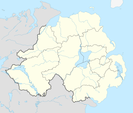
Carrickfergus known locally and colloquially as "Carrick" (Ulster Scots) (from Irish: Carraig Ḟearġais, meaning "rock of Fergus"),[3] is a large town in County Antrim, Northern Ireland. It is located on the north shore of Belfast Lough, 11 miles (18 km) from Belfast. The town had a population of 27,903 at the 2011 Census and takes its name from Fergus Mór mac Eirc, the 6th-century king of Dál Riata. It is County Antrim's oldest town and one of the oldest settlements in Ireland as a whole.[4] Carrickfergus was the administrative centre for Carrickfergus Borough Council, before this was amalgamated into the Mid and East Antrim District Council in 2015, and forms part of the Belfast Metropolitan Area. It is also a townland of 65 acres, a civil parish and a barony.[5]
The town is the subject of the classic Irish folk song "Carrickfergus", a 19th-century translation of an Irish-language song (Do Bhí Bean Uasal)[6] from Munster, which begins with the words, "I wish I was in Carrickfergus."[7]
The British peerage title of Baron Carrickfergus, which had become extinct in 1883, was bestowed upon Prince William on his wedding day on 29 April 2011.
History

As an urban settlement, Carrickfergus far pre-dates the capital city Belfast and was for a lengthy period both larger and more prominent than the nearby city. Belfast Lough itself was known as 'Carrickfergus Bay' well into the 17th century. Carrickfergus and the surrounding area was, for a time, treated as a separate county. The historical walled town originally occupied an area of around 97,000 square metres, which now comprises the town centre, bordered by Albert Road to the west, the Marine Highway to the south, Shaftesbury Park to the north and Joymount Presbyterian Church grounds to the east. Segments of the town wall are still visible in various parts of the town and in various states of preservation. Archaeological excavations close to the walls' foundations have yielded many artefacts that have helped historians piece together a picture of the lives of the 12th and 13th century inhabitants.[4][8]
In the 5/6th century, Fergus, the son of Erc of Armoy, left the province of Ulster to form a kingdom in Scotland. Upon returning to Ulster some time afterwards, his ship ran aground on a volcanic dyke by the shore, which became loosely known as "Carraig Fhearghais" – the rock of Fergus.[8]
Carrickfergus became an inhabited town shortly after 1170, when Anglo-Norman knight John de Courcy invaded Ulster, established his headquarters in the area and built Carrickfergus Castle on the "rock of Fergus" in 1177.[9] The castle, which is the most prominent landmark of Carrickfergus, is widely known as one of the best-preserved Norman castles in Ireland.
Sometime between 1203 and 1205, De Courcy was expelled from Ulster by Hugh de Lacy, as authorised by King John. de Lacy oversaw the final construction of the castle, which included the gatehouse, drum towers and outer ward. It was at this time that he established the nearby St Nicholas' Church. de Lacy was relieved of his command of the town in 1210, when King John himself arrived and placed the castle under royal authority. de Lacy eventually regained his title of Earl of Ulster in 1227, however the castle and its walled town were captured several more times following his death (in 1242) and the town largely destroyed by the Scots in 1402.[8][9]
The Battle of Carrickfergus, part of the Nine Years War, took place in and around the town in November 1597. It was fought between the crown forces of Queen Elizabeth I and the Scots clan of MacDonnell, and resulted in a defeat for the English. A contemporary Elizabethan illustration of Carrickfergus shows ten tower-houses, as well as terraces of single-storey houses, some detached cottages and 70 or more Irish beehive-type huts in the town.[10]

Sir Arthur Chichester was appointed by the Earl of Essex to govern the castle and town in 1599 and was responsible for the plantation of English and Scottish peoples in the town, as well as the building of the town wall.[11]
In 1637 the Surveyor General of Customs issued a report compiled from accounts of customs due from each port and their "subsidiary creeks". Of the Ulster ports on the list, Carrickfergus was first, followed by Bangor, Donaghadee, and Strangford.[12] In the same year the town sold its customs rights - which ran from Groomsport, County Down up to Larne, County Antrim to Belfast. This in part led to its decline in importance as the province of Ulster grew.

Nevertheless, the decaying castle withstood several days of siege by the forces of William of Orange in 1689, before surrendering on 28 August. William himself subsequently landed at Carrickfergus on 14 June 1690. During the Seven Years' War, in February 1760, the whole town was briefly captured and held to ransom by French troops landed from Francois Thurot's naval squadron, after the defenders ran out of ammunition. In 1711 Carrickfergus was the scene of the last witchcraft trial in Ireland. Eight women were charged with bewitching a young girl, and were convicted, despite a strong indication from one of the judges that the jury should acquit. They were sentenced to a year in prison and four sessions in the pillory.
In April 1778, during the American War of Independence, John Paul Jones, in command of the American ship Ranger, attempted to capture a British Royal Navy sloop of war, HMS Drake, moored at Carrickfergus. Having failed, he returned a few days later and challenged Drake to a fight out in the North Channel which the Americans won decisively.
During the 1790s there was considerable support in the Carrickfergus area for the United Irishmen.[13] On 14 October 1797 William Orr was hanged in the town following what was widely regarded as a show trial held in Carrickfergus Courthouse[14] (now the Town Hall[15]) and in 1798 United Irish founder Henry Joy McCracken was captured on the outskirts of the town while trying to escape to America.[16]
In 1912 the people of Carrickfergus turned out in their thousands to watch as the RMS Titanic made its first ever journey up the lough from its construction dock in Belfast. The famous passenger liner was anchored overnight just off the coast of Carrickfergus, before continuing on its journey.[17]
During World War II, Northern Ireland was an important military base for United States Naval and Air Operations and a training ground for American G.I.s. The First Battalions of the elite US Rangers were activated and based in Sunnylands Camp for their initial training. The US Rangers Centre in nearby Boneybefore pays homage to this period in history.[17] Italian and German POWs were held in the town, the Italians in a camp at Sullatober mill, and Germans at Sunnylands.
Recent history
In the 1970s, the town became an important centre for the textile industry. An ICI man-made fibres factory was opened at Kilroot and was followed by the Rothman's cigarette factory. Courtaulds operated a large rayon works there until the 1980s.
In 1981, Kilroot power station opened and is the largest power station in Northern Ireland. Carrickfergus now is a centre for leisure sailing, and is home to Carrickfergus Marina and Carrickfergus Sailing Club. The town is part of the Greater Belfast conurbation, being 11 miles (18 km) from Belfast city centre.
On 8 September 2007, Carrickfergus was the Northern Irish host for the Last Night at the Proms, featuring Alison Balsom, Alfie Boe, and Ulster conductor Kenneth Montgomery.
The Troubles
Throughout the course of The Troubles, there was a reasonably large paramilitary presence in the town, namely the Ulster Volunteer Force and Ulster Defence Association.[18] Census figures show that the Catholic population of Carrickfergus declined from 16.2% in 1971 to 9.56% in 2011.[19]
Demography
_-_geograph.org.uk_-_1496873.jpg)


Carrickfergus is classified by the Northern Ireland Statistics and Research Agency (NISRA)[20] as a large town (i.e. population between 18,000 and 75,000 people) and within the Belfast Metropolitan Urban Area (BMUA). On Census day (27 March 2011) there were 37,659 people living in Carrickfergus. Of these:
- 20.1% were aged under 16 years and 17.9% were aged 60 and over
- 48.74% of the population were male and 51.26% were female
- 9.56% were from a Roman Catholic community background and 85.08% were from the Protestant or other Christian community backgrounds.[21]
Notable residents
Historical
- John de Courcy (1160-1219) Anglo Norman knight and builder of Carrickfergus Castle
- Hugh de Lacy, 1st Earl of Ulster (c.1176-c.1242)
- Edward Bruce (c. 1280-1319), High King of Ireland and Earl of Carrick, brother to Robert the Bruce, King of Scots.
- Robert Adrain (1775–1843), mathematician, considered one of the best mathematical minds of his time, was born in Carrickfergus[22]
- Andrew Jackson, 7th President of the United States, was born in 1767 in the predominantly Scots-Irish Waxhaws area on the border of North Carolina and South Carolina two years after his parents left Boneybefore, near Carrickfergus. A heritage centre in the village pays tribute to Jackson's legacy.
- Sir John Jamison (1776–1844), naval surgeon, physician and, later, an important Australian land-owning pioneer and constitutional reformer, was from Carrickfergus.
- Richard Kane (1662–1736), British general, governor of Minorca and Gibraltar, was from Carrickfergus. Minorca Place in the town is named for him.
- William Orr, United Irishman was hanged in Carrickfergus on 14 October 1797 for his part in the failed rebellion.
- Jonathan Swift, the poet and satirist lived in Kilroot, on the outskirts of the town, and wrote A Tale of a Tub there.
- Charlotte Riddell, writer of the Victorian period, was born Charlotte Eliza Lawson Cowan (1832) in Carrickfergus.
20th century
- Bob Gilmore (1961-2015), musicologist and player of piano and keyboards, was born in nearby Larne; lived in Carrickfergus during his childhood.
- Two Victoria Cross recipients, Daniel Cambridge and James Crichton
- Seán Lester (1888–1959) was born in Carrickfergus. He was the last Secretary General of the League of Nations, from 1940-46.
- Louis MacNeice's family moved to the town when the poet was two years old (his father was appointed Rector of St Nicholas' Church of Ireland Church), and he left at the age of ten to attend boarding school in England; one of his poems, Carrickfergus (1937), relates his ambiguous feelings about the town where he spent his early boyhood.
- Sammy Curran, a prolific Irish League goalscorer between the wars playing for Woodburn and Belfast Celtic among others, who was also capped 4 times by Ireland.
- Billy McMillan, former Belfast Celtic and dual IFA and FAI Irish international footballer who lived his entire life in Carrickfergus.
- Patrick Joseph Kelly, member and leader of the IRA's East Tyrone Brigade, killed by the SAS in Loughgall, was born in Carrickfergus.
Contemporary
- Jackie Woodburne, actress, was born in Carrickfergus.
- Adrian McKinty, novelist, was born and raised in Carrickfergus.
- Kristina Grimes, runner up in the final of the third series of the British version of The Apprentice once lived in the town.
- Stuart Robinson, host of Northern Ireland's Young Star Search and presenter on Cool FM.
- Dave Finlay, former WWE wrestler, was born and raised in the satellite village of Greenisland.
- Ryan Eagleson, Derbyshire and Irish international cricketer, 65 caps for Ireland, 1995-2004.
- Niamh Kavanagh, Irish Eurovision entrant and winner of 1993.
- Jimmy Hill (Norwich City) and Billy McCullough (Arsenal), Northern Ireland international footballers born in Carrickfergus.
- Willie Irvine (Burnley) and Bobby Irvine (Stoke City), Northern Ireland international footballers who were born in nearby Eden before moving to Carrickfergus.
- Seán Neeson, politician and activist; former leader of the Alliance Party NI sat on Carrickfergus Council (1977-2013), and represented East Antrim in the NI Assembly (1998-2011)
Transport
Carrickfergus railway station opened on 1 October 1862.[23] In addition, the northwest of the town is served by Clipperstown railway station, and the east by Downshire railway station. All three stations have regular commuter services to Belfast and Larne. Three historic stations in Carrickfergus, Barn, Eden and Mount, closed in the 1970s.
Translink also operates a local 'town-service' bus route and regular services to both Whitehead and Belfast.
Politics
Carrickfergus is covered by the East Antrim constituency. The Parliamentary constituency of Carrickfergus existed from 1801-85.
Local MLAs for the area are:[24]
- Sammy Wilson (DUP)
- David Hilditch (DUP)
- Alastair Ross (DUP)
- Roy Beggs (UUP)
- Oliver McMullan (Sinn Féin)
- Stewart Dickson (Alliance)
Local Councillors for the area are:
- Andrew Wilson (UUP)
- John Stewart (UUP)
- Beryl McKnight (UUP)
- Eric Ferguson (UUP)
- James McClurg (DUP)
- Billy Ashe (DUP)
- Lynn McClurg (DUP
- Terry Clements (DUP)
- Charles Johnston (DUP)
- David Hilditch MLA (DUP)
- Deborah Emerson (DUP)
- May Beattie (DUP)
- Sean Neeson (ALL)
- Isobel Day (ALL)
- Noel Williams (ALL)
- Jim Brown (IND)
- Billy Hamilton (IND)
Schools and education
There are many primary and secondary schools in Carrickfergus, including:
Secondary
Primary
- Acorn Integrated Primary School
- Central Primary School
- Eden Primary School
- Model Primary School
- Oakfield Primary School
- Victoria Primary School
- Woodburn Primary School
- Woodlawn Primary School
- St Nicholas Primary School
- Sunnylands Primary School
Sports
Sporting establishments in the town include:
- Bentra Golf Course
- Carrick Rangers F.C.
- Barn United F.C.
- Carrickfergus Golf Club
- Carrickfergus Sailing Club
- Carrickfergus Cricket Club
- Carrickfergus Knights American Football Club
- Carrickfergus Rugby Club
- Carrickfergus Ladies Hockey Club
Sister cities
 Ruda Śląska, Poland[25]
 Anderson, South Carolina, USA[26]
 Danville, Kentucky, USA[27]
 Jackson, Michigan, USA[28]
 Portsmouth, New Hampshire, USA[29]
See also
- Baron Carrickfergus
- Abbeys and priories in Northern Ireland (County Antrim)
- List of towns in Northern Ireland
- List of villages in Northern Ireland
- Market Houses in Northern Ireland
References
- ↑ North-South Ministerial Council 2002 annual report (Ulster-Scots) Archived 29 August 2011 at the Wayback Machine.
- ↑ The Online Scots Dictionary; retrieved 21 August 2012.
- ↑ Placenames Database of Ireland
- 1 2 History of Carrickfergus Archived 9 July 2011 at the Wayback Machine.
- ↑ "Carrickfergus". IreAtlas Townlands Database. Retrieved 20 April 2015.
- ↑ Amhránleabhar Ógra Éireann, Folens, Dublin (8th edition, 1971)
- ↑ George Petrie: Ancient Music of Ireland, M.H. Gill, Dublin 1855 (re-printed 2005, University of Leeds; ISBN 978-1-85918-398-4)
- 1 2 3 Mediæval Times in Carrickfergus' History Archived 5 March 2011 at the Wayback Machine., carrickfergus.org; accessed 2 May 2016.
- 1 2 Culture Northern Ireland: A History of Carrickfergus
- ↑ O'Neill, B (ed). (2002). Irish Castles and Historic Houses. London, UK: Caxton Editions. p. 14.
- ↑ 1500s and Beyond in Carrickfergus Archived 5 March 2011 at the Wayback Machine., carrickfergus.org; accessed 8 March 2016.
- ↑ O'Sullivan, Aidan; Breen, Colin (2007). Maritime Ireland. An Archaeology of Coastal Communities. Stroud, UK: Tempus. p. 212. ISBN 978-0-7524-2509-2.
- ↑ "Archived copy". Archived from the original on 9 February 2012. Retrieved 2012-02-09.
- ↑
- ↑ "Archived copy" (PDF). Archived from the original (PDF) on 24 April 2011. Retrieved 2012-02-09.
- ↑
- 1 2 Recent Times Archived 5 March 2011 at the Wayback Machine., Carrickfergus.org; accessed 2 May 2016.
- ↑ http://www.carrickparish.org/history_of_parish2.htm
- ↑ Census data, cain.ulst.ac.uk; accessed 24 September 2015.
- ↑ NI Statistics and Research Agency website.
- ↑
- ↑ Who Was Who in America, Historical Volume, 1607-1896. Marquis Who's Who. 1967.
- ↑ "Carrickfergus" (PDF). Railscot - Irish Railways. Retrieved 27 August 2007.
- ↑ East Antrim MLAs Archived 29 August 2011 at the Wayback Machine.
- ↑ "Ruda Slaska webpage". Retrieved 24 September 2015.
- ↑ "Anderson, sister city join hands". Anderson Independent Mail. 30 July 2009. Retrieved 24 September 2015.
- ↑ "Carrickfergus strengthens links with America". 5 August 2009. Archived from the original on 27 February 2012. Retrieved 24 September 2015.
- ↑ Fessel, Lynn (9 May 2006). "Jackson City Council Meeting: Minutes, 9 May 2006", City of Jackson, Michigan website; accessed 24 September 2015.
- ↑ Portsmouth-Carrickfergus agreement, 20 May 1994. .
External links
| Wikimedia Commons has media related to Carrickfergus. |
| Wikisource has the text of the 1911 Encyclopædia Britannica article Carrickfergus. |
| Wikivoyage has a travel guide for Carrickfergus. |
- Christchurch - Oakfield Drive Carrickfergus
- Third Carrickfergus Silver Band
- Carrickfergus Cricket Club Website
- Carrickfergus Rugby Club
- Carrickfergus in Bloom
- Words and music to the folk song "Carrickfergus"
- Carrickfergus Borough Council
- St. Nicholas Church, Carrickfergus
- Louis MacNeice talks about Carrickfergus on the BBC website
- Carrickfergus Castle
- Carrick Rangers Football Club
- Translink Bus and Rail Website
- Culture Northern Ireland website.

