Carr Vale
| Carr Vale | |
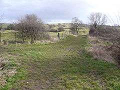 Footpath view near Carr Vale. |
|
 Carr Vale |
|
| OS grid reference | SK466698 |
|---|---|
| District | Bolsover |
| Shire county | Derbyshire |
| Region | East Midlands |
| Country | England |
| Sovereign state | United Kingdom |
| Post town | CHESTERFIELD |
| Postcode district | S44 6xx |
| Dialling code | 01246 |
| Police | Derbyshire |
| Fire | Derbyshire |
| Ambulance | East Midlands |
| EU Parliament | East Midlands |
|
|
Coordinates: 53°13′26″N 1°18′11″W / 53.224°N 1.303°W
Carr Vale is a small village attached to the New Bolsover model village, Bolsover, Derbyshire, England.[1][2] The population is included under Bolsover town.
It was begun in the late nineteenth century to house miners of the Bolsover Mining Company.
References
- ↑ Ordnance Survey: Landranger map sheet 120 Mansfield & Worksop (Sherwood Forest) (Map). Ordnance Survey. 2014. ISBN 9780319242100.
- ↑ "Ordnance Survey: 1:50,000 Scale Gazetteer" (csv (download)). www.ordnancesurvey.co.uk. Ordnance Survey. 1 January 2016. Retrieved 30 January 2016.
External links
![]() Media related to Carr Vale at Wikimedia Commons
Media related to Carr Vale at Wikimedia Commons
This article is issued from Wikipedia - version of the 3/22/2016. The text is available under the Creative Commons Attribution/Share Alike but additional terms may apply for the media files.