Carnetown
| Carnetown | |
| Carne | |
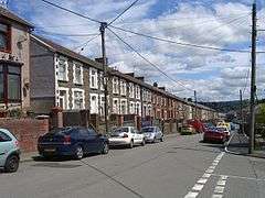 General view of Carnetown |
|
 Carnetown |
|
| OS grid reference | ST07786 |
|---|---|
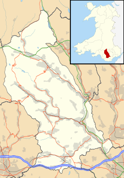
| Civil parish | Abercynon |
| Principal area | Rhondda Cynon Taf |
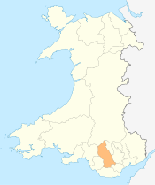
| Ceremonial county | Mid Glamorgan |
| Country | Wales |
| Sovereign state | United Kingdom |
| Post town | MOUNTAIN ASH |
| Postcode district | CF45 |
| Dialling code | 01443 |
| Police | South Wales |
| Fire | South Wales |
| Ambulance | Welsh |
| EU Parliament | Wales |
| UK Parliament | Cynon Valley |
| Welsh Assembly | Cynon Valley |
|
|
Coordinates: 51°38′27″N 3°20′02″W / 51.640780°N 3.333990°W
Carnetown (or 'Carne') is a district of Abercynon, within the Cynon Valley in the County Borough of Rhondda Cynon Taf, Wales.
Carnetown[1] is located to the south and west of Abercynon, and comprises Carnetown itself to the west, and the large modern housing estate of 'Grovers Field' to the south.
The area is home to 'Carnetown Primary School', 'St. Donat's Church'[2][3] (built in 1898[4]), 'Carne Park Hotel' and various shops/businesses, and previously had its own post office until 2005.[5]
Gallery
-

Grovers Field
References
- ↑ "Geograph:: Photos of carnetown". www.geograph.org.uk. Retrieved 2016-03-29.
- ↑ Anna, Morrell,. "Churches". The Church in Wales. Retrieved 2016-03-29.
- ↑ "Faith Wales | View St Donat's, Abercynon details". www.faithwales.org. Retrieved 2016-03-29.
- ↑ "Churches - The Parish of Abercynon". parish.churchinwales.org.uk. Retrieved 2016-03-29.
- ↑ Administrator, walesonline. "Post haste call by AM". walesonline. Retrieved 2016-03-29.
 |
Pontcynon | | ||
| Ynysybwl | |
ABERCYNON | ||
| ||||
| | ||||
| Grovers Field |
This article is issued from Wikipedia - version of the 4/26/2016. The text is available under the Creative Commons Attribution/Share Alike but additional terms may apply for the media files.