Carmen, Oklahoma
| Carmen, Oklahoma | |
|---|---|
| Town | |
 Location of Carmen, Oklahoma | |
| Coordinates: 36°34′46″N 98°27′34″W / 36.57944°N 98.45944°WCoordinates: 36°34′46″N 98°27′34″W / 36.57944°N 98.45944°W | |
| Country | United States |
| State | Oklahoma |
| County | Alfalfa |
| Area | |
| • Total | 1.5 sq mi (3.9 km2) |
| • Land | 1.5 sq mi (3.9 km2) |
| • Water | 0.0 sq mi (0.0 km2) |
| Elevation | 1,352 ft (412 m) |
| Population (2010) | |
| • Total | 355 |
| • Density | 235/sq mi (90.8/km2) |
| Time zone | Central (CST) (UTC-6) |
| • Summer (DST) | CDT (UTC-5) |
| ZIP code | 73726 |
| Area code(s) | 580 |
| FIPS code | 40-12000[1] |
| GNIS feature ID | 1090974[2] |
Carmen is a town in Alfalfa County, Oklahoma, United States. The population was 355 at the 2010 census.[3]
Geography
Carmen is located at 36°34′46″N 98°27′34″W / 36.57944°N 98.45944°W (36.579491, -98.459338).[4]
According to the United States Census Bureau, the town has a total area of 1.5 square miles (3.9 km2), all of it land.[3]
Carmen lies along State Highway 45.[5] It shared a school district with the nearby town of Dacoma until the school was closed.
In 1914, according to The Literary Digest, Carmen originated a "Take It Back Day", when neighbors would return anything they had borrowed over the last year. Apparently it never caught on nationally.
Demographics
| Historical population | |||
|---|---|---|---|
| Census | Pop. | %± | |
| 1910 | 883 | — | |
| 1920 | 792 | −10.3% | |
| 1930 | 904 | 14.1% | |
| 1940 | 818 | −9.5% | |
| 1950 | 654 | −20.0% | |
| 1960 | 533 | −18.5% | |
| 1970 | 519 | −2.6% | |
| 1980 | 516 | −0.6% | |
| 1990 | 459 | −11.0% | |
| 2000 | 411 | −10.5% | |
| 2010 | 355 | −13.6% | |
| Est. 2015 | 367 | [6] | 3.4% |
As of the census[1] of 2000, there were 411 people, 175 households, and 110 families residing in the town. The population density was 272.0 people per square mile (105.1/km²). There were 248 housing units at an average density of 164.2 per square mile (63.4/km²). The racial makeup of the town was 94.89% White, 0.49% African American, 1.95% Native American, 0.49% from other races, and 2.19% from two or more races. Hispanic or Latino of any race were 1.70% of the population.
There were 175 households out of which 26.9% had children under the age of 18 living with them, 53.1% were married couples living together, 7.4% had a female householder with no husband present, and 37.1% were non-families. 34.3% of all households were made up of individuals and 18.9% had someone living alone who was 65 years of age or older. The average household size was 2.35 and the average family size was 3.04.
In the town the population was spread out with 24.8% under the age of 18, 6.8% from 18 to 24, 22.4% from 25 to 44, 22.4% from 45 to 64, and 23.6% who were 65 years of age or older. The median age was 42 years. For every 100 females there were 82.7 males. For every 100 females age 18 and over, there were 82.8 males.
The median income for a household in the town was $25,769, and the median income for a family was $31,354. Males had a median income of $26,944 versus $21,250 for females. The per capita income for the town was $16,833. About 19.8% of families and 25.0% of the population were below the poverty line, including 48.0% of those under age 18 and 6.3% of those age 65 or over.
References
- 1 2 "American FactFinder". United States Census Bureau. Archived from the original on 2013-09-11. Retrieved 2008-01-31.
- ↑ "US Board on Geographic Names". United States Geological Survey. 2007-10-25. Retrieved 2008-01-31.
- 1 2 "Geographic Identifiers: 2010 Demographic Profile Data (G001): Carmen town, Oklahoma". U.S. Census Bureau, American Factfinder. Retrieved July 15, 2013.
- ↑ "US Gazetteer files: 2010, 2000, and 1990". United States Census Bureau. 2011-02-12. Retrieved 2011-04-23.
- ↑ Oklahoma 2009-2010 Official State Map (PDF) (Map) (2009-2010 ed.). Oklahoma Department of Transportation. Retrieved August 31, 2016.
- ↑ "Annual Estimates of the Resident Population for Incorporated Places: April 1, 2010 to July 1, 2015". Retrieved July 2, 2016.
- ↑ "Census of Population and Housing". Census.gov. Archived from the original on May 11, 2015. Retrieved June 4, 2015.
External links
Municipalities and communities of Alfalfa County, Oklahoma, United States | ||
|---|---|---|
| City | 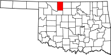 | |
| Towns | ||
| CDP | ||
| Other unincorporated communities | ||