Carlyss, Louisiana
| Carlyss, Louisiana | |
| Census-designated place | |
| Country | United States |
|---|---|
| State | Louisiana |
| Parish | Calcasieu |
| Elevation | 10 ft (3.0 m) |
| Coordinates | 30°11′34″N 93°22′27″W / 30.19278°N 93.37417°WCoordinates: 30°11′34″N 93°22′27″W / 30.19278°N 93.37417°W |
| Area | 12.0 sq mi (31.1 km2) |
| - land | 11.9 sq mi (30.8 km2) |
| - water | 0.1 sq mi (0.3 km2) |
| Population | 4,670 (2010) |
| Density | 392.0/sq mi (151.4/km2) |
| Timezone | CST (UTC-6) |
| - summer (DST) | CDT (UTC-5) |
| Area code | 337 |
 Location of Carlyss in Louisiana
| |
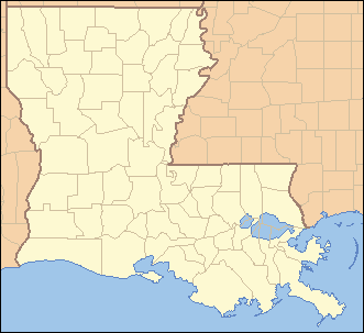
 Location of Louisiana in the United States
| |
Carlyss is a census-designated place (CDP) in Calcasieu Parish, Louisiana, United States. The population was 4,670 at the 2010 census.[1] It is part of the Lake Charles Metropolitan Statistical Area.
Geography
Carlyss is located south of the center of Calcasieu Parish at 30°11′34″N 93°22′27″W / 30.19278°N 93.37417°W (30.192655, -93.374104).[2] It is bordered to the north by the city of Sulphur. Interstate 10 follows the northern border, with access from exits 20 and 21. I-10 leads east 10 miles (16 km) to Lake Charles and west 22 miles (35 km) to Orange, Texas. Louisiana Highway 27 runs through the center of Carlyss, connecting Sulphur to the north with Holly Beach on the Gulf of Mexico, 32 miles (51 km) to the south.
According to the United States Census Bureau, the Carlyss CDP has a total area of 11.98 square miles (31.03 km2), of which 11.92 square miles (30.86 km2) is land and 0.07 square miles (0.18 km2), or 0.57%, is water.[1]
Demographics
As of the census[3] of 2000, there were 4,049 people, 1,473 households, and 1,132 families residing in the CDP. The population density was 338.0 people per square mile (130.5/km²). There were 1,668 housing units at an average density of 139.2 per square mile (53.8/km²). The racial makeup of the CDP was 97.46% White, 0.84% African American, 0.25% Native American, 0.25% Asian, 0.02% Pacific Islander, 0.32% from other races, and 0.86% from two or more races. Hispanic or Latino of any race were 1.19% of the population.
There were 1,473 households out of which 38.6% had children under the age of 18 living with them, 61.0% were married couples living together, 10.8% had a female householder with no husband present, and 23.1% were non-families. 18.1% of all households were made up of individuals and 4.8% had someone living alone who was 65 years of age or older. The average household size was 2.75 and the average family size was 3.13.
In the CDP the population was spread out with 28.7% under the age of 18, 9.3% from 18 to 24, 31.3% from 25 to 44, 21.3% from 45 to 64, and 9.4% who were 65 years of age or older. The median age was 33 years. For every 100 females there were 99.3 males. For every 100 females age 18 and over, there were 97.1 males.
The median income for a household in the CDP was $37,358, and the median income for a family was $41,583. Males had a median income of $36,042 versus $19,063 for females. The per capita income for the CDP was $17,956. About 8.1% of families and 9.7% of the population were below the poverty line, including 12.1% of those under age 18 and 10.4% of those age 65 or over.
References
- 1 2 "Geographic Identifiers: 2010 Demographic Profile Data (G001): Carlyss CDP, Louisiana". U.S. Census Bureau, American Factfinder. Retrieved August 14, 2014.
- ↑ "US Gazetteer files: 2010, 2000, and 1990". United States Census Bureau. 2011-02-12. Retrieved 2011-04-23.
- ↑ "American FactFinder". United States Census Bureau. Archived from the original on 2013-09-11. Retrieved 2008-01-31.
Municipalities and communities of Calcasieu Parish, Louisiana, United States | ||
|---|---|---|
| Cities | 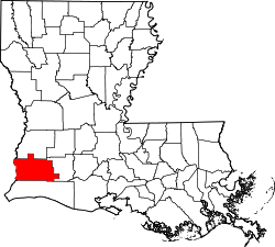 | |
| Towns | ||
| CDPs | ||
| Other unincorporated communities | ||