Cardwell, Missouri
| Cardwell, Missouri | |
|---|---|
| City | |
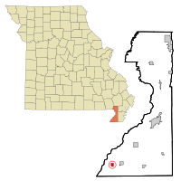 Location of Cardwell, Missouri | |
| Coordinates: 36°2′50″N 90°17′33″W / 36.04722°N 90.29250°WCoordinates: 36°2′50″N 90°17′33″W / 36.04722°N 90.29250°W | |
| Country | United States |
| State | Missouri |
| County | Dunklin |
| Area[1] | |
| • Total | 0.63 sq mi (1.63 km2) |
| • Land | 0.63 sq mi (1.63 km2) |
| • Water | 0 sq mi (0 km2) |
| Elevation | 246 ft (75 m) |
| Population (2010)[2] | |
| • Total | 713 |
| • Estimate (2012[3]) | 709 |
| • Density | 1,131.7/sq mi (437.0/km2) |
| Time zone | Central (CST) (UTC-6) |
| • Summer (DST) | CDT (UTC-5) |
| ZIP code | 63829 |
| Area code(s) | 573 |
| FIPS code | 29-11350[4] |
| GNIS feature ID | 0715393[5] |
Cardwell is a city in Dunklin County, Missouri, United States. The population was 713 at the 2010 census. The current Mayor of Cardwell is Melissa Herndon.
History
Cardwell was platted in 1895.[6] The community was named after Frank Cardwell, an Arkansas banker who lent money to the town's founders.[6][7][8] A post office has been in operation at Cardwell since 1895.[9]
Geography
Cardwell is located at 36°2′50″N 90°17′33″W / 36.04722°N 90.29250°W (36.047295, -90.292620).[10]
According to the United States Census Bureau, the city has a total area of 0.63 square miles (1.63 km2), all of it land.[1]
Demographics
| Historical population | |||
|---|---|---|---|
| Census | Pop. | %± | |
| 1900 | 502 | — | |
| 1910 | 874 | 74.1% | |
| 1920 | 1,043 | 19.3% | |
| 1930 | 861 | −17.4% | |
| 1940 | 913 | 6.0% | |
| 1950 | 952 | 4.3% | |
| 1960 | 816 | −14.3% | |
| 1970 | 859 | 5.3% | |
| 1980 | 831 | −3.3% | |
| 1990 | 792 | −4.7% | |
| 2000 | 789 | −0.4% | |
| 2010 | 713 | −9.6% | |
| Est. 2015 | 687 | [11] | −3.6% |
| source:[12] | |||
2010 census
As of the census[2] of 2010, there were 713 people, 317 households, and 180 families residing in the city. The population density was 1,131.7 inhabitants per square mile (437.0/km2). There were 386 housing units at an average density of 612.7 per square mile (236.6/km2). The racial makeup of the city was 96.35% White, 0.42% Black or African American, 0.28% Native American, 1.12% from other races, and 1.82% from two or more races. Hispanic or Latino of any race were 3.37% of the population.
There were 317 households of which 30.6% had children under the age of 18 living with them, 31.5% were married couples living together, 17.0% had a female householder with no husband present, 8.2% had a male householder with no wife present, and 43.2% were non-families. 36.0% of all households were made up of individuals and 12.6% had someone living alone who was 65 years of age or older. The average household size was 2.25 and the average family size was 2.95.
The median age in the city was 39.5 years. 25% of residents were under the age of 18; 9.1% were between the ages of 18 and 24; 24.2% were from 25 to 44; 25.1% were from 45 to 64; and 16.5% were 65 years of age or older. The gender makeup of the city was 50.2% male and 49.8% female.
2000 census
As of the census[4] of 2000, there were 789 people, 345 households, and 218 families residing in the city. The population density was 1,246.1 people per square mile (483.5/km²). There were 387 housing units at an average density of 611.2 per square mile (237.2/km²). The racial makeup of the city was 97.34% White, 0.89% African American, 0.63% Native American, and 1.14% from two or more races. Hispanic or Latino of any race were 1.01% of the population.
There were 345 households out of which 29.6% had children under the age of 18 living with them, 45.5% were married couples living together, 13.3% had a female householder with no husband present, and 36.8% were non-families. 33.6% of all households were made up of individuals and 16.5% had someone living alone who was 65 years of age or older. The average household size was 2.29 and the average family size was 2.92.
In the city the population was spread out with 24.3% under the age of 18, 7.5% from 18 to 24, 28.6% from 25 to 44, 22.6% from 45 to 64, and 17.0% who were 65 years of age or older. The median age was 39 years. For every 100 females there were 88.3 males. For every 100 females age 18 and over, there were 86.0 males.
The median income for a household in the city was $21,042, and the median income for a family was $27,361. Males had a median income of $25,179 versus $19,500 for females. The per capita income for the city was $12,207. About 25.1% of families and 27.0% of the population were below the poverty line, including 34.0% of those under age 18 and 22.7% of those age 65 or over.
Notable people
The Missouri Bootheel is the home place of 2 members of The Kentucky Headhunters, Doug and Ricky Phelps. They grew up in Cardwell and Arbyrd and obtained their education from the Southland C-9 school district. Doug and Ricky were both members of the Headhunters who then left to form their own band called - Brother Phelps. Once Ricky decided to take his music into a more gospel arena, Doug rejoined the Kentucky Headhunters as the lead singer. Doug and Ricky came back (as Brother Phelps) to the Missouri Bootheel. They performed at the Cotton Pickin Festival in Arbyrd; a place where they spent lots of time while growing up. The Kentucky Headhunters filmed part of the music video "Oh Lonesome Me" in Cardwell, Missouri.
References
- 1 2 "US Gazetteer files 2010". United States Census Bureau. Archived from the original on 2012-07-14. Retrieved 2012-07-08.
- 1 2 "American FactFinder". United States Census Bureau. Retrieved 2012-07-08.
- ↑ "Population Estimates". United States Census Bureau. Archived from the original on 2013-06-17. Retrieved 2013-05-30.
- 1 2 "American FactFinder". United States Census Bureau. Archived from the original on 2013-09-11. Retrieved 2008-01-31.
- ↑ "US Board on Geographic Names". United States Geological Survey. 2007-10-25. Retrieved 2008-01-31.
- 1 2 "Dunklin County Place Names, 1928–1945 (archived)". The State Historical Society of Missouri. Archived from the original on 24 June 2016. Retrieved 29 September 2016.
- ↑ Gannett, Henry (1905). The Origin of Certain Place Names in the United States. Govt. Print. Off. p. 69.
- ↑ Eaton, David Wolfe (1916). How Missouri Counties, Towns and Streams Were Named. The State Historical Society of Missouri. p. 165.
- ↑ "Post Offices". Jim Forte Postal History. Retrieved 29 September 2016.
- ↑ "US Gazetteer files: 2010, 2000, and 1990". United States Census Bureau. 2011-02-12. Retrieved 2011-04-23.
- ↑ "Annual Estimates of the Resident Population for Incorporated Places: April 1, 2010 to July 1, 2015". Retrieved July 2, 2016.
- ↑ "Missouri Population 1900 - 1990" (CSV). Missouri Census Data Center. Retrieved 6 October 2014.
External links
- Historic maps of Cardwell in the Sanborn Maps of Missouri Collection at the University of Missouri
Municipalities and communities of Dunklin County, Missouri, United States | ||
|---|---|---|
| Cities | 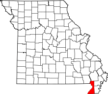 | |
| Village | ||
| Townships | ||
| Unincorporated communities | ||
| Ghost towns | ||
| Footnotes | ‡This populated place also has portions in an adjacent county or counties | |