Carbon Hill, Alabama
| Carbon Hill | |
|---|---|
| City | |
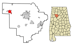 Location in Walker County and the state of Alabama | |
| Coordinates: 33°53′26″N 87°31′27″W / 33.89056°N 87.52417°W | |
| Country | United States |
| State | Alabama |
| County | Walker |
| Area | |
| • Total | 5.5 sq mi (14.4 km2) |
| • Land | 5.5 sq mi (14.3 km2) |
| • Water | 0 sq mi (0.1 km2) |
| Elevation | 479 ft (146 m) |
| Population (2010) | |
| • Total | 2,021 |
| • Density | 376.5/sq mi (143.8/km2) |
| Time zone | Central (CST) (UTC-6) |
| • Summer (DST) | CDT (UTC-5) |
| ZIP code | 35549 |
| Area code(s) | 205 |
| FIPS code | 01-12016 |
| GNIS feature ID | 0155010 |
Carbon Hill is a city in Walker County, Alabama, United States. It incorporated in February 1891.[1] At the 2010 census the population was 2,021, down from 2,071 in 2000.
Geography
Carbon Hill was begun as a small mining town in extreme western Walker County. The city is located at 33°53′26″N 87°31′28″W / 33.89056°N 87.52444°W (33.890690, -87.524307).[2]
According to the U.S. Census Bureau, the city has a total area of 5.6 square miles (15 km2), of which 5.5 square miles (14 km2) is land and 0.1 square miles (0.26 km2) (0.90%) is water.
Climate
The climate in this area is characterized by hot, humid summers and generally mild to cool winters. According to the Köppen Climate Classification system, Carbon Hill has a humid subtropical climate, abbreviated "Cfa" on climate maps. [3]
Demographics
| Historical population | |||
|---|---|---|---|
| Census | Pop. | %± | |
| 1890 | 568 | — | |
| 1900 | 830 | 46.1% | |
| 1910 | 1,627 | 96.0% | |
| 1920 | 2,666 | 63.9% | |
| 1930 | 2,519 | −5.5% | |
| 1940 | 2,555 | 1.4% | |
| 1950 | 2,179 | −14.7% | |
| 1960 | 1,944 | −10.8% | |
| 1970 | 1,929 | −0.8% | |
| 1980 | 2,452 | 27.1% | |
| 1990 | 2,115 | −13.7% | |
| 2000 | 2,071 | −2.1% | |
| 2010 | 2,021 | −2.4% | |
| Est. 2015 | 1,975 | [4] | −2.3% |
| U.S. Decennial Census[5] 2013 Estimate[6] | |||
As of the census[7] of 2000, there were 2,071 people, 880 households, and 579 families residing in the city. The population density was 374.3 people per square mile (144.6/km2). There were 1,017 housing units at an average density of 183.8 per square mile (71.0/km2). The racial makeup of the city was 89.43% White, 8.74% Black or African American, 0.10% Native American, 0.29% from other races, and 1.45% from two or more races. 1.01% of the population were Hispanic or Latino of any race.
There were 880 households out of which 28.3% had children under the age of 18 living with them, 46.3% were married couples living together, 15.1% had a female householder with no husband present, and 34.2% were non-families. 31.9% of all households were made up of individuals and 14.4% had someone living alone who was 65 years of age or older. The average household size was 2.28 and the average family size was 2.85.
In the city the population was spread out with 22.2% under the age of 18, 8.3% from 18 to 24, 24.2% from 25 to 44, 27.0% from 45 to 64, and 18.3% who were 65 years of age or older. The median age was 41 years. For every 100 females there were 81.7 males. For every 100 females age 18 and over, there were 77.1 males. The median income for a household in the city was $20,861, and the median income for a family was $25,556. Males had a median income of $23,241 versus $15,170 for females. The per capita income for the city was $12,100. About 23.0% of families and 24.0% of the population were below the poverty line, including 30.7% of those under age 18 and 20.5% of those age 65 or over.
2010 census
As of the census[8] of 2010, there were 2,021 people, 860 households, and 550 families residing in the city. The population density was 367.5 people per square mile (141.3/km2). There were 995 housing units at an average density of 180.9 per square mile (69.6/km2). The racial makeup of the city was 89.4% White, 8.2% Black or African American, 0.2% Native American, 0.6% from other races, and 1.2% from two or more races. 1.2% of the population were Hispanic or Latino of any race.
There were 860 households out of which 25.7% had children under the age of 18 living with them, 41.4% were married couples living together, 17.0% had a female householder with no husband present, and 36.0% were non-families. 33.8% of all households were made up of individuals and 15.8% had someone living alone who was 65 years of age or older. The average household size was 2.35 and the average family size was 2.97.
In the city the population was spread out with 23.7% under the age of 18, 7.4% from 18 to 24, 25.2% from 25 to 44, 26.4% from 45 to 64, and 17.3% who were 65 years of age or older. The median age was 40.9 years. For every 100 females there were 90.3 males. For every 100 females age 18 and over, there were 90.6 males.
The median income for a household in the city was $25,481, and the median income for a family was $36,298. Males had a median income of $32,455 versus $25,417 for females. The per capita income for the city was $15,167. About 24.6% of families and 26.2% of the population were below the poverty line, including 44.0% of those under age 18 and 27.9% of those age 65 or over.
History
About 310 million years ago, Carbon Hill was located south of the equator, in a swampy area, where dinosaurs roamed. Carbon Hill is noted for fossil discoveries from that era.
Carbon Hill, Alabama was settled in 1886 because of coal mining and the railroad. A post office was established in 1887 with John T. Anderson as the first Postmaster. By 1888, the community had grown enough to support the Carbon Hill United Methodist Church.
The Galloway Coal Company was responsible for the early development of Carbon Hill. Col. Robert Galloway entered the coal and transfer business in 1863. On May 1, 1890 Galloway bought mines and property on Carbon Hill (as it was then called) from The Kansas City Coal and Coke Company for $130,000. Galloway turned the operation into a commercial success. Other mining companies set up operations after word spread of Galloway's success.
On February 1, 1891, the Sheriff of Walker County telegraphed the governor of Alabama requesting fifty soldiers to be dispatched to Carbon Hill. Mayor Anderson wired: "There is a lawless mob here. Colored people are shot and driven from home. No arrest made. We need troops." Superintendent B. W. Whitfield of the Carbon Hill Coal and Coke Company was anxious to fire 200 striking miners, and the men had caught word of it. The strikers feared the black citizens would take their jobs.
On February 14, 1891, the town of Carbon Hill was incorporated, with John T. Anderson as mayor. February 14 is also known as St. Valentine's Day; the founding fathers wanted the tiny town to be known as The Village of Love and Luck. The notion of coal as luck derives from the cultural traditions of Scotland (where Colonel Galloway was born) - it is also customary and considered lucky in Scotland and the North of England to give coal as a gift on New Year's Day. This occurs as part of First-Footing and represents warmth for the year to come.
On May 27, 1917, an F3 tornado hit Carbon Hill, killing 6 people and destroying 200 homes in an area 3 miles wide by 17 miles long.
Carbon Hill was "especially hard-hit by the Depression," and became known for its "savvy utilization of federal resources" provided by the Works Progress Administration (WPA) and the Public Works Administration (PWA). Residents used the funding to build a new high school, and made improvements to sewers, sidewalks, and streets. [9]
On November 17, 1957 a category F4 (max. wind speeds 207-260 mph) tornado 13.2 miles away from the Carbon Hill city center killed 4 people and injured 15 people.
An F3 tornado destroyed much of Carbon Hill on November 10, 2002.[10]
Churches
Carbon Hill is known for its vast selection of Christian Churches in the city. There were approximately 30 churches inside the city limits as of 2011. Two of the town's churches, the Carbon Hill Church of God of Prophecy, and the Carbon Hill First Baptist gained national attention from the media during the destruction of the 2002 tornadoes. The Church of God of Prophecy was a temporary housing and safe unit during the catastrophe, under direction of the American Red Cross and the Southern Baptist Association.
Notable people
- Ken Guin, Member of Alabama House of Representatives from 1994 to 2010, House Majority Leader 1997 to 2010.
- Buddy Nix, Buffalo Bills General Manager from 2010 to 2013.
- C. Lloyd Nix, Auburn Tigers quarterback 1957 National Championship and member Alabama Sports Hall of Fame.
- Joseph Sam Perry, federal judge on the United States District Court for the Northern District of Illinois from 1951 to 1971.
- James R. Sides, former President and CEO of Atlantic Research Corporation.
- Wimp Sanderson, college basketball coach and former basketball coach at Carbon Hill High School.
- Elmer Tutwiler, former baseball player for the Pittsburgh Pirates.
Education
This town is served by the Carbon Hill High School, a facility of 430 students in grades 9-12. The school is widely known as the first place of employment for legendary college basketball coach "Wimp" Sanderson, and home to many great collegiate football players. The school's mascot is the Bulldog, and the colors are blue and white. The school is a member of the Walker County Board of Education. In 2002, the original school building was destroyed by fire. It was recently replaced by a new building.[11] Carbon Hill Elementary/Junior High School which some of the students were temporarily relocated was destroyed by an F3 tornado that destroyed much of Carbon Hill on November 10, 2002.[12]
References
| Wikimedia Commons has media related to Carbon Hill, Alabama. |
- ↑ http://www.encyclopediaofalabama.org/article/h-3415
- ↑ "US Gazetteer files: 2010, 2000, and 1990". United States Census Bureau. 2011-02-12. Retrieved 2011-04-23.
- ↑ Climate Summary for Carbon Hill, Alabama
- ↑ "Annual Estimates of the Resident Population for Incorporated Places: April 1, 2010 to July 1, 2015". Retrieved July 2, 2016.
- ↑ "U.S. Decennial Census". Census.gov. Archived from the original on May 11, 2015. Retrieved June 6, 2013.
- ↑ "Annual Estimates of the Resident Population: April 1, 2010 to July 1, 2013". Retrieved June 3, 2014.
- ↑ "American FactFinder". United States Census Bureau. Archived from the original on 2013-09-11. Retrieved 2008-01-31.
- ↑ "American FactFinder". United States Census Bureau. Archived from the original on 2013-09-11. Retrieved 2015-08-13.
- ↑ "A New Deal for Carbon Hill, Alabama". Retrieved 2012-03-03.
- ↑
- ↑ "Carbon Hill High School - Home". Walkercountyschools.com. Retrieved 2012-03-03.
- ↑
Coordinates: 33°53′26″N 87°31′28″W / 33.89069°N 87.524307°W
Municipalities and communities of Walker County, Alabama, United States | ||
|---|---|---|
| Cities | 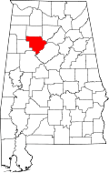 | |
| Towns | ||
| Unincorporated communities | ||
| Footnotes | ‡This populated place also has portions in an adjacent county or counties | |