Capitol South station
 The station platform in November 2005 | |||||||||||||||||||||
| Location |
355 1st Street, Southeast Washington, D.C. 20003 | ||||||||||||||||||||
| Owned by | Washington Metropolitan Area Transit Authority | ||||||||||||||||||||
| Line(s) |
| ||||||||||||||||||||
| Platforms | 1 island platform | ||||||||||||||||||||
| Tracks | 2 | ||||||||||||||||||||
| Connections |
| ||||||||||||||||||||
| Construction | |||||||||||||||||||||
| Structure type | Underground | ||||||||||||||||||||
| Disabled access | Yes | ||||||||||||||||||||
| Other information | |||||||||||||||||||||
| Station code | D05 | ||||||||||||||||||||
| History | |||||||||||||||||||||
| Opened | July 1, 1977 | ||||||||||||||||||||
| Traffic | |||||||||||||||||||||
| Passengers (2015) |
7973 daily [1] | ||||||||||||||||||||
| Services | |||||||||||||||||||||
| |||||||||||||||||||||
Capitol South is an island platformed Washington Metro station in the Capitol Hill neighborhood of Washington, D.C., United States. The station was opened on July 1, 1977, and is operated by the Washington Metropolitan Area Transit Authority (WMATA). The station currently provides service for the Blue, Orange, and Silver Lines.
The station opened on July 1, 1977.[2] Its opening coincided with the completion of 11.8 miles (19.0 km)[3] of rail between National Airport and RFK Stadium and the opening of the Arlington Cemetery, Crystal City, Eastern Market, Farragut West, Federal Center SW, Federal Triangle, Foggy Bottom–GWU, L'Enfant Plaza, McPherson Square, National Airport, Pentagon, Pentagon City, Potomac Avenue, Rosslyn, Smithsonian and Stadium–Armory stations.[4] Orange Line service to the station began upon the line's opening on November 20, 1978.[5] Silver Line service at Capitol South began on July 26, 2014.[6]
Location
Capitol South is located in the south-central section of the Capitol Hill neighborhood of Washington, D.C. As such, it is surrounded by a wealth of government offices and buildings. Most importantly, it is the closest station to the Capitol Building which holds the Senate and House of Representatives.[7] All three buildings of the Library of Congress are within a quarter-of-a-mile radius of Capitol South as are the Democratic National Committee and Republican National Committee headquarters.[7] The Folger Shakespeare Library, the world's largest collection of printed Shakespearean works is a five-minute walk west from the station.[7]
Station layout
| G | Street Level | Exit/ Entrance |
| M | Mezzanine | One-way faregates, ticket machines, station agent |
| P Platform level |
Westbound | ← ← ← |
| Island platform, doors will open on the left | ||
| Eastbound | → → → | |
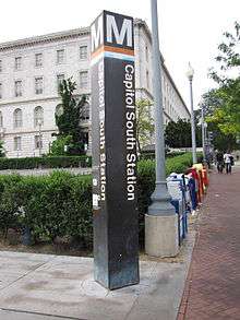
There is only one entrance to the station located on the southwestern corner at the intersection of 1st Street SE and C Street SE.[7] A row of three escalators and a staircase brings passengers to the station's mezzanine level, where they may buy tickets from vending machines and pass through the faregates.[8] Once passengers pass through these faregates, a pair of escalators brings passengers onto the platform.[8] There are two elevators for handicapped passengers, one from street level to the mezzanine on the northwestern corner at the intersection of 1st Street SE and D Street SE and another between the mezzanine and platform.[8]
Capitol South station utilises an island platform layout with two tracks, D1 and D2.[9] Eastbound trains to New Carrollton or Largo Town Center use track D1 whilst westbound trains to Vienna, Franconia–Springfield, or Wiehle – Reston East use track D2.[9]
References
- ↑ "Metrorail Average Weekday Passenger Boardings" (PDF). WMATA. Retrieved 2016-06-07.
- ↑ Feaver, Douglas B. (July 1, 1977), "Today, Metro could be U.S. model", The Washington Post, p. A1
- ↑ Washington Metropolitan Area Transit Authority (July 2009). "Sequence of Metrorail openings" (PDF). Archived from the original (PDF) on January 13, 2010. Retrieved July 25, 2010.
- ↑ Staff Reporters (June 24, 1977), "Metro's newest stations: Where they are, what's nearby", The Washington Post
- ↑ Eisen, Jack; Feinstein, John (November 18, 1978), "City-County fanfare opens Orange Line; Ceremonies open new Orange Line", The Washington Post, p. D1
- ↑ Halsey, Ashley (July 26, 2014). "All aboard! Metro's new Silver Line rolls down the tracks for the first time". The Washington Post. Retrieved July 8, 2016.
- 1 2 3 4 Capitol South station: 1st Street exit WMATA Retrieved 2009-01-25
- 1 2 3 Capitol South station WMATA Retrieved 2009-01-25
- 1 2 John R Cambron track maps John R Cambron Retrieved 2009-01-25
External links
![]() Media related to Capitol South (WMATA station) at Wikimedia Commons
Media related to Capitol South (WMATA station) at Wikimedia Commons
- WMATA: Capitol South Station
- StationMasters Online: Capitol South Station
- The Schumin Web Transit Center: Capitol South Station
- 1st Street entrance from Google Maps Street View
Coordinates: 38°53′8″N 77°0′21.8″W / 38.88556°N 77.006056°W