Capel St. Mary
| Capel St. Mary | |
 St. Mary's church, Capel St. Mary |
|
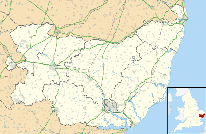 Capel St. Mary |
|
| Population | 2,877 (2001 Census) 2,847 (2011)[1] |
|---|---|
| – density | 8,280/sq mi (3,200/km2) |
| OS grid reference | TM092381 |
| District | Babergh |
| Shire county | Suffolk |
| Region | East |
| Country | England |
| Sovereign state | United Kingdom |
| Post town | IPSWICH |
| Postcode district | IP9 |
| Dialling code | 01473 |
| EU Parliament | East of England |
Coordinates: 52°00′07″N 1°02′46″E / 52.002°N 1.046°E
Capel St. Mary – commonly known as Capel – is a village in Suffolk, England. It is about 6 miles (10 km) southwest of Ipswich and 2 miles (3 km) from Dedham Vale, a designated Area of Outstanding Natural Beauty.
History
Early history
The village was listed in the Domesday Book as part of the manor of Boynton.[2] A 13th Century document was the first to mention it by its current name, derived from the Latin capele, meaning "chapel".
Tentative evidence of Bronze Age habitation has recently been discovered just outside the boundaries of the village,[3] and well-documented human settlement in the area dates from the Roman period.[4] Evidence of a villa was found during construction of council houses on Windmill Hill at the west end of the village in the 1930s, along with remains of a kiln nearby, and smaller artefacts such as coins and tiles.[5]
A fortified house was built in nearby Little Wenham between 1260 and 1290. It is believed to be one of the first examples of fortified houses made from English brick.[6]
A railway station was built as part of the Hadleigh branch line in 1847. The station was closed to passengers in 1932 but freight services continued until 1965, when the line was closed as a result of the Beeching Axe.
The village was birthplace in 1859 of Lieutenant-General Sir Edwin Alderson, first commander of the Canadian Expeditionary Force of World War I.[7]
20th century

During the second World War, the village was frequented by American airmen from nearby RAF Raydon. Men from the village were involved in two local Auxiliary Units, Wenham and Capel, part of the 202nd battalion of the Home Guard. The Wenham unit was based at a dugout under Jermyn's Farm to the north of the village, and a dugout a short distance away housed their supply of explosives.[8] The Capel unit was based in woods near Bentley; the three dugouts at their disposal housed ammunition, a field telephone, and their supplies of gelignite and plastic explosive. The explosives were destroyed in-situ after the end of hostilities because they were deemed too dangerous to move.[9]
In 1960, initial plans were drawn up for significant housing development and mains sewerage in the village – the latter was needed following the introduction of mains water in 1951. These were finalised by 1963, initiating an expansion of the village from some 632 people in 1961 to a peak of 3,176 people in 1991. The new houses were built with an open-plan design: front gardens were not to be enclosed, and grass verges were to separate fences from the pavement. Plans for the village shopping centre were approved in 1974.[9]
Facilities
Shopping and health
Most facilities are located in the centre of the village, including the Co-Op and independent shops such as a bakery, hairdresser, and a newsagent. There is also a post office and doctors' surgery with a pharmacy.
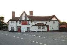
Capel's only pub – the White Horse, – and a Jet petrol station are at the east end of the village. A second pub – the Plough – closed in 1996.
Capel also has a bar that can be found near the shops attached to the village hall
The White Horse is open again after being taken over from the local garden centre and appears to be doing well
Recreation
There is a large playing field which hosts football pitches, tennis courts, a cricket ground and a bowling green. There is also a children's playground at the same site. A fireworks display is held here each year on the 5 November. The pitches are home to Capel Plough F.C. who play in the Suffolk and Ipswich Football League. The village hall and the attached bar are used by many societies. These are maintained by the Capel Community Trust
There is a thriving Scout Group based in the Village, who have their own HQ and close to 100 members (correct at January 2013).[10]
Education
There is a primary school in the village. Most children then go to East Bergholt High School, although some go to selective or private secondary schools in nearby Ipswich or Colchester.
Religious sites
The village is in the Anglican parish of Capel St. Mary with Lt Wenham and Gt Wenham. The parish church is St Mary Virgin and Mother. Construction started in the early 13th Century, but most of the building dates from the 15th Century. However, the churchyard was found to contain Roman cremation urns when digging took place for a northern extension in the late 1990s.
There is also a Methodist church and a Community church in the village. Roman Catholic services used to be conducted in St Mary's, but declining numbers of priests meant these became unfeasible. The nearest Catholic Services are either in Ipswich or Brantham
All churches are very active and work closely together.
Transport
Capel sits next to the A12 road, which links the village to Ipswich and Colchester. There is also a local bus service.[11]
Demography
| Capel St Mary compared | |||
|---|---|---|---|
| 2001 UK census | Capel St Mary[12] | Babergh[13] | England |
| Total population | 2,877 | 83,461 | 49,138,831 |
| White | 98.3% | 98.7% | 91% |
| Asian | 0.4% | 0.3% | 4.6% |
| Black | 0.2% | 0.2% | 2.3% |
According to the Office for National Statistics, at the time of the United Kingdom Census 2001, Capel St Mary had a population of 2,877. The 2001 population density was 8,280 inhabitants per square mile (3,197/km2), with a 100 to 94.9 female-to-male ratio.[14] Of those over 16 years old, 19.1% were single (never married), 59.4% married, and 5.5% divorced.[15] Capel St Mary's 1,105 households included 17.1% one-person, 58.1% married couples living together, 4.2% were co-habiting couples, and 6.5% single parents with their children.[16] Of those aged 16–74, 19.1% had no academic qualifications, much lower than the averages of Babergh (27.8%) and England (28.9%).[17][18]
At the 2001 UK census, 78.8% of Capel St Mary's residents reported themselves as being Christian, 0.2% Hindu, 0.2% Jewish, and 0.1% Buddhist. The census recorded 13.8% as having no religion, 0.2% had an alternative religion and 6.8% did not state their religion.[19]
Population change
| Population growth in Capel St Mary since 1881 | |||||||||||
|---|---|---|---|---|---|---|---|---|---|---|---|
| Year | 1871 | 1881 | 1891 | 1901 | 1911 | 1921 | 1931 | 1951 | 1961 | 2001 | 2011 |
| Population | 593 | 567 | 605 | 526 | 516 | 480 | 504 | 582 | 632 | 2,877 | 2,847 |
| Source: A Vision of Britain through Time[14] (to 2001); 2011 census[1] | |||||||||||
Economy
| Capel St Mary compared | |||
|---|---|---|---|
| 2001 UK Census | Capel St Mary[20] | Babergh[21] | England |
| Population of working age | 2,136 | 59,886 | 35,532,091 |
| Full-time employment | 41.3% | 40.3% | 40.8% |
| Part-time employment | 16.5% | 13.5% | 11.8% |
| Self-employed | 9.6% | 11.7% | 8.3% |
| Unemployed | 1.5% | 2.2% | 3.3% |
| Retired | 15.5% | 15.5% | 13.5% |
According to the 2001 UK census, the industry of employment of residents aged 16–74 was 16.2% retail and wholesale, 13.3% property and business services, 11.4% transport and communications, 10.9% finance, 9.7% manufacturing, 8.1% health and social work, 6.9% education, 6.1% construction, 5.7% public administration, 5.3% hotels and restaurants, 1.4% agriculture, 1.3% energy and water supply, and 3.8% other. Compared with national figures, Capel St Mary had a relatively high percentage of residents working in energy and water supply (0.9% nationally); transport and communications (7.0% nationally); and finance (5.1%); and a relatively low percentage working in manufacturing (17.6% nationally). Although the proportion of people in Capel St Mary was similar to the national average (1.5%), it was below the average for the borough (3.5%).[22][23] The census recorded the economic activity of residents aged 16–74, 3.1% students were with jobs, 2.8% students without jobs, 6.1% looking after home or family, 2.5% permanently sick or disabled, and 1.1% economically inactive for other reasons.[20]
Location
 |
Great Wenham, Little Wenham | Chattisham | Copdock, Ipswich | |
| Raydon | |
Tattingstone | ||
| ||||
| | ||||
| East Bergholt, Stratford St Mary, Colchester | Brantham, Manningtree | Bentley |
References
- 1 2 "Civil Parish population 2011". Neighbourhood Statistics. Office for National Statistics. Retrieved 18 August 2016.
- ↑ Boynton Hall's location can be seen on this OS map from 1946
- ↑ Neolithic axe, and a Summary of Bronze Age, Iron Age and medieval finds Archived 9 October 2011 at the Wayback Machine.
- ↑ Archaeology Data Service
- ↑ A large selection of these are on free display in Ipswich Museum Archived 23 January 2010 at the Wayback Machine.
- ↑ "Archived copy" (PDF). Archived from the original (PDF) on 22 July 2011. Retrieved 2009-09-10. Babergh District Council description of the site with some history
- ↑ Alderson, Sir Edwin Alfred Hervey, Dictionary of Canadian Biography article by Desmond Morton, Retrieved 5 November 2007
- ↑ Archaeology Data Service
- 1 2 R. Pearce (ed.). The Book of Capel. Capel St Mary Parish Council
- ↑ "1st Capel St Mary Scout Group". 1st Capel St Mary Scout Group. Retrieved 9 November 2013.
- ↑ Service 93 Timetable, serving Colchester and Ipswich
- ↑ "KS06 Ethnic group: Census 2001, Key Statistics for urban areas". Statistics.gov.uk. 25 January 2005. Archived from the original on 4 August 2009. Retrieved 19 April 2009.
- ↑ "Babergh Local Authority ethnic group". Statistics.gov.uk. Retrieved 14 September 2009.
- 1 2 "KS01 Usual resident population: Census 2001, Key Statistics for urban areas". Statistics.gov.uk. 7 February 2005. Archived from the original on 6 December 2010. Retrieved 14 September 2009.
- ↑ "KS04 Marital status: Census 2001, Key Statistics for urban areas". Statistics.gov.uk. 2 February 2005. Archived from the original on 29 July 2009. Retrieved 14 September 2009.
- ↑ "KS20 Household composition: Census 2001, Key Statistics for urban areas". Statistics.gov.uk. 2 February 2005. Archived from the original on 22 December 2008. Retrieved 14 September 2009.
- ↑ "Babergh Local Authority key statistics". Statistics.gov.uk. Retrieved 14 September 2009.
- ↑ "KS13 Qualifications and students: Census 2001, Key Statistics for urban areas". Statistics.gov.uk. 2 February 2005. Archived from the original on 4 August 2009. Retrieved 14 September 2009.
- ↑ "KS07 Religion: Census 2001, Key Statistics for urban areas". Statistics.gov.uk. 2 February 2005. Retrieved 14 September 2009.
- 1 2 "KS09a Economic activity – all people: Census 2001, Key Statistics for urban areas". Statistics.gov.uk. 3 February 2005. Retrieved 14 September 2009.
- ↑ "Babergh Local Authority economic activity". Statistics.gov.uk. Retrieved 14 September 2009.
- ↑ "KS11a Industry of employment – all people: Census 2001, Key Statistics for urban areas". Statistics.gov.uk. 3 February 2005. Retrieved 14 September 2009.
- ↑ "Babergh Local Authority industry of employment". Statistics.gov.uk. Retrieved 14 September 2009.
External links
| Wikimedia Commons has media related to Capel St. Mary. |