Capel Curig
| Capel Curig | |
 St Julitta's Church |
|
 Capel Curig |
|
| Population | 206 (2011) |
|---|---|
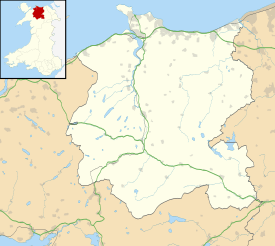
| OS grid reference | SH720582 |
| Community | Capel Curig |
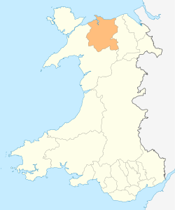
| Principal area | Conwy |
| Ceremonial county | Clwyd |
| Country | Wales |
| Sovereign state | United Kingdom |
| Post town | BETWS-Y-COED |
| Postcode district | LL24 |
| Dialling code | 01690 |
| Police | North Wales |
| Fire | North Wales |
| Ambulance | Welsh |
| EU Parliament | Wales |
| UK Parliament | Meirionnydd Nant Conwy |
Coordinates: 53°06′18″N 3°54′47″W / 53.105°N 3.913°W

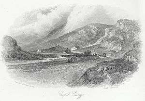
Capel Curig (Welsh pronunciation: [ˈkɑːpɛl ˈkɨːrɪɡ]; meaning "Curig's Chapel") is a village and community in Conwy County Borough, in Wales. It lies in the heart of Snowdonia, on the River Llugwy, and has a population of 226,[1] reducing slightly to 206 at the 2011 census.[2] It is at the junction of the A5 road from Bangor and Bethesda to Betws-y-Coed with the A4086 road from Caernarfon, Llanberis, Pen-y-Pass and Pen-y-Gwryd.
Name
Capel Curig takes its name from the little Saint Julitta's Church in the ancient graveyard by the river bridge on the Llanberis road. This confusingly has been known for over 100 years as St. Julitta's Church and is currently being restored by the "Friends of Saint Julitta". Tradition claims this chapel to be the 6th century foundation of St. Curig, a Celtic bishop. Centuries later, probably when the present ancient church was built, the name appears to have been Latinised as Cyricus, which is the name of a 4th-century child martyr whose mother was Julitta. They are usually named together as Saints Quiricus and Julietta.
The names Capel Kiryg and Capel Kerig were recorded in 1536 and 1578 respectively.[3]
Evan Roberts
Capel Curig was home to the botanist Evan Roberts.[4] Roberts lived at Gelli, from where he explored all of Snowdonia, and compiled an unparalleled knowledge of the plant life of North Wales. Although he spent the first 40 years of his life as a quarry worker, he went on to become the colleague of academics. He was awarded the honorary degree of M.Sc. of the University of Wales, in 1956, at the same ceremony as the architect Frank Lloyd Wright, and his portrait was painted by Kyffin Williams.
Roman fort
Approximately one kilometre from Pont Cyfyng, on the farm of Bryn Gefeiliau, there are the remains of a Roman fort (c.90–100 AD) and named Caer Llugwy by its excavators.[5] (53°05′50″N 3°52′27″W / 53.0972°N 3.8743°W, OS Grid Reference SH746572). In 1920 excavations undertaken by J.P. Hall and Captain G.H. Hodgson revealed a roughly square Roman fort of approximately 4 acres (1.6 ha). Stone buildings were uncovered and traced. The rectangular walled area is on flat land close to the River Llugwy. From the pottery and finds in 1923 and subsequently, it appears to have only been garrisoned for 20–30 years.[6]
Activity centre
The village is a popular centre for walking, climbing, mountaineering, mountain biking and other outdoor pursuits and is served by the Sherpa bus network. It is also home to a youth hostel, Army training camp, a camp site, several cafes and hotels and outdoor activity gear shops.
Wolverhampton City Council have since 1961 operated 'The Towers' outdoors activity centre just outside Capel Curig. The centre facilitates walking, climbing, a variety of watersports and field studies on a schdule that is adapted day to day according to the prevailing weather conditions and to the abilities and needs of individuals and groups.[7]
Also located in Capel Curig is the UK National Mountain Centre at Plas y Brenin, which offers the highest quality mountaineering, climbing, canoeing facilities and training. One mile east of the village on the A5 is Tŷ Hyll, home of the Snowdonia Society
Culture
Capel Curig is mentioned in the song Bottleneck at Capel Curig by cult UK band Half Man Half Biscuit on their album Trouble Over Bridgwater.
Capel Curig is the setting for the climax of the 1956 thriller The Hidden Face by Victor Canning.
Climate
As with much of the rest of the British Isles, Capel Curig experiences a temperate maritime climate, with warm summers and cold winters, little extremes of temperature and high humidity year round. The sunniest and driest month is May, meanwhile the wettest is December, with more than 300 mm. The warmest recorded temperature was 30.6°C on 19th July 2006 and the coldest -16.8°C on 20th December 2010. Capel Curig is one of the wettest places in the UK and the wettest in Wales. Record high temperatures during the Winter have been higher than in the average summer.
| Climate data for Capel Curig (1981-2010) (Extremes 1994-) | |||||||||||||
|---|---|---|---|---|---|---|---|---|---|---|---|---|---|
| Month | Jan | Feb | Mar | Apr | May | Jun | Jul | Aug | Sep | Oct | Nov | Dec | Year |
| Record high °C (°F) | 19.4 (66.9) |
17.4 (63.3) |
20.4 (68.7) |
23.8 (74.8) |
26.5 (79.7) |
28.7 (83.7) |
30.6 (87.1) |
28.6 (83.5) |
25.3 (77.5) |
23.8 (74.8) |
16.8 (62.2) |
14.5 (58.1) |
30.6 (87.1) |
| Average high °C (°F) | 6.8 (44.2) |
6.6 (43.9) |
8.5 (47.3) |
10.8 (51.4) |
14.1 (57.4) |
16.1 (61) |
18.1 (64.6) |
17.8 (64) |
15.8 (60.4) |
12.5 (54.5) |
9.4 (48.9) |
7.2 (45) |
12.0 (53.6) |
| Daily mean °C (°F) | 4.3 (39.7) |
3.9 (39) |
5.7 (42.3) |
7.4 (45.3) |
10.2 (50.4) |
12.7 (54.9) |
14.7 (58.5) |
14.5 (58.1) |
12.5 (54.5) |
9.7 (49.5) |
6.8 (44.2) |
4.6 (40.3) |
9.0 (48.2) |
| Average low °C (°F) | 1.8 (35.2) |
1.1 (34) |
2.8 (37) |
4.0 (39.2) |
6.3 (43.3) |
9.2 (48.6) |
11.3 (52.3) |
11.2 (52.2) |
9.2 (48.6) |
6.9 (44.4) |
4.2 (39.6) |
1.9 (35.4) |
5.9 (42.6) |
| Record low °C (°F) | −11.4 (11.5) |
−8.4 (16.9) |
−11.7 (10.9) |
−5.1 (22.8) |
−3.2 (26.2) |
−0.1 (31.8) |
2.8 (37) |
1.7 (35.1) |
−0.6 (30.9) |
−5.4 (22.3) |
−11.6 (11.1) |
−16.8 (1.8) |
−16.8 (1.8) |
| Average rainfall mm (inches) | 290.2 (11.425) |
224.1 (8.823) |
243.5 (9.587) |
152.3 (5.996) |
132.7 (5.224) |
133.9 (5.272) |
143.4 (5.646) |
181.4 (7.142) |
209.6 (8.252) |
298.8 (11.764) |
293.3 (11.547) |
308.9 (12.161) |
2,612.2 (102.843) |
| Average rainy days (≥ 1.0 mm) | 19.6 | 16.4 | 17.7 | 15.1 | 14.3 | 13.5 | 14.5 | 16.1 | 14.7 | 19.3 | 19.8 | 18.6 | 199.5 |
| Mean monthly sunshine hours | 31.0 | 56.5 | 93.0 | 150.0 | 186.0 | 180.0 | 155.0 | 155.0 | 120.0 | 93.0 | 60.0 | 31.0 | 1,310.5 |
| Source #1: Met Office[8] | |||||||||||||
| Source #2: UK holiday weather (sunshine)[9](Extremes)[10] | |||||||||||||
References
- ↑ Office for National Statistics : Census 2001 : Parish Headcounts : Conwy
- ↑ "Community population 2011". Retrieved 21 May 2015.
- ↑ A Dictionary of British Place Names, A.D.Mills, Oxford University Press, 1991
- ↑ Robin Gwyndaf (2006). The Mountain Man. A portrayal of Evan Roberts, Capel Curig, rockman, botanist and conservationist. Capel Curig: Friends of St. Julitta's Church. ISBN 0-9552995-0-0.
- ↑ J.P. Hall (November–December 1923). "Caer Llygwy: the Roman Fort between Capel Curig and Betws-y-Coed". The Classical Review. 37 (7/8): 186. doi:10.1017/s0009840x00085413.
- ↑ Gwynedd Archaeological Trust Archwilio Bryn y Gefeiliau (Caer Llugwy) Roman Fort, Primary Reference Number (PRN): 799. Accessed 12 September 2013
- ↑ http://www.thetowers.org/aboutus/whoarewe.html
- ↑ "Capel Curig Climate Period: 1981–2010". Met Office. Retrieved 2 June 2016.
- ↑ http://www.ukholidayweather.co.uk/holidayweather/wales/aberconwy-and-colwyn/capel-curig/
- ↑ http://en.tutiempo.net/climate/ws-33050.html
External links
| Wikimedia Commons has media related to Capel Curig. |
| Wikivoyage has a travel guide for Capel Curig. |
| Wikisource has the text of the 1911 Encyclopædia Britannica article Capel Curig. |
- A Vision of Britain Through Time
- British Listed Buildings
- Capel Curig—The Heart of Snowdonia
- Genuki
- Geograph
- Gwydyr Mountaineering Club
- History of Capel Curig
- Plas y Brenin—The National Mountain Sports Centre
- Office for National Statistics