Cape Wrath Trail
| Cape Wrath Trail | |
|---|---|
|
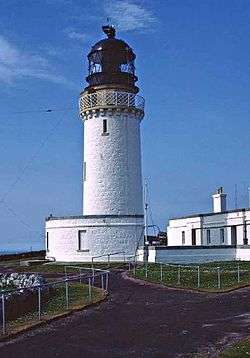
Cape Wrath lighthouse, the final destination on the Cape Wrath Trail | |
| Length | 205 mi (330 km) |
| Location | Scotland, United Kingdom |
| Trailheads |
Banavie (Fort William) 56°50′40″N 5°05′48″W / 56.8444°N 5.0966°W Cape Wrath 58°37′31″N 4°59′56″W / 58.6252°N 4.9990°W |
| Use | Hillwalking, Hiking, Munro Bagging |
| Hiking details | |
| Trail difficulty | Moderate to Strenuous |
| Season | All year |
| Sights | Scottish Highlands |
| Hazards | Severe Weather, Lack of facilities |
Cape Wrath Trail is a hiking route that runs through the Scottish Highlands and along the west coast of Scotland.
It is approximately 200 miles in length and is considered to be one of the most challenging long distance walks in the UK. Despite not being an officially recognised National Trail it has grown to be one of the most highly regarded backpacking routes, attracting hikers from around the world.
The trek was pioneered in the early 1990s by David Paterson who, in 1996, published a book entitled The Cape Wrath Trail: A New 200-mile Walking Route Through the North-west Scottish Highlands. This was followed in 1999 by a separate publication (North to the Cape: A trek from Fort William to Cape Wrath) by Denis Brook and Phil Hinchliffe.
In both versions the trail begins in Fort William and ends at Cape Wrath lighthouse on the northwest tip of the Scottish mainland. It connects with the West Highland Way and part of an alternative route suggested by Cameron McNeish follows the Great Glen Way out of Fort William before joining the main route in Glen Shiel.
A new, updated guidebook to the Cape Wrath Trail was published by Cicerone in May 2013.
These guidebooks estimate an experienced walker should be able to traverse the entire route in less than 20 days. However the authors detail slightly different routes and stages for walkers to follow. There are other alternatives on various segments of the route, thus there is yet to be an "official" established route. Many walkers see this variety as a quintessential part of the trail's appeal. The alternatives allow differing access to bothies, provisions, stream crossings and scenery.
Officially the trail is not endorsed by Scottish Natural Heritage and it is not waymarked or signposted. Facilities along the trail are also minimal and it covers some of the remotest parts of mainland Britain.
Locations on route
- Cape Wrath
- Dundonnell
- Durness
- Fort William
- Inchnadamph
- Inverie
- Kinlochewe
- Morar
- Rhiconich
- Shiel Bridge
- Strathcarron
- Ullapool
Geographic features on route
- Beinne Eighe (Mountain and National Nature Reserve)
- Eas a' Chual Aluinn (Waterfall)
- Knoydart (Peninsula)
- Loch Duich
- Falls of Glomach (Waterfall)
- Sandwood Bay
- Torridon (Mountain range)
- An Teallach (Mountain)
See also
References
Further reading
- Harper, Iain: Cicerone, 2013 The Cape Wrath Trail Guide
- Paterson, David: Peak Publishing, 1996 The Cape Wrath Trail: A New 200-mile Walking Route Through the North-west Scottish Highlands
External links
- Cape Wrath Trail Guide - website for new guide book
- Cape Wrath Trail in Winter - expedition blog with useful info
- Ramblers Association website description
- Cape Wrath Trail - An Expedition Report
- Cape Wrath Trail - Another Expedition Report
- Cape Wrath Trail - Climate Charts
- Cape Wrath Trail - a detailed trip report with logistical information
Coordinates: 57°36′16″N 5°18′12″W / 57.6045°N 5.3034°W