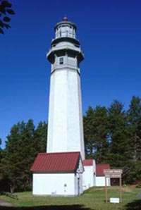
Cape Flattery Light
 | |
 | |
| Location | Neah Bay, Washington |
|---|---|
| Coordinates | 48°23′30″N 124°44′12″W / 48.3917°N 124.7366°WCoordinates: 48°23′30″N 124°44′12″W / 48.3917°N 124.7366°W[1] |
| Year first constructed | 1854 |
| Year first lit | 1857 |
| Automated | 1977 |
| Deactivated | 2008 |
| Foundation | Surface |
| Construction | Sandstone/brick |
| Tower shape | Conical |
| Markings / pattern | White with black lantern and red roof |
| Height | 65 feet (20 m) |
| Focal height | 165 feet (50 m) |
| Original lens | First order Fresnel lens (removed) |
| Current lens | VRB-25 (on skeletal structure) |
| Characteristic | Two white flashes every 20 s[2] |
| Wikimedia Commons has media related to Cape Flattery Light. |
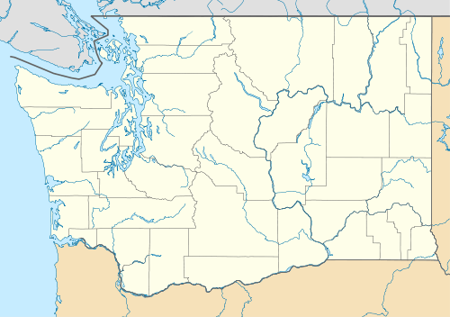
The Cape Flattery Light is a historic lighthouse structure located at the entrance to the Strait of Juan de Fuca near Neah Bay, Clallam County, in the U.S. state of Washington.[3] The deactivated lighthouse sits on Tatoosh Island, which is named after Chief Tatooche of the Makah Tribe.[4] It is the northwesternmost lighthouse on the West Coast of the contiguous United States. Although closed to the public, it can be viewed from Cape Flattery via a short 30-minute walk.[5][6]
History
The lighthouse was built in 1854 based on the design by Ammi B. Young. Its first light was displayed from a first-order lens in 1857 and was Washington Territory's third lighthouse. The house with a 65-foot (20 m) tower from the center still stands; the tower's light stands 165 feet (50 m) above water.[7][8] A fog signal building with a 12-inch (300 mm) steam whistle was built on the island in 1872. The original first-order lens was replaced by a fourth-order lens in 1932, then with a modern optic lens in 1977.
The lighthouse's light was decommissioned after a 30-foot (9.1 m) skeletal structure with a solar-powered beacon fitted with six-year solar pack batteries was built on the island in 2008.[9] In 2009, the Coast Guard began cleanup operations in anticipation of turning the historic lighthouse over to the Makah tribe, who own Tatoosh Island.[10] After the transfer, the Coast Guard will continue to have access for purposes of maintaining the optic.[11]
References
- ↑ "Cape Flattery Lighthouse". Geographic Names Information System. United States Geological Survey.
- ↑ Rowlett, Russ (October 19, 2014). "Lighthouses of the United States: Washington". University of North Carolina at Chapel Hill. Retrieved June 5, 2015.
- ↑ "Cape Flattery Light". Inventory of Historic Light Stations: Washington Lighthouses. National Park Service. Archived from the original on April 7, 2004. Retrieved April 24, 2015.
- ↑ Elyea, Winifred (1929). "History of Tatoosh Island". Washington Historical Quarterly. Washington University State Historical Society. 20 (3): 223–227. Retrieved April 24, 2015.
- ↑ "The Cape Flattery Trail". Makah Tribal Council. Retrieved June 5, 2015.
- ↑ "Cape Flattery, WA". Lighthousefriends. Retrieved April 24, 2015.
- ↑ "Historic Light Station Information & Photography: Washington". U.S. Coast Guard. November 17, 2014. Retrieved April 24, 2015.
- ↑ "13th Coast Guard District Lighthouses". 13th Coast Guard District. January 1996. Retrieved April 24, 2015.
- ↑ Schroeder, Deeda (September 21, 2009). "Coast Guard prepares island for transfer to Makah". The Herald. Everett, Wash.: The Daily Herald Co. Archived from the original on March 4, 2016. Retrieved April 24, 2015.
- ↑ Miller, Marcie (October 17, 2009). "Historic Cape Flattery lighthouse to be turned over to Makah; no timeline set". Peninsula Daily News. Black Press Ltd./Sound Publishing Inc. Retrieved April 24, 2015.
- ↑ Clark, Sue (October 20, 2009). "Cape Flattery lighthouse transferred". Lighthouse News. Retrieved April 24, 2015.
External links
- "Historic Light Station Information and Photography: Washington". United States Coast Guard Historian's Office.