Cape Engaño (Dominican Republic)
- For the cape of the same name in the Philippines, see Cape Engaño (Luzon).
 Dominican Republic | |
| Location |
Cape Engaño Dominican Republic |
|---|---|
| Coordinates | 18°34′01.3″N 68°19′34.6″W / 18.567028°N 68.326278°W |
| Year first constructed | 1915 (first) |
| Year first lit | 1990s |
| Construction | metal skeletal tower |
| Tower shape | square pyramidal tower with balcony |
| Markings / pattern | unpainted tower |
| Height | 20 metres (66 ft) |
| Focal height | 43 metres (141 ft) |
| Light source | solar power |
| Range | 11 nautical miles (20 km; 13 mi) |
| Characteristic | Fl W 5s. |
| Admiralty number | J5444 |
| NGA number | 14296 |
| ARLHS number | DOM-005[1] [2] |
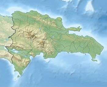
Cabo Engaño is the easternmost point of the island of Hispaniola, on the territory of the Dominican Republic. Cape Engaño contains dangerous reefs near Santo Domingo. Punta Cana International Airport, the nation's busiest, lies slightly south of the cape.
Climate
| Climate data for Cape Engaño (Punta Cana) 1961–1990 | |||||||||||||
|---|---|---|---|---|---|---|---|---|---|---|---|---|---|
| Month | Jan | Feb | Mar | Apr | May | Jun | Jul | Aug | Sep | Oct | Nov | Dec | Year |
| Record high °C (°F) | 31.0 (87.8) |
30.7 (87.3) |
31.2 (88.2) |
32.0 (89.6) |
33.9 (93) |
34.4 (93.9) |
34.7 (94.5) |
34.5 (94.1) |
34.6 (94.3) |
33.7 (92.7) |
32.7 (90.9) |
32.5 (90.5) |
34.7 (94.5) |
| Average high °C (°F) | 27.7 (81.9) |
27.6 (81.7) |
28.1 (82.6) |
28.7 (83.7) |
29.6 (85.3) |
30.3 (86.5) |
30.5 (86.9) |
30.7 (87.3) |
30.9 (87.6) |
30.5 (86.9) |
29.4 (84.9) |
28.1 (82.6) |
29.3 (84.7) |
| Daily mean °C (°F) | 24.8 (76.6) |
24.7 (76.5) |
25.0 (77) |
25.5 (77.9) |
26.4 (79.5) |
27.2 (81) |
27.5 (81.5) |
27.7 (81.9) |
27.6 (81.7) |
27.0 (80.6) |
26.3 (79.3) |
25.2 (77.4) |
26.2 (79.2) |
| Average low °C (°F) | 21.9 (71.4) |
21.8 (71.2) |
22.0 (71.6) |
22.5 (72.5) |
23.2 (73.8) |
24.1 (75.4) |
24.6 (76.3) |
24.8 (76.6) |
24.4 (75.9) |
23.6 (74.5) |
23.2 (73.8) |
22.3 (72.1) |
23.2 (73.8) |
| Record low °C (°F) | 16.0 (60.8) |
14.0 (57.2) |
14.8 (58.6) |
15.2 (59.4) |
16.0 (60.8) |
14.9 (58.8) |
19.0 (66.2) |
17.9 (64.2) |
15.0 (59) |
15.0 (59) |
15.9 (60.6) |
14.0 (57.2) |
14.0 (57.2) |
| Average rainfall mm (inches) | 66.4 (2.614) |
54.2 (2.134) |
54.2 (2.134) |
69.2 (2.724) |
124.4 (4.898) |
103.9 (4.091) |
78.3 (3.083) |
103.1 (4.059) |
101.7 (4.004) |
152.1 (5.988) |
116.6 (4.591) |
78.5 (3.091) |
1,102.6 (43.409) |
| Average rainy days (≥ 0.1 mm) | 10.0 | 6.8 | 6.7 | 6.6 | 10.1 | 9.2 | 9.1 | 10.0 | 10.4 | 11.4 | 11.5 | 11.0 | 112.8 |
| Average relative humidity (%) | 82.8 | 81.4 | 81.2 | 82.1 | 83.0 | 82.2 | 82.3 | 82.6 | 82.5 | 83.0 | 82.2 | 83.2 | 82.4 |
| Mean monthly sunshine hours | 256.9 | 241.9 | 278.8 | 265.0 | 249.7 | 255.1 | 268.3 | 271.2 | 245.2 | 242.7 | 238.3 | 233.2 | 3,046.3 |
| Source #1: World Meteorological Organization[3] | |||||||||||||
| Source #2: NOAA[4] | |||||||||||||
See also
References
- ↑ Dominica Republic The Lighthouse Directory. University of North Carolina at Chapel Hill. Retrieved 8 September 2016
- ↑ List of Lights, Buoys and Fog Signals Atlantic Coast. Retrieved 8 September 2016
- ↑ "World Weather Information Service - Punta Cana". World Meteorological Organization. Retrieved February 23, 2013.
- ↑ "Climate Normals for Cabo Engaño (Punta Cana) 1961-1990". National Oceanic and Atmospheric Administration. Retrieved February 23, 2013.
Coordinates: 18°36′18″N 68°19′39″W / 18.6049°N 68.3276°W
This article is issued from Wikipedia - version of the 9/21/2016. The text is available under the Creative Commons Attribution/Share Alike but additional terms may apply for the media files.