Cannon Falls, Minnesota
| Cannon Falls, Minnesota | |
|---|---|
| City | |
|
Buildings in downtown Cannon Falls | |
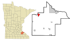 Location of Cannon Falls, Minnesota | |
| Coordinates: 44°30′37″N 92°54′16″W / 44.51028°N 92.90444°W | |
| Country | United States |
| State | Minnesota |
| County | Goodhue |
| Government | |
| • Mayor | Robby Robinson |
| • City Administrator | Ron Johnson |
| Area[1] | |
| • Total | 4.45 sq mi (11.53 km2) |
| • Land | 4.35 sq mi (11.27 km2) |
| • Water | 0.10 sq mi (0.26 km2) |
| Elevation | 840 ft (256 m) |
| Population (2010)[2] | |
| • Total | 4,083 |
| • Estimate (2012[3]) | 4,081 |
| • Density | 938.6/sq mi (362.4/km2) |
| Time zone | Central (CST) (UTC-6) |
| • Summer (DST) | CDT (UTC-5) |
| ZIP code | 55009 |
| Area code(s) | 507 |
| FIPS code | 27-09730[4] |
| GNIS feature ID | 0640870[5] |
| Website | http://cannonfallsmn.gov/ |

Cannon Falls is a city in Goodhue County, Minnesota, United States. The population was 4,083 at the 2010 census.[6] Located along U.S. Route 52 to the southeast of the Twin Cities, Cannon Falls may be best known as the home of Pachyderm Studio, where many famous musicians have recorded their music. Nirvana is probably the best known band to use the site. The group recorded In Utero at the studio.
Cannon Falls is named for the falls along the Cannon River and serves as the western trailhead for the Cannon Valley Trail. Colonel William J. Colvill, a hero of the Battle of Gettysburg, is buried in the Cannon Falls Cemetery. Two American presidents have visited the city. The first, Calvin Coolidge, visited in 1928 to dedicate the memorial erected in honor of Colonel Colvill. The second, Barack Obama, visited on August 15, 2011, to kick off the first day of his campaign for a second term.
History
The first settler was Edway Stoughton. Charles Parks settled the land that is now the village of Cannon Falls in July 1854. Cannon Falls village proper was laid out by Richard and William Freeborn and was platted in 1855[7] by county surveyor S. A. Hart.[8] The village was incorporated March 10, 1857.[9] A post office was established as Cannon River Falls in 1855, and the name of the post office was shortened to Cannon Falls in 1889.[10] Cannon Falls was reincorporated as a city in 1905.[7]
An abundance of water power from both the big Cannon River and the Little Cannon River attracted manufacturers and capital investment.[9] The first flouring mill was built by R. C. Knox & Co., in 1957. Other manufacturers, such as a wool mill, a grist mill and a mill producing syrup from amber cane, used power generated from the Little Cannon River starting in 1861.[8]
Geography
According to the United States Census Bureau, the city has a total area of 4.45 square miles (11.53 km2), of which 4.35 square miles (11.27 km2) is land and 0.10 square miles (0.26 km2) is water.[1] U.S. Highway 52, State Highway 19, and State Highway 20 are three of the main routes in the city.
Lake Byllesby, a reservoir of the Cannon River, lies just west of town.
Demographics
| Historical population | |||
|---|---|---|---|
| Census | Pop. | %± | |
| 1880 | 942 | — | |
| 1890 | 1,078 | 14.4% | |
| 1900 | 1,239 | 14.9% | |
| 1910 | 1,385 | 11.8% | |
| 1920 | 1,315 | −5.1% | |
| 1930 | 1,358 | 3.3% | |
| 1940 | 1,544 | 13.7% | |
| 1950 | 1,831 | 18.6% | |
| 1960 | 2,055 | 12.2% | |
| 1970 | 2,072 | 0.8% | |
| 1980 | 2,653 | 28.0% | |
| 1990 | 3,232 | 21.8% | |
| 2000 | 3,795 | 17.4% | |
| 2010 | 4,083 | 7.6% | |
| Est. 2015 | 4,062 | [11] | −0.5% |
| U.S. Decennial Census | |||
2010 census
As of the census[2] of 2010, there were 4,083 people, 1,708 households, and 1,061 families residing in the city. The population density was 938.6 inhabitants per square mile (362.4/km2). There were 1,869 housing units at an average density of 429.7 per square mile (165.9/km2). The racial makeup of the city was 94.3% White, 2.4% African American, 0.5% Native American, 0.5% Asian, 0.8% from other races, and 1.5% from two or more races. Hispanic or Latino of any race were 2.2% of the population.
There were 1,708 households of which 31.9% had children under the age of 18 living with them, 48.2% were married couples living together, 10.2% had a female householder with no husband present, 3.7% had a male householder with no wife present, and 37.9% were non-families. 32.1% of all households were made up of individuals and 15% had someone living alone who was 65 years of age or older. The average household size was 2.33 and the average family size was 2.96.
The median age in the city was 40 years. 23.9% of residents were under the age of 18; 7.4% were between the ages of 18 and 24; 25.3% were from 25 to 44; 26.5% were from 45 to 64; and 17% were 65 years of age or older. The gender makeup of the city was 48.3% male and 51.7% female.
2000 census
As of the census[4] of 2000, there were 3,795 people, 1,550 households, and 996 families residing in the city. The population density was 946.4 people per square mile (365.4/km²). There were 1,611 housing units at an average density of 401.8 per square mile (155.1/km²). The racial makeup of the city was 98.18% White, 0.18% African American, 0.29% Native American, 0.66% Asian, 0.42% from other races, and 0.26% from two or more races. Hispanic or Latino of any race were 1.08% of the population.
There were 1,550 households out of which 32.6% had children under the age of 18 living with them, 51.4% were married couples living together, 9.7% had a female householder with no husband present, and 35.7% were non-families. 31.2% of all households were made up of individuals and 14.8% had someone living alone who was 65 years of age or older. The average household size was 2.40 and the average family size was 3.03.
In the city the population was spread out with 26.5% under the age of 18, 7.6% from 18 to 24, 29.2% from 25 to 44, 19.5% from 45 to 64, and 17.2% who were 65 years of age or older. The median age was 37 years. For every 100 females there were 94.3 males. For every 100 females age 18 and over, there were 89.9 males.
The median income for a household in the city was $40,721, and the median income for a family was $53,903. Males had a median income of $37,095 versus $24,906 for females. The per capita income for the city was $20,820. About 3.5% of families and 5.6% of the population were below the poverty line, including 5.7% of those under age 18 and 8.7% of those age 65 or over.
Religion
St. Paul's Lutheran Church is a Christian church of the Wisconsin Evangelical Lutheran Synod (WELS) in Cannon Falls.[12]
Education
Cannon Falls has a public elementary, middle, and high school system.
St. Paul's Lutheran School is a Christian pre-school and K-8 school of the Wisconsin Evangelical Lutheran Synod (WELS) in Cannon Falls.[13]
See Cannon Falls Area Schools.
Visitors
President Barack Obama delivered a speech in Cannon Falls on August 15, 2011, as part of a three-day bus tour through Minnesota, Iowa, and Illinois.[14]
See also
References
- 1 2 "US Gazetteer files 2010". United States Census Bureau. Archived from the original on July 14, 2012. Retrieved 2012-11-13.
- 1 2 "American FactFinder". United States Census Bureau. Retrieved 2012-11-13.
- ↑ "Population Estimates". United States Census Bureau. Archived from the original on June 17, 2013. Retrieved 2013-05-28.
- 1 2 "American FactFinder". United States Census Bureau. Archived from the original on September 11, 2013. Retrieved 2008-01-31.
- ↑ "US Board on Geographic Names". United States Geological Survey. 2007-10-25. Retrieved 2008-01-31.
- ↑ "2010 Census Redistricting Data (Public Law 94-171) Summary File". American FactFinder. United States Census Bureau. Archived from the original on July 21, 2011. Retrieved April 27, 2011.
- 1 2 Upham, Warren (1920). Minnesota Geographic Names: Their Origin and Historic Significance. Minnesota Historical Society. p. 206.
- 1 2 Hancock, Joseph (1893). Goodhue County, Minnesota, Past and Present. Goodhue County (Minn.): Red Wing Print. Company. p. 256.
- 1 2 Curtiss-Wedge, Franklin (1909). History of Goodhue County Minnesota Illustrated; Chapter XIII;. H. C. Cooper Jr. & Co.
- ↑ "Goodhue County". Jim Forte Postal History. Retrieved 14 June 2015.
- ↑ "Annual Estimates of the Resident Population for Incorporated Places: April 1, 2010 to July 1, 2015". Retrieved July 2, 2016.
- ↑ "St. Paul's Lutheran Church and School".
- ↑ "About Us".
- ↑ Jerry Smith (August 15, 2011). "Obama: It's politics, not government that's broken". Northfield News. Retrieved August 19, 2011.
External links
| Wikivoyage has a travel guide for Cannon Falls. |
Municipalities and communities of Goodhue County, Minnesota, United States | ||
|---|---|---|
| Cities | 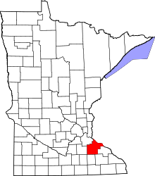 | |
| Townships | ||
| CDP | ||
| Unincorporated communities | ||
| Indian reservation | ||
| Footnotes | ‡This populated place also has portions in an adjacent county or counties | |
Coordinates: 44°30′25″N 92°54′20″W / 44.50694°N 92.90556°W