Caney, Oklahoma
| Caney, Oklahoma | |
|---|---|
| Town | |
 Location of Caney, Oklahoma | |
| Coordinates: 34°14′2″N 96°12′45″W / 34.23389°N 96.21250°WCoordinates: 34°14′2″N 96°12′45″W / 34.23389°N 96.21250°W | |
| Country | United States |
| State | Oklahoma |
| County | Atoka |
| Area | |
| • Total | 0.8 sq mi (2.1 km2) |
| • Land | 0.8 sq mi (2.1 km2) |
| • Water | 0.0 sq mi (0.0 km2) |
| Elevation | 600 ft (183 m) |
| Population (2010) | |
| • Total | 205 |
| • Density | 254/sq mi (97.9/km2) |
| Time zone | Central (CST) (UTC-6) |
| • Summer (DST) | CDT (UTC-5) |
| ZIP code | 74533 |
| Area code(s) | 580 |
| FIPS code | 40-11550[1] |
| GNIS feature ID | 1090906[2] |
Caney is a town in Atoka County, Oklahoma, United States. The population was 205 at the 2010 census.[3]
Geography
Caney is located at 34°14′2″N 96°12′45″W / 34.23389°N 96.21250°W (34.233837, -96.212375).[4]
According to the United States Census Bureau, the town has a total area of 0.81 square miles (2.1 km2), all land.[3]
Caney is not directly served by the Oklahoma state highway system; however, U.S. Highway 69 is located just west of town.[5]
Demographics
| Historical population | |||
|---|---|---|---|
| Census | Pop. | %± | |
| 1910 | 295 | — | |
| 1920 | 432 | 46.4% | |
| 1930 | 274 | −36.6% | |
| 1940 | 361 | 31.8% | |
| 1950 | 252 | −30.2% | |
| 1960 | 128 | −49.2% | |
| 1970 | 200 | 56.3% | |
| 1980 | 203 | 1.5% | |
| 1990 | 184 | −9.4% | |
| 2000 | 199 | 8.2% | |
| 2010 | 205 | 3.0% | |
| Est. 2015 | 198 | [6] | −3.4% |
As of the census[1] of 2000, there were 199 people, 85 households, and 57 families residing in the town. The population density was 237.8 people per square mile (91.5/km²). There were 94 housing units at an average density of 112.3 per square mile (43.2/km²). The racial makeup of the town was 80.90% White, 14.57% Native American, 0.50% Asian, and 4.02% from two or more races. Hispanic or Latino of any race were 1.01% of the population.
There were 85 households out of which 31.8% had children under the age of 18 living with them, 48.2% were married couples living together, 14.1% had a female householder with no husband present, and 31.8% were non-families. 31.8% of all households were made up of individuals and 10.6% had someone living alone who was 65 years of age or older. The average household size was 2.34 and the average family size was 2.95.
In the town the population was spread out with 26.6% under the age of 18, 10.1% from 18 to 24, 25.6% from 25 to 44, 26.1% from 45 to 64, and 11.6% who were 65 years of age or older. The median age was 39 years. For every 100 females there were 95.1 males. For every 100 females age 18 and over, there were 92.1 males.
The median income for a household in the town was $14,063, and the median income for a family was $17,045. Males had a median income of $18,438 versus $18,125 for females. The per capita income for the town was $6,825. About 25.0% of families and 36.5% of the population were below the poverty line, including 46.8% of those under the age of eighteen and 45.8% of those sixty five or over.
References
- 1 2 "American FactFinder". United States Census Bureau. Archived from the original on 2013-09-11. Retrieved 2008-01-31.
- ↑ "US Board on Geographic Names". United States Geological Survey. 2007-10-25. Retrieved 2008-01-31.
- 1 2 "Geographic Identifiers: 2010 Demographic Profile Data (G001): Caney town, Oklahoma". U.S. Census Bureau, American Factfinder. Retrieved July 16, 2013.
- ↑ "US Gazetteer files: 2010, 2000, and 1990". United States Census Bureau. 2011-02-12. Retrieved 2011-04-23.
- ↑ Official State Map (Map) (2008 ed.). Oklahoma Department of Transportation.
- ↑ "Annual Estimates of the Resident Population for Incorporated Places: April 1, 2010 to July 1, 2015". Retrieved July 2, 2016.
- ↑ "Census of Population and Housing". Census.gov. Archived from the original on May 11, 2015. Retrieved June 4, 2015.
External links
Municipalities and communities of Atoka County, Oklahoma, United States | ||
|---|---|---|
| City | 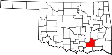 | |
| Towns | ||
| CDP | ||
| Other unincorporated communities | ||
| Ghost towns | ||