Caney, Kansas
| Caney, Kansas | |
|---|---|
| City | |
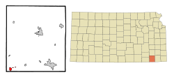 Location within Montgomery County and Kansas | |
 KDOT map of Montgomery County (legend) | |
| Coordinates: 37°0′49″N 95°56′1″W / 37.01361°N 95.93361°WCoordinates: 37°0′49″N 95°56′1″W / 37.01361°N 95.93361°W | |
| Country | United States |
| State | Kansas |
| County | Montgomery |
| Area[1] | |
| • Total | 1.35 sq mi (3.50 km2) |
| • Land | 1.35 sq mi (3.50 km2) |
| • Water | 0 sq mi (0 km2) |
| Elevation | 778 ft (237 m) |
| Population (2010)[2] | |
| • Total | 2,203 |
| • Estimate (2012[3]) | 2,155 |
| • Density | 1,600/sq mi (630/km2) |
| Time zone | CST (UTC-6) |
| • Summer (DST) | CDT (UTC-5) |
| ZIP code | 67333 |
| Area code | 620 |
| FIPS code | 20-10375 [4] |
| GNIS feature ID | 0469249 [5] |
| Website | City Website |
Caney is a city in Montgomery County, Kansas, United States. As of the 2010 census, the city population was 1,966.[6]
History
Caney was founded in 1869.[7] It was named from the Caney River.[8] The first post office in Caney was established in May 1870.[9]
In 1887, the railroad was built through Caney, and in that same year, the town was incorporated.[10]
Caney has long been associated with the petroleum industry in Kansas. In 1906, a major gas well fire took place in this area. In 1909, Caney became the site of the original Kanotex Refining Company.[11] Currently, CVR Energy's pipeline system can transport up to 145,000 barrels/day of crude oil from Caney to that company's refinery in Coffeyville, Kansas.[12]
Caney Kansas: "A March attempt to cover the huge burning gas well six miles from here with a great iron hood upon which a week of preparation had been spent was made last night and failed. The hood with its attached pipes and weights weighing more than 35 tons was thrust aside, bent and broken by the mighty rush of gas and flames. The cap was placed partly over the stream of fire only after strenuous efforts and at great hardship to the men, the intensity from the heat slowing the effort; the gas spouted from the well with renewed force expelling rocks and shooting a flame over 150 feet into the air. Several thousand spectators drawn by the unusual spectacle came to Caney from all directions, the railways running in excursion trains. The well has now been burning for 15 days and millions of feet of gas have been burned."
Geography
Caney is located at 37°0′49″N 95°56′1″W / 37.01361°N 95.93361°W (37.013537, -95.933739).[14] According to the United States Census Bureau, the city has a total area of 1.35 square miles (3.50 km2), all of it land.[1]
Climate
The climate in this area is characterized by hot, humid summers and generally mild to cool winters. According to the Köppen Climate Classification system, Caney has a humid subtropical climate, abbreviated "Cfa" on climate maps.[15]
Demographics
| Historical population | |||
|---|---|---|---|
| Census | Pop. | %± | |
| 1890 | 542 | — | |
| 1900 | 887 | 63.7% | |
| 1910 | 3,597 | 305.5% | |
| 1920 | 3,427 | −4.7% | |
| 1930 | 2,794 | −18.5% | |
| 1940 | 2,629 | −5.9% | |
| 1950 | 2,876 | 9.4% | |
| 1960 | 2,682 | −6.7% | |
| 1970 | 2,192 | −18.3% | |
| 1980 | 2,284 | 4.2% | |
| 1990 | 2,062 | −9.7% | |
| 2000 | 2,092 | 1.5% | |
| 2010 | 1,966 | −6.0% | |
| Est. 2015 | 2,080 | [16] | 5.8% |
| U.S. Decennial Census | |||
2010 census
As of the census[2] of 2010, there were 2,203 people, 866 households, and 574 families residing in the city. The population density was 1,631.9 inhabitants per square mile (630.1/km2). There were 1,020 housing units at an average density of 755.6 per square mile (291.7/km2). The racial makeup of the city was 86.2% White, 0.7% African American, 5.8% Native American, 0.2% Asian, 0.1% Pacific Islander, 0.9% from other races, and 6.0% from two or more races. Hispanic or Latino of any race were 5.1% of the population.
There were 866 households of which 36.3% had children under the age of 18 living with them, 48.2% were married couples living together, 12.8% had a female householder with no husband present, 5.3% had a male householder with no wife present, and 33.7% were non-families. 30.0% of all households were made up of individuals and 11.8% had someone living alone who was 65 years of age or older. The average household size was 2.48 and the average family size was 3.05.
The median age in the city was 35.9 years. 25.8% of residents were under the age of 18; 9.7% were between the ages of 18 and 24; 24.5% were from 25 to 44; 24.3% were from 45 to 64; and 15.8% were 65 years of age or older. The gender makeup of the city was 48.3% male and 51.7% female.
2000 census
As of the census[4] of 2000, there were 2,092 people, 850 households, and 574 families residing in the city. The population density was 1,738.0 people per square mile (673.1/km²). There were 992 housing units at an average density of 824.2 per square mile (319.2/km²). The racial makeup of the city was 90.44% White, 0.19% African American, 5.59% Native American, 0.10% Asian, 1.39% from other races, and 2.29% from two or more races. Hispanic or Latino of any race were 3.01% of the population.
There were 850 households out of which 35.4% had children under the age of 18 living with them, 52.8% were married couples living together, 11.3% had a female householder with no husband present, and 32.4% were non-families. 30.1% of all households were made up of individuals and 15.1% had someone living alone who was 65 years of age or older. The average household size was 2.43 and the average family size was 3.03.
In the city the population was spread out with 28.6% under the age of 18, 7.0% from 18 to 24, 27.4% from 25 to 44, 19.8% from 45 to 64, and 17.2% who were 65 years of age or older. The median age was 36 years. For every 100 females there were 87.1 males. For every 100 females age 18 and over, there were 82.1 males.
The median income for a household in the city was $31,316, and the median income for a family was $40,000. Males had a median income of $29,833 versus $22,917 for females. The per capita income for the city was $17,578. About 6.1% of families and 11.3% of the population were below the poverty line, including 11.5% of those under age 18 and 10.1% of those age 65 or over.
Area events
Mayfest is a yearly gathering to celebrate School Alumni and the town's festivities.[17]
Notable people
- Clancy Hayes, jazz musician
- Kenneth McFarland, educator and superintendent of schools for Topeka at the time of Brown v. Board of Education
- Rosalie Wahl, former associate justice of the Minnesota Supreme Court
References
- 1 2 "US Gazetteer files 2010". United States Census Bureau. Archived from the original on 2012-07-14. Retrieved 2012-07-06.
- 1 2 "American FactFinder". United States Census Bureau. Retrieved 2012-07-06.
- ↑ "Population Estimates". United States Census Bureau. Archived from the original on 2013-06-17. Retrieved 2013-05-29.
- 1 2 "American FactFinder". United States Census Bureau. Archived from the original on 2013-09-11. Retrieved 2008-01-31.
- ↑ "US Board on Geographic Names". United States Geological Survey. 2007-10-25. Retrieved 2008-01-31.
- ↑ "2010 City Population and Housing Occupancy Status". U.S. Census Bureau. Archived from the original on July 21, 2011. Retrieved March 31, 2011.
- ↑ Kansas State Historical Society (1916). Biennial Report of the Board of Directors of the Kansas State Historical Society. Kansas State Printing Plant. p. 242.
- ↑ "Profile for Caney, Kansas". ePodunk. Retrieved 16 June 2014.
- ↑ "Kansas Post Offices, 1828-1961". Kansas Historical Society. Retrieved 16 June 2014.
- ↑ Blackmar, Frank Wilson (1912). Kansas: A Cyclopedia of State History, Embracing Events, Institutions, Industries, Counties, Cities, Towns, Prominent Persons, Etc. Standard Publishing Company. p. 279.
- ↑ Staff. "Identified Sites List Information: Former Kanotex Refinery (Caney)". Kansas Department of Health and Environment, Bureau of Environmental Remediation. Retrieved May 5, 2012.
- ↑ "CVR Energy Inc. (stock symbol: CVI on New York Consolidated)". Reuters.
- ↑ "Kansas Gasser Still Burns". Van Wert Daily Bulletin. March 12, 1906. p. 1.
- ↑ "US Gazetteer files: 2010, 2000, and 1990". United States Census Bureau. 2011-02-12. Retrieved 2011-04-23.
- ↑ Climate Summary for Caney, Kansas
- ↑ "Annual Estimates of the Resident Population for Incorporated Places: April 1, 2010 to July 1, 2015". Retrieved July 2, 2016.
- ↑ "Caney prepares for colorful weekend". Montgomery County Chronicle. May 21, 2009. Retrieved April 30, 2012.
External links
| Wikimedia Commons has media related to Caney, Kansas. |
- City
- Schools
- USD 436, local school district
- Historical
- Maps
- Caney City Map, KDOT
Municipalities and communities of Montgomery County, Kansas, United States | ||
|---|---|---|
| Cities |  | |
| Unincorporated communities | ||