Cananéia
| Município da Estância Balneária de Cananeia Cananéia | |||
|---|---|---|---|
| |||
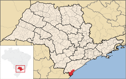 Location in the state of São Paulo and Brazil | |||
| Coordinates: 25°00′53″S 47°55′36″W / 25.01472°S 47.92667°WCoordinates: 25°00′53″S 47°55′36″W / 25.01472°S 47.92667°W | |||
| Country | Brazil | ||
| Region | Southeast | ||
| State | São Paulo | ||
| Settled | August 12, 1892 | ||
| Government | |||
| • Mayor | Pedro Ferreira Dias Filho (PV) | ||
| Area | |||
| • Total | 1,242.010 km2 (479.543 sq mi) | ||
| Elevation | 8 m (26 ft) | ||
| Population (2008)[1] | |||
| • Total | 12,377 | ||
| • Density | 11.4/km2 (30/sq mi) | ||
| Time zone | UTC-3 (UTC-3) | ||
| • Summer (DST) | UTC-2 (UTC-2) | ||
| HDI (2000) | 0.775 – medium[2] | ||
| Website | www.cananeia.sp.gov.br | ||


Cananéia is the southernmost city in the state of São Paulo, Brazil, near to where the Tordesilhas Line passed. The population in 2008 was 12,377 and the area is 1,242.010 km². The elevation is 8 m. The city of Cananéia is host to the Dr. João de Paiva Carvalho research base belonging to the Oceanographic Institute of the University of São Paulo.
Conservation
The municipality contains the 13,500 hectares (33,000 acres) Ilha do Cardoso State Park, created in 1962.[3] It contains part of the Tupiniquins Ecological Station.[4] It contains the 1,176 hectares (2,910 acres) Mandira Extractive Reserve, established in 2002.[5] The municipality contains the 1,662 hectares (4,110 acres) Taquari Extractive Reserve, created in 2008.[6] It contains the 1,128 hectares (2,790 acres) Ilha do Tumba Extractive Reserve, also created in 2008.[7] It contains the 1,243 hectares (3,070 acres) Itapanhapima Sustainable Development Reserve, created at the same time.[8]
References
- ↑ IBGE 2008 statistics
- ↑ "Archived copy". Archived from the original on 2009-10-03. Retrieved 2009-12-17. - UNDP
- ↑ Sobre o Parque (in Portuguese), SAP: Sistema Ambiental Paulista, retrieved 2016-11-17
- ↑ Unidade de Conservação: Estação Ecológica dos Tupiniquins, MMA: Ministério do Meio Ambiente, retrieved 2016-04-18
- ↑ RESEX do Mandira (in Portuguese), ISA: Instituto Socioambiental, retrieved 2016-09-19
- ↑ RESEX Taquari (in Portuguese), ISA: Instituto Socioambiental, retrieved 2016-11-21
- ↑ RESEX da Ilha do Tumba (in Portuguese), ISA: Instituto Socioambiental, retrieved 2016-11-25
- ↑ RDS de Itapanhapima (in Portuguese), ISA: Instituto Socioambiental, retrieved 2016-11-25