Canalou, Missouri
| Canalou, Missouri | |
|---|---|
| City | |
 Location of Canalou, Missouri | |
| Coordinates: 36°45′16″N 89°41′13″W / 36.75444°N 89.68694°WCoordinates: 36°45′16″N 89°41′13″W / 36.75444°N 89.68694°W | |
| Country | United States |
| State | Missouri |
| County | New Madrid |
| Area[1] | |
| • Total | 0.20 sq mi (0.52 km2) |
| • Land | 0.20 sq mi (0.52 km2) |
| • Water | 0 sq mi (0 km2) |
| Elevation | 289 ft (88 m) |
| Population (2010)[2] | |
| • Total | 338 |
| • Estimate (2012[3]) | 324 |
| • Density | 1,690.0/sq mi (652.5/km2) |
| Time zone | Central (CST) (UTC-6) |
| • Summer (DST) | CDT (UTC-5) |
| ZIP code | 63828 |
| Area code(s) | 573 |
| FIPS code | 29-11026[4] |
| GNIS feature ID | 0731548[5] |
Canalou is a city in New Madrid County, Missouri, United States. The population was 338 at the 2010 census. The ZIP code is 63828.
Except for Main, First, and MacArthur, the rest of the streets are named after U.S. presidents, including Washington, Adams, Jefferson, Madison, Van Buren, Harrison, Roosevelt, Taft, and Kennedy.
History
Canalou had its start in 1902 as a lumber company town.[6] A post office called Canalou has been in operation since 1903.[7] It is unknown why the name "Canalou" was applied to this community.[6]
Geography
Canalou is located at 36°45′16″N 89°41′13″W / 36.75444°N 89.68694°W (36.754415, -89.687063).[8]
According to the United States Census Bureau, the city has a total area of 0.20 square miles (0.52 km2), all of it land.[1]
Notable resident
Artist Michael Parkes. Parkes, who now resides in Spain, was born in Sikeston in 1944 and grew up in Canalou. Parkes is noted for his fantasy-themed prints, paintings and sculptures.
Author/speaker/newspaper columnist Dan Whittle is a native of Canalou, having recently penned book entitled "Canalou: People, Culture, Bootheel Town" published by Center for Regional History at Southeast Missouri State University in Cape Girardeau, Mo.
Demographics
| Historical population | |||
|---|---|---|---|
| Census | Pop. | %± | |
| 1910 | 296 | — | |
| 1920 | 477 | 61.1% | |
| 1930 | 359 | −24.7% | |
| 1940 | 419 | 16.7% | |
| 1950 | 438 | 4.5% | |
| 1960 | 447 | 2.1% | |
| 1970 | 358 | −19.9% | |
| 1980 | 369 | 3.1% | |
| 1990 | 319 | −13.6% | |
| 2000 | 348 | 9.1% | |
| 2010 | 338 | −2.9% | |
| Est. 2015 | 314 | [9] | −7.1% |
2010 census
As of the census[2] of 2010, there were 338 people, 114 households, and 77 families residing in the city. The population density was 1,690.0 inhabitants per square mile (652.5/km2). There were 121 housing units at an average density of 605.0 per square mile (233.6/km2). The racial makeup of the city was 96.15% White, 1.18% Black or African American, 0.89% Native American, and 1.78% from two or more races. Hispanic or Latino of any race were 0.59% of the population.
There were 114 households of which 47.4% had children under the age of 18 living with them, 49.1% were married couples living together, 14.0% had a female householder with no husband present, 4.4% had a male householder with no wife present, and 32.5% were non-families. 22.8% of all households were made up of individuals and 10.5% had someone living alone who was 65 years of age or older. The average household size was 2.96 and the average family size was 3.52.
The median age in the city was 32 years. 31.4% of residents were under the age of 18; 9.6% were between the ages of 18 and 24; 29% were from 25 to 44; 21.8% were from 45 to 64; and 8% were 65 years of age or older. The gender makeup of the city was 51.2% male and 48.8% female.
2000 census
As of the census[4] of 2000, there were 348 people, 125 households, and 91 families residing in the city. The population density was 1,380.1 people per square mile (537.5/km²). There were 140 housing units at an average density of 555.2 per square mile (216.2/km²). The racial makeup of the city was 95.11% White, 3.74% African American, 0.29% Asian, and 0.86% from two or more races.
There were 125 households out of which 40.8% had children under the age of 18 living with them, 54.4% were married couples living together, 14.4% had a female householder with no husband present, and 26.4% were non-families. 21.6% of all households were made up of individuals and 12.0% had someone living alone who was 65 years of age or older. The average household size was 2.78 and the average family size was 3.24.
In the city the population was spread out with 33.3% under the age of 18, 6.9% from 18 to 24, 28.2% from 25 to 44, 21.8% from 45 to 64, and 9.8% who were 65 years of age or older. The median age was 32 years. For every 100 females there were 89.1 males. For every 100 females age 18 and over, there were 87.1 males.
The median income for a household in the city was $21,250, and the median income for a family was $25,417. Males had a median income of $24,792 versus $14,464 for females. The per capita income for the city was $9,660. About 20.0% of families and 27.4% of the population were below the poverty line, including 37.5% of those under age 18 and 39.4% of those age 65 or over.
Media
The Public Radio International documentary show This American Life aired a half-hour segment featuring Canalou, titled "You Can't Go Home Again," as part of its April 9, 1999 "Do-Gooders" episode. The genesis of the segment is chronicled in the comic book: Radio: An Illustrated Guide.
References
- 1 2 "US Gazetteer files 2010". United States Census Bureau. Archived from the original on 2012-07-14. Retrieved 2012-07-08.
- 1 2 "American FactFinder". United States Census Bureau. Retrieved 2012-07-08.
- ↑ "Population Estimates". United States Census Bureau. Archived from the original on 2013-06-17. Retrieved 2013-05-30.
- 1 2 "American FactFinder". United States Census Bureau. Archived from the original on 2013-09-11. Retrieved 2008-01-31.
- ↑ "US Board on Geographic Names". United States Geological Survey. 2007-10-25. Retrieved 2008-01-31.
- 1 2 "New Madrid County Place Names, 1928–1945". The State Historical Society of Missouri. Archived from the original on June 24, 2016. Retrieved November 19, 2016.
- ↑ "Post Offices". Jim Forte Postal History. Retrieved 19 November 2016.
- ↑ "US Gazetteer files: 2010, 2000, and 1990". United States Census Bureau. 2011-02-12. Retrieved 2011-04-23.
- ↑ "Annual Estimates of the Resident Population for Incorporated Places: April 1, 2010 to July 1, 2015". Retrieved July 2, 2016.
- ↑ "Census of Population and Housing". Census.gov. Archived from the original on May 11, 2015. Retrieved June 4, 2015.
External links
Municipalities and communities of New Madrid County, Missouri, United States | ||
|---|---|---|
| Cities | 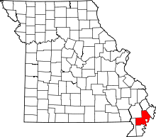 | |
| Village | ||
| Townships |
| |
| Unincorporated communities | ||
| Ghost towns | ||
| Footnotes | ‡This populated place also has portions in an adjacent county or counties | |