Camp Douglas, Wisconsin
| Camp Douglas, Wisconsin | |
|---|---|
| Village | |
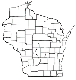 Location of Camp Douglas, Wisconsin | |
| Coordinates: 43°55′16″N 90°16′12″W / 43.92111°N 90.27000°WCoordinates: 43°55′16″N 90°16′12″W / 43.92111°N 90.27000°W | |
| Country | United States |
| State | Wisconsin |
| County | Juneau |
| Area[1] | |
| • Total | 1.01 sq mi (2.62 km2) |
| • Land | 1.01 sq mi (2.62 km2) |
| • Water | 0 sq mi (0 km2) |
| Elevation[2] | 942 ft (287 m) |
| Population (2010)[3] | |
| • Total | 601 |
| • Estimate (2012[4]) | 611 |
| • Density | 595.0/sq mi (229.7/km2) |
| Time zone | Central (CST) (UTC-6) |
| • Summer (DST) | CDT (UTC-5) |
| Area code(s) | 608 |
| FIPS code | 55-12350[5] |
| GNIS feature ID | 1562599[2] |
Camp Douglas is a village in Juneau County, Wisconsin, United States. The population was 601 at the 2010 census. Camp Douglas is home to Volk Field Air National Guard Base.
History
Camp Douglas was laid out in 1870.[6] The village was named after a logging camp established by James Douglas, which brought wood to steam locomotives.[7] A post office called Camp Douglas has been in operation since 1873.[8]
Geography
According to the United States Census Bureau, the village has a total area of 1.01 square miles (2.62 km2), all of it land.[1]
Demographics
| Historical population | |||
|---|---|---|---|
| Census | Pop. | %± | |
| 1890 | 225 | — | |
| 1900 | 432 | 92.0% | |
| 1910 | 473 | 9.5% | |
| 1920 | 471 | −0.4% | |
| 1930 | 438 | −7.0% | |
| 1940 | 445 | 1.6% | |
| 1950 | 556 | 24.9% | |
| 1960 | 489 | −12.1% | |
| 1970 | 547 | 11.9% | |
| 1980 | 589 | 7.7% | |
| 1990 | 512 | −13.1% | |
| 2000 | 592 | 15.6% | |
| 2010 | 601 | 1.5% | |
| Est. 2015 | 607 | [9] | 1.0% |
2010 census
As of the census[3] of 2010, there were 601 people, 244 households, and 161 families residing in the village. The population density was 595.0 inhabitants per square mile (229.7/km2). There were 264 housing units at an average density of 261.4 per square mile (100.9/km2). The racial makeup of the village was 97.5% White, 0.5% African American, 0.2% Native American, 0.3% Asian, 0.5% from other races, and 1.0% from two or more races. Hispanic or Latino of any race were 0.8% of the population.
There were 244 households of which 36.5% had children under the age of 18 living with them, 43.9% were married couples living together, 17.6% had a female householder with no husband present, 4.5% had a male householder with no wife present, and 34.0% were non-families. 27.9% of all households were made up of individuals and 15.2% had someone living alone who was 65 years of age or older. The average household size was 2.46 and the average family size was 3.00.
The median age in the village was 36.3 years. 27.1% of residents were under the age of 18; 7.4% were between the ages of 18 and 24; 29.2% were from 25 to 44; 21.2% were from 45 to 64; and 15.3% were 65 years of age or older. The gender makeup of the village was 47.4% male and 52.6% female.
2000 census
As of the census[5] of 2000, there were 592 people, 242 households, and 154 families residing in the village. The population density was 621.9 people per square mile (240.6/km²). There were 264 housing units at an average density of 277.3 per square mile (107.3/km²). The racial makeup of the village was 97.64% White, 0.17% African American, 1.01% Native American, 0.34% Asian, 0.17% from other races, and 0.68% from two or more races. Hispanic or Latino of any race were 1.69% of the population.
There were 242 households out of which 35.1% had children under the age of 18 living with them, 49.2% were married couples living together, 11.2% had a female householder with no husband present, and 36.0% were non-families. 30.2% of all households were made up of individuals and 16.1% had someone living alone who was 65 years of age or older. The average household size was 2.45 and the average family size was 3.08.
In the village the population was spread out with 29.6% under the age of 18, 5.9% from 18 to 24, 30.4% from 25 to 44, 19.4% from 45 to 64, and 14.7% who were 65 years of age or older. The median age was 34 years. For every 100 females there were 100.0 males. For every 100 females age 18 and over, there were 94.9 males.
The median income for a household in the village was $39,583, and the median income for a family was $44,038. Males had a median income of $31,324 versus $21,607 for females. The per capita income for the village was $17,919. About 2.6% of families and 2.8% of the population were below the poverty line, including 1.3% of those under age 18 and 2.2% of those age 65 or over.
Notable people
- George Frohmader, Wisconsin State Assemblyman and merchant lived in Camp Douglas; he served as the village president and the postmaster.[11]
References
- 1 2 "US Gazetteer files 2010". United States Census Bureau. Archived from the original on 2012-07-14. Retrieved 2012-11-18.
- 1 2 "US Board on Geographic Names". United States Geological Survey. 2007-10-25. Retrieved 2008-01-31.
- 1 2 "American FactFinder". United States Census Bureau. Retrieved 2012-11-18.
- ↑ "Population Estimates". United States Census Bureau. Archived from the original on 2013-06-17. Retrieved 2013-06-24.
- 1 2 "American FactFinder". United States Census Bureau. Archived from the original on 2013-09-11. Retrieved 2008-01-31.
- ↑ Chicago and North Western Railway Company (1908). A History of the Origin of the Place Names Connected with the Chicago & North Western and Chicago, St. Paul, Minneapolis & Omaha Railways. p. 170.
- ↑ "Profile for Camp Douglas, Wisconsin". ePodunk. Retrieved 2010-06-02.
- ↑ "Juneau County". Jim Forte Postal History. Retrieved 3 April 2015.
- ↑ "Annual Estimates of the Resident Population for Incorporated Places: April 1, 2010 to July 1, 2015". Retrieved July 2, 2016.
- ↑ "Census of Population and Housing". Census.gov. Archived from the original on May 11, 2015. Retrieved June 4, 2015.
- ↑ 'Wisconsin Blue Book 1919,' Biographical Sketch of George Frohmader, pg. 486
External links
- Camp Douglas Official Website
- Camp Douglas History Video produced by Wisconsin Public Television
Municipalities and communities of Juneau County, Wisconsin, United States | ||
|---|---|---|
| Cities |  | |
| Villages | ||
| Towns | ||
| Unincorporated communities | ||
| Indian reservation | ||
| Footnotes | ‡This populated place also has portions in an adjacent county or counties | |