Cameron, Oklahoma
| Cameron, Oklahoma | |
|---|---|
| Town | |
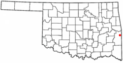 Location of Cameron, Oklahoma | |
| Coordinates: 35°8′9″N 94°32′8″W / 35.13583°N 94.53556°WCoordinates: 35°8′9″N 94°32′8″W / 35.13583°N 94.53556°W | |
| Country | United States |
| State | Oklahoma |
| County | Le Flore |
| Area | |
| • Total | 0.3 sq mi (0.7 km2) |
| • Land | 0.3 sq mi (0.7 km2) |
| • Water | 0.0 sq mi (0.0 km2) |
| Elevation | 486 ft (148 m) |
| Population (2010) | |
| • Total | 302 |
| • Density | 1,158.9/sq mi (447.4/km2) |
| Time zone | Central (CST) (UTC-6) |
| • Summer (DST) | CDT (UTC-5) |
| ZIP code | 74932 |
| Area code(s) | 539/918 |
| FIPS code | 40-11300[1] |
| GNIS feature ID | 1090830[2] |
Cameron is a town in Le Flore County, Oklahoma, United States. It is part of the Fort Smith, Arkansas-Oklahoma Metropolitan Statistical Area. The population was 302 at the 2010 census, a loss of 3.2 percent from 312 at the 2000 census.[3]
History
When the Fort Smith and Southern Railway laid tracks in the area pf the present day town of Cameron in 1886–87, there was already a settlement of about 40 people.[lower-alpha 1] The U. S. Post Office Department established a post office that it named Cameron in 1888. According to Encyclopedia of Oklahoma History and Culture, the post office and town may have been named for either of two persons. One was William Cameron, a former Mine Inspector for Indian Territory. The other was James Cameron, an employee of the Fort Smith and Southern Railway.[4]
In 1883, James Reynolds, a successful rancher and entrepreneur, established the Cameron Institute, which was sponsored by the Presbyterian Church but was open to enrolling students of any denomination. It educated children from primary to high school level. Reynolds became a resident of Cameron, where he built an imposing home that had the appearance of a castle. The building is on the National Register of Historic Places.[4]
Geography
Cameron is located at 35°8′9″N 94°32′8″W / 35.13583°N 94.53556°W (35.135722, -94.535561).[5] It is 8 miles (13 km) northeast of Poteau.[4]
According to the United States Census Bureau, the town has a total area of 0.3 square miles (0.78 km2), all of it land.
Demographics
| Historical population | |||
|---|---|---|---|
| Census | Pop. | %± | |
| 1900 | 316 | — | |
| 1910 | 206 | −34.8% | |
| 1920 | 203 | −1.5% | |
| 1930 | 283 | 39.4% | |
| 1940 | 203 | −28.3% | |
| 1950 | 209 | 3.0% | |
| 1960 | 211 | 1.0% | |
| 1970 | 311 | 47.4% | |
| 1980 | 365 | 17.4% | |
| 1990 | 327 | −10.4% | |
| 2000 | 312 | −4.6% | |
| 2010 | 302 | −3.2% | |
| Est. 2015 | 293 | [6] | −3.0% |
As of the census[1] of 2000, there were 312 people, 115 households, and 90 families residing in the town. The population density was 1,158.9 people per square mile (446.2/km²). There were 126 housing units at an average density of 468.0 per square mile (180.2/km²). The racial makeup of the town was 83.65% White, 0.32% African American, 11.54% Native American, and 4.49% from two or more races.
There were 115 households out of which 35.7% had children under the age of 18 living with them, 53.9% were married couples living together, 15.7% had a female householder with no husband present, and 21.7% were non-families. 20.0% of all households were made up of individuals and 8.7% had someone living alone who was 65 years of age or older. The average household size was 2.71 and the average family size was 3.11.
In the town the population was spread out with 26.6% under the age of 18, 9.3% from 18 to 24, 29.5% from 25 to 44, 23.1% from 45 to 64, and 11.5% who were 65 years of age or older. The median age was 35 years. For every 100 females there were 113.7 males. For every 100 females age 18 and over, there were 104.5 males.
The median income for a household in the town was $23,750, and the median income for a family was $26,339. Males had a median income of $27,679 versus $17,321 for females. The per capita income for the town was $11,055. About 14.7% of families and 19.6% of the population were below the poverty line, including 32.9% of those under age 18 and 10.5% of those age 65 or over.
Notes
- ↑ The St. Louis and San Francisco Railway (aka SL&SF, or Frisco) bought the Fort Smith and Southern in February 1887 and completed the line.[4]
References
- 1 2 "American FactFinder". United States Census Bureau. Archived from the original on 2013-09-11. Retrieved 2008-01-31.
- ↑ "US Board on Geographic Names". United States Geological Survey. 2007-10-25. Retrieved 2008-01-31.
- ↑ CensusViewer: Cameron, Oklahoma Population. Retrieved September 14, 2012.
- 1 2 3 4 Larry O'Dell, "Cameron." Encyclopedia of Oklahoma History and Culture. Accessed March 20, 2015.
- ↑ "US Gazetteer files: 2010, 2000, and 1990". United States Census Bureau. 2011-02-12. Retrieved 2011-04-23.
- ↑ "Annual Estimates of the Resident Population for Incorporated Places: April 1, 2010 to July 1, 2015". Retrieved July 2, 2016.
- ↑ "Census of Population and Housing". Census.gov. Archived from the original on May 11, 2015. Retrieved June 4, 2015.
External links
- Encyclopedia of Oklahoma History and Culture - Cameron
- Oklahoma Digital Maps: Digital Collections of Oklahoma and Indian Territory
Municipalities and communities of Le Flore County, Oklahoma, United States | ||
|---|---|---|
| Cities | 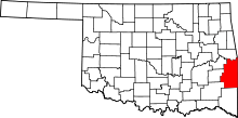 | |
| Towns | ||
| CDP | ||
| Other unincorporated communities | ||
| Footnotes | ‡This populated place also has portions in an adjacent county or counties | |