Camden, Missouri
| Camden, Missouri | |
|---|---|
| City | |
 Location of Camden, Missouri | |
| Coordinates: 39°11′52″N 94°1′23″W / 39.19778°N 94.02306°WCoordinates: 39°11′52″N 94°1′23″W / 39.19778°N 94.02306°W | |
| Country | United States |
| State | Missouri |
| County | Ray |
| Area[1] | |
| • Total | 0.76 sq mi (1.97 km2) |
| • Land | 0.76 sq mi (1.97 km2) |
| • Water | 0 sq mi (0 km2) |
| Elevation | 735 ft (224 m) |
| Population (2010)[2] | |
| • Total | 191 |
| • Estimate (2012[3]) | 188 |
| • Density | 251.3/sq mi (97.0/km2) |
| Time zone | Central (CST) (UTC-6) |
| • Summer (DST) | CDT (UTC-5) |
| ZIP code | 64017 |
| Area code(s) | 816 |
| FIPS code | 29-10738[4] |
| GNIS feature ID | 0715228[5] |
Camden is a city in Ray County, Missouri, United States. The population was 191 at the 2010 census.[6]
History
Camden was platted in 1838.[7]
Geography
Camden is located at 39°11′52″N 94°1′23″W / 39.19778°N 94.02306°W (39.197753, -94.023067).[8]
According to the United States Census Bureau, the city has a total area of 0.76 square miles (1.97 km2), all of it land.[1]
Demographics
| Historical population | |||
|---|---|---|---|
| Census | Pop. | %± | |
| 1860 | 364 | — | |
| 1870 | 357 | −1.9% | |
| 1880 | 509 | 42.6% | |
| 1890 | 650 | 27.7% | |
| 1900 | 392 | −39.7% | |
| 1910 | 477 | 21.7% | |
| 1920 | 534 | 11.9% | |
| 1930 | 407 | −23.8% | |
| 1940 | 399 | −2.0% | |
| 1950 | 383 | −4.0% | |
| 1960 | 310 | −19.1% | |
| 1970 | 286 | −7.7% | |
| 1980 | 219 | −23.4% | |
| 1990 | 238 | 8.7% | |
| 2000 | 209 | −12.2% | |
| 2010 | 191 | −8.6% | |
| Est. 2015 | 186 | [9] | −2.6% |
2010 census
As of the census[2] of 2010, there were 191 people, 73 households, and 48 families residing in the city. The population density was 251.3 inhabitants per square mile (97.0/km2). There were 87 housing units at an average density of 114.5 per square mile (44.2/km2). The racial makeup of the city was 99.0% White and 1.0% from two or more races. Hispanic or Latino of any race were 0.5% of the population.
There were 73 households of which 31.5% had children under the age of 18 living with them, 57.5% were married couples living together, 2.7% had a female householder with no husband present, 5.5% had a male householder with no wife present, and 34.2% were non-families. 27.4% of all households were made up of individuals and 12.3% had someone living alone who was 65 years of age or older. The average household size was 2.62 and the average family size was 3.27.
The median age in the city was 36.5 years. 26.2% of residents were under the age of 18; 6.7% were between the ages of 18 and 24; 27.3% were from 25 to 44; 23.5% were from 45 to 64; and 16.2% were 65 years of age or older. The gender makeup of the city was 55.0% male and 45.0% female.
2000 census
As of the census[4] of 2000, there were 209 people, 84 households, and 57 families residing in the city. The population density was 277.0 people per square mile (107.6/km²). There were 93 housing units at an average density of 123.2 per square mile (47.9/km²). The racial makeup of the city was 98.09% White, 0.96% African American, and 0.96% from two or more races. Hispanic or Latino of any race were 0.48% of the population.
There were 84 households out of which 38.1% had children under the age of 18 living with them, 60.7% were married couples living together, 4.8% had a female householder with no husband present, and 32.1% were non-families. 28.6% of all households were made up of individuals and 19.0% had someone living alone who was 65 years of age or older. The average household size was 2.49 and the average family size was 3.05.
In the city the population was spread out with 26.3% under the age of 18, 7.7% from 18 to 24, 29.2% from 25 to 44, 20.6% from 45 to 64, and 16.3% who were 65 years of age or older. The median age was 39 years. For every 100 females there were 97.2 males. For every 100 females age 18 and over, there were 94.9 males.
The median income for a household in the city was $25,833, and the median income for a family was $27,813. Males had a median income of $27,188 versus $18,000 for females. The per capita income for the city was $13,194. About 3.5% of families and 9.8% of the population were below the poverty line, including 11.5% of those under the age of eighteen and 26.7% of those sixty five or over.
References
- 1 2 "US Gazetteer files 2010". United States Census Bureau. Archived from the original on 2012-07-14. Retrieved 2012-07-08.
- 1 2 "American FactFinder". United States Census Bureau. Retrieved 2012-07-08.
- ↑ "Population Estimates". United States Census Bureau. Archived from the original on 2013-06-17. Retrieved 2013-05-30.
- 1 2 "American FactFinder". United States Census Bureau. Archived from the original on 2013-09-11. Retrieved 2008-01-31.
- ↑ "US Board on Geographic Names". United States Geological Survey. 2007-10-25. Retrieved 2008-01-31.
- ↑ "Race, Hispanic or Latino, Age, and Housing Occupancy: 2010 Census Redistricting Data (Public Law 94-171) Summary File (QT-PL), Camden city, Missouri". U.S. Census Bureau, American FactFinder 2. Archived from the original on September 11, 2013. Retrieved September 2, 2011.
- ↑ Earngey, Bill (1995). Missouri Roadsides: The Traveler's Companion. University of Missouri Press. p. 33.
- ↑ "US Gazetteer files: 2010, 2000, and 1990". United States Census Bureau. 2011-02-12. Retrieved 2011-04-23.
- ↑ "Annual Estimates of the Resident Population for Incorporated Places: April 1, 2010 to July 1, 2015". Retrieved July 2, 2016.
- ↑ "Census of Population and Housing". Census.gov. Archived from the original on May 11, 2015. Retrieved June 4, 2015.
Municipalities and communities of Ray County, Missouri, United States | ||
|---|---|---|
| Cities | 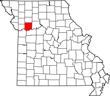 | |
| Villages | ||
| Townships | ||
| CDP | ||
| Other unincorporated communities | ||
| Footnotes | ‡This populated place also has portions in an adjacent county or counties | |