Cambooya, Queensland
| Cambooya Queensland | |
|---|---|
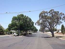 Eton Street, 2014 | |
 Cambooya | |
| Coordinates | 27°43′0″S 151°52′0″E / 27.71667°S 151.86667°ECoordinates: 27°43′0″S 151°52′0″E / 27.71667°S 151.86667°E |
| Population | 1,298 (2011 census)[1] |
| Postcode(s) | 4358 |
| Elevation | 465 m (1,526 ft) |
| Location | |
| LGA(s) | Toowoomba Region |
| State electorate(s) | Condamine |
| Federal Division(s) | Groom |
Cambooya is a town in the Darling Downs region of Queensland, Australia, 148 kilometres (92 mi) west of the state capital, Brisbane. At the 2011 Australian census the town recorded a population of 1,298.[1]
A suburban rail motor service from Toowoomba along the Southern railway line commenced in May, 1917, running to Wyreema, 10 miles away. It was extended to Cambooya and to Willowburn in 1918. They ceased around 1923.[2]
History
European settlement of the area dates from 1840, when Arthur Hodgson chose 65,000 acres (26,305 ha) of prime land, which he named Eton Vale. In 1843 the New South Wales Commissioner of Crown Lands, Christopher Rolleston, carried out a survey and reserved a site on Eton Vale for a township. He named it Cambooya, a rendering of the Aboriginal word 'yambuya', thought to refer to tubers growing in a water hole. Hodgson resisted the formation of a township, and no development occurred until 1868, when a railway station was built at Cambooya as the railway line was extended from Toowoomba to Warwick.[3] and Cambooya Post Office opened on 12 March 1869.[4]
Climate
| Climate data for Cambooya | |||||||||||||
|---|---|---|---|---|---|---|---|---|---|---|---|---|---|
| Month | Jan | Feb | Mar | Apr | May | Jun | Jul | Aug | Sep | Oct | Nov | Dec | Year |
| Record high °C (°F) | 41.0 (105.8) |
39.7 (103.5) |
35.6 (96.1) |
34.5 (94.1) |
29.4 (84.9) |
26.0 (78.8) |
26.5 (79.7) |
31.1 (88) |
33.5 (92.3) |
38.3 (100.9) |
39.4 (102.9) |
40.5 (104.9) |
41.0 (105.8) |
| Average high °C (°F) | 30.1 (86.2) |
29.3 (84.7) |
27.9 (82.2) |
25.1 (77.2) |
21.4 (70.5) |
18.3 (64.9) |
17.7 (63.9) |
19.3 (66.7) |
22.6 (72.7) |
25.8 (78.4) |
28.5 (83.3) |
30.0 (86) |
24.7 (76.5) |
| Average low °C (°F) | 16.3 (61.3) |
16.1 (61) |
14.3 (57.7) |
9.6 (49.3) |
5.7 (42.3) |
3.0 (37.4) |
2.0 (35.6) |
2.7 (36.9) |
5.9 (42.6) |
10.0 (50) |
13.0 (55.4) |
15.2 (59.4) |
9.5 (49.1) |
| Record low °C (°F) | 7.8 (46) |
4.4 (39.9) |
3.5 (38.3) |
−1.0 (30.2) |
−5.6 (21.9) |
−7.5 (18.5) |
−8.3 (17.1) |
−7.8 (18) |
−4.4 (24.1) |
−4.5 (23.9) |
1.9 (35.4) |
5.0 (41) |
−8.3 (17.1) |
| Average rainfall mm (inches) | 97.3 (3.831) |
80.5 (3.169) |
68.1 (2.681) |
42.2 (1.661) |
40.6 (1.598) |
40.9 (1.61) |
38.4 (1.512) |
31.2 (1.228) |
36.5 (1.437) |
64.3 (2.531) |
76.5 (3.012) |
100.6 (3.961) |
717.1 (28.231) |
| Average rainy days (≥ 0.2mm) | 8.5 | 7.9 | 7.6 | 5.4 | 5.6 | 5.9 | 5.7 | 5.1 | 5.2 | 7.1 | 7.9 | 8.7 | 80.6 |
| Source: Bureau of Meteorology[5] | |||||||||||||
Heritage listings

Cambooya has a number of heritage-listed sites, including:
- New England Highway: Eton Vale Homestead Ruins[6]
Education
Cambooya has only one school, Cambooya State School. It has over 100 students enrolled, from prep to grade 7.
The first public school in Cambooya opened in 1882, with 12 students from four local families. Due to growing attendance and an increased population caused by the railway, the school was moved and a building was erected in 1899 at the current school site; this building became a school residence in 1910 when a new State School was built. By 1990 there were 104 students and 25 pre-school students enrolled, plus a teaching staff of six teachers and three teacher-aides.[7]
Eton Vale school was originally a private school on Eton Vale Station, three-and-a-half miles from the Cambooya Railway Station. Most children who attended the school in 1890 were girls and infants, as they could not travel to Cambooya School with any regularity and the black soil was impassable in wet weather. Eton Vale became a half-time school with Preston in 1925; Preston School closed shortly after and Eton Vale school closed in 1929.[8]
Facilities
Library services in Cambooya are provided by the Toowoomba Regional Council's mobile library service. The van visits Cambooya State School every Friday.[9]
Landmarks
Cambooya has a pub called the Bull and Barley. It has been featured on the television show Getaway.
References
- 1 2 Australian Bureau of Statistics (31 October 2012). "Cambooya (State Suburb)". 2011 Census QuickStats. Retrieved 26 October 2014.
- ↑ The Toowoomba Suburban Rail Motor Service Knowles, J.W. Australian Railway Historical Society Bulletin, July, 1992 pp170-171
- ↑ "Cambooya". queenslandplaces.com.au. Retrieved 14 December 2009.
- ↑ Premier Postal History. "Post Office List". Premier Postal Auctions. Retrieved 10 May 2014.
- ↑ "CAMBOOYA POST OFFICE". Climate statistics for Australian locations. Bureau of Meteorology. March 2014. Retrieved 1 April 2014.
- ↑ "Eton Vale Homestead Ruins (entry 600391)". Queensland Heritage Register. Queensland Heritage Council. Retrieved 15 July 2013.
- ↑ Pennycuick, Rae (1991). The Cambooya Story: 1840-1990. Cambooya Shire Council. pp. 157–158. ISBN 0646063448.
- ↑ Pennycuick, Rae (1991). The Cambooya Story: 1840-1990. Cambooya Shire Council. p. 159. ISBN 0646063448.
- ↑ "Mobile library". Toowoomba Regional Council. Retrieved 10 November 2014.
External links
| Wikimedia Commons has media related to Cambooya, Queensland. |