A202 road
| |
|---|---|
| Major junctions | |
| East end: | New Cross Gate |
|
| |
| West end: | London Victoria station |
| Road network | |

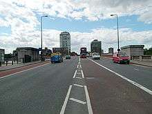
The A202 is a primary A road in London. It runs from New Cross Gate to London Victoria station. The section forming part of the London Inner Ring Road is known as Vauxhall Bridge Road.
Camberwell New Road
Camberwell New Road is part of the A202. It goes from Camberwell to Kennington Oval. It was a turnpike road authorised by Act of Parliament in 1818,[1] just after the construction in 1816 of the first Vauxhall Bridge, which it leads to, thus providing a second route from Camberwell to central London. Camberwell New Road is the longest Georgian Road in England.[2] London Bus routes 36, 185 and 436 run the whole length of Camberwell New Road.
Queen's Road
Queen's Road extends eastwards from the end of Peckham High Street at the junctions of Consort Road and Meeting House Lane, to New Cross Road, a distance of approximately 1.5 km. Queen's Road was formerly known as Deptford Lane, and was renamed in honour of Queen Victoria, who often passed through it on her way to the Royal Naval School at New Cross.
The first branded cigarettes manufactured in Britain were made at a factory on Deptford Lane around 1859 by Robert Peacock Gloag. The brand, Sweet Threes, had a yellowish tissue paper filled with ground tobacco. Gloag had been paymaster to the Turkish forces during the Crimean War (1853–1856), where he is purported to have seen locals smoking. Gloags business on Deptford Lane is largely responsible for the popularity of the cigarette in England today. In 1926 Queen's Road saw the first holistic health centre in Britain, known as the Pioneer, later known as The Peckham Experiment. It was purposefully located in the area due to the deprived nature of the area, the low income and poor level of education of the population.
References
A roads in Zone 2 of the Great Britain road numbering scheme | ||
|---|---|---|
Coordinates: 51°29′N 0°07′W / 51.48°N 0.11°W