Camagh

Camagh (from Irish: either Cam-achadh meaning 'A crooked field' or Cam-magh meaning 'A crooked plain') is a townland in the civil parish of Templeport, County Cavan, Ireland. It lies in the Roman Catholic parish of Templeport and barony of Tullyhaw.
Geography
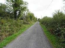
Camagh is bounded on the north by Rosehill, Templeport and Gortnaleck townlands, on the west by Derryragh and Porturlan townlands, on the south by Gorteen, Templeport and Derrycassan townlands and on the east by Kilnavert townland. Its chief geographical features are Camagh Lough and forestry plantations. Camagh is traversed by the regional R205 road and several rural lanes.
The townland covers 163 statute acres.[1]
Etymology
In medieval times Coologe Lough stretched all the way north up to and including Camagh Lake, before being reduced by later drainage works. On the 1656 Down Survey map of Tullyhaw, the lake is depicted as a crooked shape, which may be the origin of the townland name.[2]
History
Until the Cromwellian Act for the Settlement of Ireland 1652, Camagh included the modern townland of Gorteen as one of its subdivisions. Another subdivision was 'Gort na Muc Lach' which means A cultivated field where pigs feed.
The 1609 Baronial Map depicts the townland as Cammagh.[3] [4] The 1665 Down Survey map depicts it as Comaike.
In the Plantation of Ulster by grant dated 29 April 1611, along with other lands, King James I granted the two polls of Camagh to the McGovern Chief, Phelim Magawran, but it is probable that the lands had been in the possession of the McGovern clan for several hundred years before this and it was just a Surrender and regrant confirming the existing title to the McGoverns. An Inquisition of King Charles I held in Cavan town on 4 October 1626 stated that the aforesaid Phelim Magawrane died on 20 January 1622 and his lands including two polls of Camagh went to his son Brian who was aged 30 (born 1592) and married.
The McGovern lands in Derrycassan were confiscated in the Cromwellian Act for the Settlement of Ireland 1652 and were distributed as follows:
In the Hearth Money Rolls of 1662 there were four people paying the Hearth Tax in Camocke- John Horne, Robert Rice, Donagh McCorister, the widow Margaret Sinkler.
A grant dated 30 January 1668 from King Charles II to James Thornton included half a pole of ye 2 poles of Cama alias Camick, called Gortnemucklagh, containing 37 acres and 2 roods. On the same day, a grant dated 30 January 1668 from King Charles II to John Davies included 98 acres in ye poles of Camagh. Less than 1½ years later another grant dated 7 July 1669 from King Charles II to John, Lord Viscount Massareene included 12 acres 2 roods 27 perches in Comack.
The Tithe Applotment Books for 1827 list six tithepayers in the townland.[5]
Griffith's Valuation of 1857 lists seven landholders in the townland.[6]
In the 1901 census of Ireland, there are six families listed in the townland,[7] and in the 1911 census of Ireland, there are still six families listed in the townland.[8]
Antiquities
The Ordnance Survey Namebooks of 1836 state: The townland is bounded on the West by a lake and a stream. There is an old Danish fort near the centre of the townland near which are situated the houses of the tenantry.
The chief structures of historical interest in the townland are:
References
- ↑ "IreAtlas". Retrieved 29 February 2012.
- ↑ Trinity College Dublin: The Down Survey of Ireland.
- ↑ National Archives Dublin:
- ↑
- ↑ Comagh, Commagh and Commiagh in the Tithe Applotment Books 1827
- ↑ Camagh
- ↑ Census of Ireland 1901
- ↑ Census of Ireland 1911
- ↑ Site number 282 in “Archaeological Inventory of County Cavan”, Patrick O’Donovan, 1995
- ↑ Site number 74 in “Archaeological Inventory of County Cavan”, Patrick O’Donovan, 1995
External links
| Wikimedia Commons has media related to Camagh. |
Places in County Cavan | ||
|---|---|---|
| Towns |  | |
| Villages |
| |
| Townlands | ||
| Landforms | ||
| ||
Coordinates: 54°04′20″N 7°40′21″W / 54.0723008°N 7.6723732°W