Calvert City, Kentucky
| Calvert City, Kentucky | |
|---|---|
| City | |
|
Calvert City's City Hall, located on 5th Avenue | |
 Location of Calvert City, Kentucky | |
| Coordinates: 37°1′59″N 88°20′58″W / 37.03306°N 88.34944°WCoordinates: 37°1′59″N 88°20′58″W / 37.03306°N 88.34944°W | |
| Country | United States |
| State | Kentucky |
| County | Marshall |
| Area | |
| • Total | 13.9 sq mi (36.1 km2) |
| • Land | 13.9 sq mi (36.0 km2) |
| • Water | 0.0 sq mi (0.1 km2) |
| Elevation | 341 ft (104 m) |
| Population (2000) | |
| • Total | 2,701 |
| • Density | 194.5/sq mi (75.1/km2) |
| Time zone | Central (CST) (UTC-6) |
| • Summer (DST) | CDT (UTC-5) |
| ZIP code | 42029 |
| Area code(s) | 270 & 364 |
| FIPS code | 21-12016 |
| GNIS feature ID | 0488648 |
| Website | www.calvertcity.com |

Calvert City is a home rule-class city[1] in Marshall County, Kentucky, United States. The population was 2,701 at the 2000 census.
Geography
Calvert City is located at 37°1′59″N 88°20′58″W / 37.03306°N 88.34944°W (37.033126, -88.349570).[2]
According to the United States Census Bureau, the city has a total area of 13.9 square miles (36.1 km²), of which 13.9 square miles (35.9 km²) is land and 0.1 square mile (0.1 km²) (0.36%) is water.
Government
Calvert City has a mayor-council form of government, as allowed by its standing as a fourth-class city under Kentucky's system of local government classification.[3]
| Official | Name [3] |
|---|---|
| Mayor | Lynn B. Jones |
| Council member | Jeremy Rowe |
| Council member | Gene Colburn |
| Council member | Kevin Stokes |
| Council member | Ben Leonard |
| Council member | Lisa Sills |
| Council member | Tim Hawkins |
Despite being in an otherwise dry county, sales by the drink in restaurants seating at least 100 diners are allowed after a 2004 local option election.
Demographics
| Historical population | |||
|---|---|---|---|
| Census | Pop. | %± | |
| 1880 | 85 | — | |
| 1890 | 142 | 67.1% | |
| 1900 | 127 | −10.6% | |
| 1910 | 124 | −2.4% | |
| 1920 | 226 | 82.3% | |
| 1930 | 319 | 41.2% | |
| 1960 | 1,505 | — | |
| 1970 | 2,104 | 39.8% | |
| 1980 | 2,388 | 13.5% | |
| 1990 | 2,531 | 6.0% | |
| 2000 | 2,701 | 6.7% | |
| 2010 | 2,566 | −5.0% | |
| Est. 2015 | 2,532 | [4] | −1.3% |
As of the census[6] of 2000, there were 2,701 people, 1,141 households, and 787 families residing in the city. The population density was 194.5 people per square mile (75.1/km²). There were 1,203 housing units at an average density of 86.6 per square mile (33.5/km²). The racial makeup of the city was 99.00% White, 0.26% Native American, 0.07% Asian, 0.04% from other races, and 0.63% from two or more races. Hispanic or Latino of any race were 0.37% of the population.
There were 1,141 households out of which 28.4% had children under the age of 18 living with them, 55.9% were married couples living together, 9.7% had a female householder with no husband present, and 31.0% were non-families. 28.7% of all households were made up of individuals and 12.3% had someone living alone who was 65 years of age or older. The average household size was 2.27 and the average family size was 2.76.
The age distribution was 21.0% under the age of 18, 7.0% from 18 to 24, 25.4% from 25 to 44, 26.3% from 45 to 64, and 20.2% who were 65 years of age or older. The median age was 43 years. For every 100 females there were 88.7 males. For every 100 females age 18 and over, there were 82.3 males.
The median income for a household in the city was $41,107, and the median income for a family was $48,098. Males had a median income of $43,464 versus $23,403 for females. The per capita income for the city was $22,473. About 4.5% of families and 6.9% of the population were below the poverty line, including 7.1% of those under age 18 and 10.3% of those age 65 or over.
History

Calvert City was named for Potilla Willis Calvert. He built his home, Oak Hill, in 1860 and around a decade later gave a portion of his land to a new railroad, specifying that a station be built near his home.[7] That station served as the starting point of the town, which was incorporated on March 18, 1871.[8] The railroad station and post office long favored the shorter Calvert, but the Board on Geographic Names reversed its earlier decision in 1957 and switched to the longer form.[7]
During the Ohio River flood of 1937, Calvert City's business district and much of the residential area was severely damaged by floodwaters.
In the 1940s, the construction of nearby Kentucky Dam by the Tennessee Valley Authority brought plentiful electric power that led to many industrial plants, mostly chemical manufacturers, to locate between the city and the Tennessee River. Merchant Luther Draffen was instrumental in attracting the dam and industrial plants.
Industry
Calvert City has 16 industrial plants that are a key source of employment for Western Kentucky. The majority are chemical manufacturers with some steel and metallurgical plants and industrial services firms.
| Company[9] | Employees |
|---|---|
| Wacker Chemical Corporation | 380 |
| Arkema Chemicals | 264 |
| Carbide Graphite | 104 |
| B. F. Goodrich Company | 130 |
| Westlake Monomers/CA&O | 295 |
| Westlake PVC Corporation | 77 |
| Ashland Inc. | 563 |
| Gerdau Ameristeel, Inc. | 205 |
| CC Metals and Alloys, Inc. | 210 |
| LWD | 225 |
| Estron Chemicals, Inc. | 32 |
| Rail Services | 31 |
| Ibex Industries, Inc. | 65 |
| Jexco | 35 |
| Degussa Corporation International Catalyst Technology | 67 |
| Metal Fab, Inc. | 45 |
Transportation
Calvert City is a hub for surface transportation. The city is the northern terminus of the Julian M. Carroll Purchase Parkway, providing a link to Memphis, Tennessee. The city is skirted on the south by Interstate 24, linking Calvert City to Nashville and St. Louis, and, via the Wendell H. Ford Western Kentucky Parkway, Louisville and Lexington. The city has rail access through the Paducah and Louisville Railway main line and is a commercial port on the Tennessee River.[10]
Attractions
Media
Newspaper
- The Lake News, a weekly newspaper is owned and operated by Loyd W. Ford. It was founded in 1985 and is the newspaper of record for the City of Calvert. The Lake News has a circulation of 2800 and is distributed in Marshall and Livingston Counties in Kentucky.[11]
Radio
- WCCK-FM — 95.7
References
- Historical marker, 26 Aspen St., Calvert City, Ky. Kentucky Historical Marker Database
- Huddleston, Connie M.; Aldridge, Carol; Smith, Virginia (2006). Images of America: Marshall County. Arcadia Publishing. ISBN 0-7385-4284-9.
- ↑ "Summary and Reference Guide to House Bill 331 City Classification Reform" (PDF). Kentucky League of Cities. Retrieved December 30, 2014.
- ↑ "US Gazetteer files: 2010, 2000, and 1990". United States Census Bureau. 2011-02-12. Retrieved 2011-04-23.
- 1 2 "Kentucky Secretary of State Cities Database". Retrieved 2008-04-01.
- ↑ "Annual Estimates of the Resident Population for Incorporated Places: April 1, 2010 to July 1, 2015". Retrieved July 2, 2016.
- ↑ "Census of Population and Housing". Census.gov. Archived from the original on May 11, 2015. Retrieved June 4, 2015.
- ↑ "American FactFinder". United States Census Bureau. Archived from the original on 2013-09-11. Retrieved 2008-01-31.
- 1 2 Rennick, Robert. Kentucky Place Names, p. 46. University Press of Kentucky (Lexington), 1987. Accessed 24 Jul 2013.
- ↑ Commonwealth of Kentucky. Office of the Secretary of State. Land Office. "Calvert City, Kentucky". Accessed 24 Jul 2013.
- ↑ "Economic Development in Calvert City, Ky". Retrieved 2008-01-10.
- ↑ "Calvert City Transportation". Archived from the original on 2008-04-27. Retrieved 2008-10-13.
- ↑ The Lake News website.
External links
- The Lake News, local newspaper
- Semi-official city site
- Marshall County Board of Education
Municipalities and communities of Marshall County, Kentucky, United States | ||
|---|---|---|
| Cities | 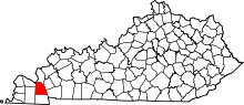 | |
| CDP | ||
| Other unincorporated communities | ||
| Ghost town | ||