Callejón de Huaylas
The Santa Valley is an inter-andean valley in the Ancash Region in the north-central highlands of Peru. Due to its location between two mountain ranges it is known as Callejón de Huaylas, the Alley of Huaylas, whereas "Huaylas" refers to the territorial division's name during the Viceroyalty of Peru.
Going north from Lima, the road climbs to an altitude of 3,945 m, where the lake Quñuqqucha marks the head of the valley. This lake is the main source of Santa River. From here the road descends into the Callejón de Huaylas, demarcated by the Cordillera Blanca to the east and the Cordillera Negra ("black range") to the west. To the south rise the summits of the Waywash mountain range.
Huaraz, the capital of Ancash, is the largest city in the Callejón, located at 3,000 m above sea level. In the valley north of Huaraz there are the towns Carhuaz, Yungay (the site of a major earthquake and landslide in 1970 that buried the town and killed over 20,000 people) and Caraz which is considered the last city in the valley.
Location
The Callejón de Huaylas stretches for 150 km in the Ancash Region of Peru. The Santa river runs along the valley floor in a north-westerly direction. The valley's southern extreme begins at 4,000 m above sea level, and descends to 2,000 m at its northern end past the city of Caraz where the Santa River leaves the valley. It is bordered by two mountain ranges, the snow-covered Cordillera Blanca (White Mountain Range) to the east, where many climbable peaks boast year-round snow above 5,000 m, and the Cordillera Negra (Black Mountain Range) to the west, reaching over 4,000 m but typically getting no snow as it is exposed to warm coastal winds on its western flank. Nevado Huascarán (6,746 m), the highest peak of Peru, is located in the Cordillera Blanca above the town of Yungay.
History
Between the years 600 and 400 BCE the Chavin culture flourished in the area.[1]
José de San Martín and Simón Bolívar used the valley as a base during the Wars of Independence because of its strategic value.
In 1885, Pedro Pablo Atusparia was the leader of a peasant uprising in the valley.
On 31 May 1970 a landslide caused by the 1970 Ancash earthquake buried the whole town of Yungay, killing 25,000 persons. Only 92 people survived, most of whom were in the cemetery and stadium at the time of the earthquake. The regional capital, Huaraz, as well as Caraz and Aija were partially destroyed.
Located in the Callejón de Huaylas, Huascarán National Park was designated a World Biosphere Reserve by UNESCO in 1977 to protect the local flora, fauna and archaeological sites.
Population
The population of the Callejón de Huaylas is primarily Quechua and Spanish-speaking Andeans, most of them small-scale and subsistence-farmers living in mountain villages, mixed with Spanish-speaking Mestizos in the small towns and cities along the Santa river. The richer Mestizos dominate politically and economically, but migration, education and tourism have brought changes in the population in recent decades.
Most Quechua families adhere to traditional forms of food, music, and dress, yet still have cell phones and typically raise Guinea Pigs and other farm animals in their farms. Although men have typically adopted modern pants, collared shirts and sweaters, Quechua women continue to wear llikllas and layered colored skirts called polleras in Spanish. Both men and women wear llanq'is, rudimentary sandals in the traditional style, although they are now made from recycled rubber from car tires. One can buy them in any size from the various markets in the region, for around 5 soles a pair.
Climate change
The climate in the valley is subtropical and dry. The rainy season lasts from October to April, during which time it can rain nearly every afternoon. The yearly average temperature is 16.6 °C in the daytime and 12.6 °C at night.
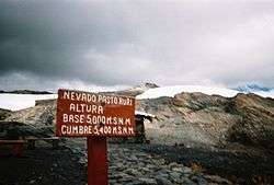
As rainy seasons get less rainy and dry seasons get hotter and drier, climate change has become a very worrisome topic for the Peruvian government. As glaciers continue to recede, there is much worry that many glaciers such as the popular tourist site Pastoruri will disappear in as little as 20 years. This will threaten the very existence of many towns who depend on glacial runoff as their primary water source, and will likely lead to increased migration to the cities as glacial rivers dry up.
Furthermore, as the region heats up, parasites such as mosquitoes are able to survive the rainy season and live at increasingly high altitudes that were previously uninhabitable for them. These trends pose a danger to public health in the region, and will also likely contribute to pressures on the government to address the changing environment of the Callejón de Huaylas.[2]
Tourism
The valley is an excellent tourist destination both for Peruvians and foreigners, and the city of Huaraz is home to a variety of local tour agencies that organize trips to the major attractions. Tourists come primarily for trekking and mountaineering, though the region also offers opportunities for adventure sports such as skiing, paragliding and rafting, as well as archaeology and botany.
Pre-Inca ruins such as those at Chavín de Huantar, a relic of the Chavín culture which spanned 900 to 300 BCE have been preserved and studied and provide a significant tourist attraction.
Climbing
The climbing season coincides with the summer in the northern hemisphere, as the dry season spans from roughly May to September. Multiple climbing routes have been opened and detailed on most of the peaks of the Cordillera Blanca, ranging in difficulty from E to ES, and the Huaraz Guide Association guides climbers of all levels to virtually any peak in the region.
Because of the tropical heat of the Callejón, the snow line sits above 5,000 m during the dry season. Most climbs between 5,000 m and 6,000 m are typically done in two days: one day of approach and one day to summit. Nevado Huascarán, the highest peak in the range, is typically climbed in three days by a variety of routes.
There are many difficult climbs in the region, and many have died on the peaks of the Cordillera Blanca. Snow conditions in the area are unlike those in the rest of the world, and many inexperienced climbers attempt to climb beyond their means or without spending enough time to acclimatise because of the relative technical ease of some of the lesser peaks. Although guide service prices may appear high when compared with the general prices of things in Peru, they are lower than in other climbing regions of the world and are an important way to minimize risk.
See also
References
- ↑ Peru.com - Ancash history
- ↑ Mark, Bryan G., Jeffrey Bury, Jeffrey M. McKenzie, Adam French, and Michel Baraer. “Climate Change and Tropical Andean Glacier Recession: Evaluating Hydrologic Changes and Livelihood Vulnerability in the Cordillera Blanca, Peru.” Annals of the Association of American Geographers 100, no. 4 (August 31, 2010): 794–805. doi:10.1080/00045608.2010.497369.
Further reading
- Bode, Barbara. No Bells to Toll: Destruction and Creation in the Andes. New York: Scribner, 1989.
Coordinates: 9°16′S 77°07′W / 9.267°S 77.117°W