California State Route 62
| ||||
|---|---|---|---|---|
 | ||||
| Route information | ||||
| Defined by Streets and Highways Code § 362 | ||||
| Maintained by Caltrans | ||||
| Length: | 151.438 mi[1] (243.716 km) | |||
| Major junctions | ||||
| West end: |
| |||
|
| ||||
| East end: |
| |||
| Highway system | ||||
| ||||

State Route 62 (SR 62) is a state highway in the U.S. state of California.
Route description
This route is part of the California Freeway and Expressway System[2] and is eligible for the State Scenic Highway System.[3] It is also recognized by Caltrans as a scenic highway for its entire length.[4][5]
SR 62 is designated as a Blue Star Memorial Highway from Interstate 10 to Adobe Road in Twentynine Palms. SR 62 is known as the Daniel J. Muehlhausen Memorial Highway (honoring a California Highway Patrol officer killed in the line of duty) from 5.4 mi (8.7 km) west of Route 177 to 4.6 mi (7.4 km) east of Route 177, and the Twentynine Palms Highway from I-10 to SR 177.[6]
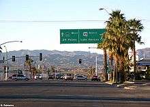
The route cuts across the Little San Bernardino Mountains along southern San Bernardino County. Route 62 begins at a freeway-to-freeway intersection with Interstate 10 at the eastern end of the San Gorgonio Pass northwest of Palm Springs in Riverside County and heads due north until its intersection with SR 247 in Yucca Valley, and then it heads east through the unincorporated community of Joshua Tree and the city of Twentynine Palms. In 1970, Route 62 ended at the eastern city limit of Twentynine Palms, but it was later extended along the northern boundary of the Joshua Tree National Park to meet Arizona State Route 95 in Parker, Arizona. East of Twentynine Palms, there is a sign warning drivers that there are no services for 100 miles/160 km until reaching Vidal Junction where SR 62 meets US 95. This is one of the most desolate stretches of highway in California, and consequently, the most heavily traveled portion is between I-10 and Twentynine Palms. Travelers between the eastern Coachella Valley and the river utilize that more desolate stretch as the fastest route to the resorts of the Colorado River, accessing it via California State Route 177 in Desert Center.
In 2014, the Palm Springs Desert Sun newspaper reported that a dozen marines from the Marine Corps Air Ground Combat Center Twentynine Palms have been killed in accidents on Highway 62 since 2007 (out of a total of 33 vehicle-related deaths among personnel at the base); the paper attributed the problem in part to the base's unusually remote location, leaving personnel few options for entertainment.[7]

History
The routing west of Twentynine Palms was added to the state highway system in phases, with the part from White Water to Morongo Valley added in 1935, and from Morongo Valley to Yucca Valley in 1959; both were designated as Route 187.[8][9] From Yucca Valley to Twentynine Palms, Route 218 was added in 1961.[10] In the 1964 state highway renumbering, SR 62 was designated from I-10 into the town of Twentynine Palms.[11] The portion from Twentynine Palms to Arizona was added to SR 62 in 1970.[12]
Major intersections
Except where prefixed with a letter, postmiles were measured on the road as it was in 1964, based on the alignment that existed at the time, and do not necessarily reflect current mileage. R reflects a realignment in the route since then, M indicates a second realignment, L refers an overlap due to a correction or change, and T indicates postmiles classified as temporary (for a full list of prefixes, see the list of postmile definitions).[1] Segments that remain unconstructed or have been relinquished to local control may be omitted. The numbers reset at county lines; the start and end postmiles in each county are given in the county column.
| County | Location | Postmile [1][13][14] | Destinations | Notes | |
|---|---|---|---|---|---|
| Riverside RIV 0.00-9.24 | | 0.00 | Interchange; westbound exit and eastbound entrance; west end of SR 62; former US 99; I-10 exit 117 | ||
| | R6.45 | North Indian Canyon Avenue | Base of the Morongo Grade, a gentle, mountainous stretch of highway leading to the Morongo Basin | ||
| San Bernardino SBD 0.00-79.48 | Yucca Valley | 12.40 | |||
| Joshua Tree | 18.26 | Park Boulevard | Serves Joshua Tree National Park | ||
| Twentynine Palms | 34.22 | Utah Trail – Amboy | Serves Joshua Tree National Park | ||
| Riverside RIV 79.48-90.20 | | 84.97 | |||
| San Bernardino SBD 90.20-142.66 | Vidal Junction | 125.76 | |||
| 125.76 | Agricultural Inspection Station (westbound only) | ||||
| | 142.66 | East end of SR 62; continuation beyond the Arizona state line | |||
| 1.000 mi = 1.609 km; 1.000 km = 0.621 mi | |||||
References
- 1 2 3 California Department of Transportation. "State Truck Route List". Sacramento: California Department of Transportation. Archived from the original (XLS file) on June 30, 2015. Retrieved June 30, 2015.
- ↑ CA Codes (shc:250-257)
- ↑ CA Codes (shc:260-284)
- ↑ "Officially Designated State Scenic Highways and Historic Parkways". California Department of Transportation. December 7, 2007. Retrieved June 22, 2011.
- ↑ A road to somewhere, not yet apparent (Photo)
- ↑ 2007 Named Freeways, Highways, Structures and Other Appurtenances in California (PDF). Caltrans. p. 132. Retrieved 2007-03-28.
- ↑ Brett Kelman and Drew Schmenner, "Desert base, deadly highway: Since 2007, more Marines from the Twentynine Palms Marine base have died back home than in the war-torn Middle East", The Desert Sun, March 22, 2014.
- ↑ California State Assembly. "An act to amend sections 2, 3 and 5 and to add two sections to be numbered 6 and 7 to an act entitled 'An act to provide for the acquisition of rights of way for and the construction, maintenance...". Fiftieth Session of the Legislature. Statutes of California. State of California. Ch. 767.
- ↑ California State Assembly. "An act to amend Sections 306, 320, 332, 351, 362, 365, 369, 374, 382, 388, 397, 407, 408, 409, 410, 415, 422, 435, 440, 446, 453, 456, 460, 467, 470, 476, 487, 492, 493, 494, 506, 521, 528, and 529...". 1959 Session of the Legislature. Statutes of California. State of California. Ch. 1062.
- ↑ California State Assembly. "An act... relating to state highway routes". 1961 Session of the Legislature. Statutes of California. State of California. Ch. 1768.
- ↑ California State Assembly. "An act to add Section 253 and Article 3 (commencing with Section 300) to Chapter 2 of Division 1 of, and to repeal Section 253 and Article 3 (commencing with Section 300) of Chapter 2 of Division 1 of, the...". 1963 Session of the Legislature. Statutes of California. State of California. Ch. 385.
- ↑ California State Assembly. "An act to amend Sections 253.1, 253.4, 253.7, 263.1, 333, 362, 365, 387, 404, 445, 462, 530, 547, 555, and 608 of, to add Sections 465, 543, 570, 571, 581, 583, 584, and 585 to, and to repeal Section 568...". 1970 Session of the Legislature. Statutes of California. State of California. Ch. 1473.
- ↑ California Department of Transportation, Log of Bridges on State Highways, July 2007
- ↑ California Department of Transportation, All Traffic Volumes on CSHS, 2005 and 2006
External links
- California @ AARoads.com - State Route 62
- Caltrans: Route 62 highway conditions
- California Highways: SR 62