California State Route 162
| ||||
|---|---|---|---|---|
 | ||||
| Route information | ||||
| Defined by Streets and Highways Code § 462 | ||||
| Maintained by Caltrans | ||||
| Section 1 | ||||
| West end: |
| |||
| East end: | Mendocino Pass Road near Covelo | |||
| Section 2 | ||||
| West end: |
| |||
| Major junctions: |
| |||
| East end: | Foreman Creek Road at Brush Creek | |||
| Highway system | ||||
| ||||

State Route 162 runs roughly west–east from U.S. Route 101 near Longvale, in Mendocino County, to Oroville, in Butte County. For most of its length, it is a two lane, undivided highway. The highway is broken into two pieces; the state's sponsorship of the road ends where it enters the Mendocino National Forest in Mendocino County where it becomes an unimproved dirt road maintained by the U.S. Forest Service as Forest Highway 7 (FH 7). State Route 162 begins again at the eastern boundary of the National Forest in Glenn County, some 30 miles (48 km) west of Willows.
This route is part of the California Freeway and Expressway System.[1]
Part of SR 162 was designated SR 261 from 1965 to 1972.
Route description
Longvale to Covelo
State Route 162 (SR 162) begins in Mendocino County at Longvale, 10 miles (16 km) south of the town of Laytonville along U.S. Route 101. It goes east through Long Valley next to the Middle Fork of the Eel River. On the opposite bank of the river is the right of way of the disused Northwestern Pacific Railroad. It is 28 miles (45 km) from Longvale to Covelo. This portion of SR 162 is called Covelo Road. Covelo is in Round Valley, home of the Round Valley Indian Reservation.[2] SR 162 is called Covelo Road, Commercial Street, and/or Mina Road as it goes north through the center of town. Beyond Covelo, there are 11 miles (18 km) of paved road, called Mendocino Pass Road, between Covelo and the Mendocino National Forest.

Crossing the Mendocino National Forest
| |
|---|---|
| Location: | Mendocino National Forest |
| Length: | 50 mi (80 km) |
When entering the national forest the road becomes Forest Highway 7 (FH 7). FH 7 is maintained by the U.S. Forest Service as it continues across the Mendocino National Forest for approximately 50 miles (80 km) over Mendocino Pass (5,006 ft or 1,526 m), which is closed in winter due to heavy snowfall. It is roughly 35 miles (56 km) along the unpaved road to Alder Springs, which is inside the Mendocino National Forest in Glenn County. Alder Springs is the location of the Alder Springs GASB site, which is part of the Consolidated Reporting of Earthquakes and Tsunamis (CREST) network run by the National Oceanic and Atmospheric Administration (NOAA), the United States Geological Survey (USGS), and the Federal Emergency Management Agency (FEMA). State Route 162 resumes near Alder Springs and it is 41 miles (66 km) from there to Willows. Along the way, SR 162 crosses Stoney Creek and runs east paralleling Nye Creek. Seven miles west (11 km) of Willows is Thunderhill Raceway Park. At Willows, SR 162 passes the Willows-Glenn County Airport and crosses Interstate 5.
Across the Central Valley
From Willows and the intersection of Interstate 5, SR 162 runs east for 9 miles (14 km) to the town of Glenn. The track of SR 162 turns right and follows State Route 45 south for 4 miles (6.4 km) along the bank of the Sacramento River to Codora. The highway then turns left going east, crosses the Sacramento River and enters the town of Butte City. The highway jogs north as it passes through Butte City, then east again going 20 miles (32 km) due east to meet State Route 99 (formerly U.S. Route 99). This section is called the Butte City Highway. SR 162 turns north along SR 99 then east again as Oroville Dam Boulevard.

Oroville
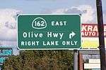
Travelling east, SR 162 passes the Thermalito Afterbay and the Oroville Municipal Airport,[3] before crossing the Feather River on the Randy Jennings Memorial Bridge. As the highway enters Oroville, it crosses under State Route 70. This section is named Oroville Dam Blvd or "Oro-Dam". SR 162 goes 2 miles (3.2 km) through the center of Oroville then turns right onto Olive Highway. Olive Highway goes east 7 1⁄4 miles (11.7 km) to Kelly Ridge Road where it turns north and crosses Lake Oroville over the Bidwell Bar Bridge. SR 162 ends along the Oroville-Quincy Highway at Foreman Creek Road along the eastern edge of the Lake Oroville National Recreation Area.

Oroville-Quincy Highway
In 1915, the Oroville-Quincy Highway was designated as Legislative Route Number 30.[4] This route was abandoned by the state in 1924. In the late 1930s, there was a temporary routing of Alternate US 40 that ran from Davis through Yuba City to Oroville thence to Quincy along Oroville-Quincy Highway, and Bucks Lake Road. The Oroville-Quincy Highway begins in Oroville at Oro-Dam Blvd E just past Olive Highway and runs east. It continues east roughly paralleling Olive Highway until it merges with SR 162 just before Oakvale Ave. It breaks off from SR 162 at Wally B Lane running parallel to the highway for a mile or so before reconnecting at Kelly Ridge Road. The highway runs roughly north and crosses Lake Oroville over the Bidwell Bar Bridge. SR 162 ends near here at Foreman Creek Road, but the Oroville-Quincy Highway continues toward Berry Creek and Madrone Lake. Here it turns east again and runs 6½ miles to Brush Creek. From Brush Creek, the highway turns north for 12½ miles to Palmetto. Here the highway turns ENE 11 miles (18 km) to Buck's Lodge and Bucks Lake. It then goes 16¼ east along Bucks Lake Road past Meadow Valley and Spanish Ranch before arriving at Quincy, a total distance of 62¾ miles.
Major intersections
Except where prefixed with a letter, postmiles were measured on the road as it was in 1964, based on the alignment that existed at the time, and do not necessarily reflect current mileage. R reflects a realignment in the route since then, M indicates a second realignment, L refers an overlap due to a correction or change, and T indicates postmiles classified as temporary (for a full list of prefixes, see the list of postmile definitions).[5] Segments that remain unconstructed or have been relinquished to local control may be omitted. The numbers reset at county lines; the start and end postmiles in each county are given in the county column.
| County | Location | Postmile [5][6][7] | Destinations | Notes | |||
|---|---|---|---|---|---|---|---|
| Mendocino MEN R0.00-34.05 | Longvale | R0.00 | West end of SR 162 | ||||
| | 34.05 | ||||||
| Gap in route | |||||||
| Glenn GLE 37.65-84.59 | | 37.65 | |||||
| | 41.38 | Road 306 north – Newville | |||||
| | 45.12 | Road 306 south – Elk Creek | |||||
| Willows | 65.52 | Interchange | |||||
| 66.63 | Former US 99W | ||||||
| Glenn | 76.27 7.53[N 1] | West end of SR 45 overlap | |||||
| Codora | 3.06[N 1] 76.28 | East end of SR 45 overlap | |||||
| Butte BUT 0.00-31.07 | | 9.73 11.16[N 2] | West end of SR 99 overlap | ||||
| | 13.16[N 2] R9.73 | East end of SR 99 overlap | |||||
| Oroville | 15.83 | Interchange; signed as exit 46 on SR 70; west end of SR 70 Bus. overlap | |||||
| | East end of SR 70 Bus. overlap | ||||||
| | 21.26 | ||||||
| | 26.87 | Bidwell Bar Bridge over Lake Oroville (middle fork) | |||||
| Brush Creek | 31.07 | Foreman Creek Road | East end of SR 162 | ||||
| 31.07 | Oroville-Quincy Highway | Continuation beyond Foreman Creek Road | |||||
1.000 mi = 1.609 km; 1.000 km = 0.621 mi
| |||||||
References
- ↑ CA Codes (shc:250-257)
- ↑ http://www.covelo.net/tribes/pages/tribes_history.shtml
- ↑ http://www.airnav.com/airport/KOVE
- ↑ http://www.cahighways.org/chrphas2.html
- 1 2 California Department of Transportation. "State Truck Route List". Sacramento: California Department of Transportation. Archived from the original (XLS file) on June 30, 2015. Retrieved June 30, 2015.
- ↑ California Department of Transportation, Log of Bridges on State Highways, July 2007
- ↑ California Department of Transportation, All Traffic Volumes on CSHS, 2005 and 2006