Calhoun County, South Carolina
| Calhoun County, South Carolina | |
|---|---|
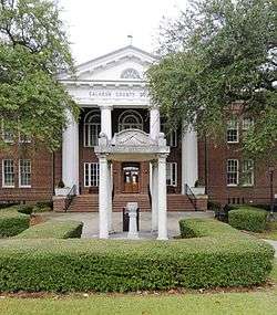 Calhoun County Courthouse | |
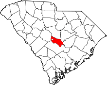 Location in the U.S. state of South Carolina | |
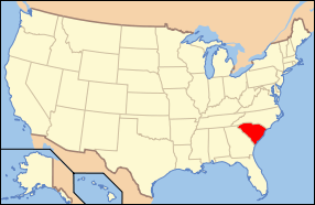 South Carolina's location in the U.S. | |
| Founded | 1908 |
| Named for | John C. Calhoun |
| Seat | St. Matthews |
| Largest town | St. Matthews |
| Area | |
| • Total | 392 sq mi (1,015 km2) |
| • Land | 381 sq mi (987 km2) |
| • Water | 11 sq mi (28 km2), 2.9% |
| Population | |
| • (2010) | 15,175 |
| • Density | 40/sq mi (15/km²) |
| Congressional district | 6th |
| Time zone | Eastern: UTC-5/-4 |
| Website |
www |
Calhoun County is a county in the U.S. state of South Carolina. As of the 2010 census, its population was 15,175,[1] making it the third-least populous county in South Carolina. Its county seat is St. Matthews.[2] The county was formed in 1908 from portions of Lexington and Orangeburg Counties and is named for John C. Calhoun, the former U.S. Vice-President, Senator, Representative and cabinet member from South Carolina.
Calhoun County is part of the Columbia, SC Metropolitan Statistical Area.
Geography
According to the U.S. Census Bureau, the county has a total area of 392 square miles (1,020 km2), of which 381 square miles (990 km2) is land and 11 square miles (28 km2) (2.9%) is water.[3] It is the second-smallest county in South Carolina by land area and smallest by total area.
Adjacent counties
- Richland County - north
- Sumter County - northeast
- Clarendon County - east
- Orangeburg County - south
- Lexington County - northwest
Demographics
| Historical population | |||
|---|---|---|---|
| Census | Pop. | %± | |
| 1910 | 16,634 | — | |
| 1920 | 18,384 | 10.5% | |
| 1930 | 16,707 | −9.1% | |
| 1940 | 16,229 | −2.9% | |
| 1950 | 14,753 | −9.1% | |
| 1960 | 12,256 | −16.9% | |
| 1970 | 10,780 | −12.0% | |
| 1980 | 12,206 | 13.2% | |
| 1990 | 12,753 | 4.5% | |
| 2000 | 15,185 | 19.1% | |
| 2010 | 15,175 | −0.1% | |
| Est. 2015 | 14,781 | [4] | −2.6% |
| U.S. Decennial Census[5] 1790-1960[6] 1900-1990[7] 1990-2000[8] 2010-2013[1] | |||
2000 census
As of the census[9] of 2000, there were 15,185 people, 5,917 households, and 4,272 families residing in the county. The population density was 40 people per square mile (15/km²). There were 6,864 housing units at an average density of 18 per square mile (7/km²). The racial makeup of the county was 50.03% White, 48.69% Black or African American, 0.19% Native American, 0.14% Asian, 0.03% Pacific Islander, 0.24% from other races, and 0.69% from two or more races. 1.40% of the population were Hispanic or Latino of any race.
There were 5,917 households out of which 30.20% had children under the age of 18 living with them, 52.00% were married couples living together, 15.80% had a female householder with no husband present, and 27.80% were non-families. 24.50% of all households were made up of individuals and 9.60% had someone living alone who was 65 years of age or older. The average household size was 2.54 and the average family size was 3.03.
In the county, the population was spread out with 25.10% under the age of 18, 7.40% from 18 to 24, 27.00% from 25 to 44, 26.70% from 45 to 64, and 13.80% who were 65 years of age or older. The median age was 39 years. For every 100 females there were 90.10 males. For every 100 females age 18 and over, there were 86.40 males.
The median income for a household in the county was $32,736, and the median income for a family was $39,823. Males had a median income of $31,431 versus $22,267 for females. The per capita income for the county was $17,446. About 13.20% of families and 16.20% of the population were below the poverty line, including 20.40% of those under age 18 and 18.30% of those age 65 or over.
2010 census
As of the 2010 United States Census, there were 15,175 people, 6,080 households, and 4,204 families residing in the county.[10] The population density was 39.8 inhabitants per square mile (15.4/km2). There were 7,340 housing units at an average density of 19.3 per square mile (7.5/km2).[11] The racial makeup of the county was 53.9% white, 42.6% black or African American, 0.3% American Indian, 0.2% Asian, 0.1% Pacific islander, 1.8% from other races, and 1.2% from two or more races. Those of Hispanic or Latino origin made up 3.0% of the population.[10] In terms of ancestry, respondents identified as 15.4% American, 14.9% were German, 8.5% Irish, and 7.1% of English heritage.[12]
Of the 6,080 households, 30.3% had children under the age of 18 living with them, 48.6% were married couples living together, 15.9% had a female householder with no husband present, 30.9% were non-families, and 26.8% of all households were made up of individuals. The average household size was 2.47 and the average family size was 2.99. The median age was 43.4 years.[10]
The median income for a household in the county was $36,790 and the median income for a family was $51,975. Males had a median income of $42,394 versus $31,001 for females. The per capita income for the county was $20,845. About 11.6% of families and 15.8% of the population were below the poverty line, including 22.4% of those under age 18 and 15.6% of those age 65 or over.[13]
Communities
Towns
- Cameron
- St. Matthews (county seat)
Unincorporated communities
- Creston
- Fort Motte
- Lone Star
- Sandy Run
See also
External links
References
- 1 2 "State & County QuickFacts". United States Census Bureau. Retrieved November 22, 2013.
- ↑ "Find a County". National Association of Counties. Archived from the original on 2011-05-31. Retrieved 2011-06-07.
- ↑ "2010 Census Gazetteer Files". United States Census Bureau. August 22, 2012. Retrieved March 16, 2015.
- ↑ "County Totals Dataset: Population, Population Change and Estimated Components of Population Change: April 1, 2010 to July 1, 2015". Retrieved July 2, 2016.
- ↑ "U.S. Decennial Census". United States Census Bureau. Archived from the original on May 11, 2015. Retrieved March 16, 2015.
- ↑ "Historical Census Browser". University of Virginia Library. Retrieved March 16, 2015.
- ↑ Forstall, Richard L., ed. (March 27, 1995). "Population of Counties by Decennial Census: 1900 to 1990". United States Census Bureau. Retrieved March 16, 2015.
- ↑ "Census 2000 PHC-T-4. Ranking Tables for Counties: 1990 and 2000" (PDF). United States Census Bureau. April 2, 2001. Retrieved March 16, 2015.
- ↑ "American FactFinder". United States Census Bureau. Archived from the original on 2013-09-11. Retrieved 2011-05-14.
- 1 2 3 "DP-1 Profile of General Population and Housing Characteristics: 2010 Demographic Profile Data". United States Census Bureau. Retrieved 2016-03-09.
- ↑ "Population, Housing Units, Area, and Density: 2010 - County". United States Census Bureau. Retrieved 2016-03-09.
- ↑ "DP02 SELECTED SOCIAL CHARACTERISTICS IN THE UNITED STATES – 2006-2010 American Community Survey 5-Year Estimates". United States Census Bureau. Retrieved 2016-03-09.
- ↑ "DP03 SELECTED ECONOMIC CHARACTERISTICS – 2006-2010 American Community Survey 5-Year Estimates". United States Census Bureau. Retrieved 2016-03-09.
Municipalities and communities of Calhoun County, South Carolina, United States | ||
|---|---|---|
| Towns | | |
| Unincorporated communities | ||
Coordinates: 33°40′N 80°47′W / 33.67°N 80.78°W