Calgro, California
| Calgro, California | |
|---|---|
| Unincorporated community | |
 Calgro, California | |
| Coordinates: 36°29′23″N 119°17′08″W / 36.48972°N 119.28556°WCoordinates: 36°29′23″N 119°17′08″W / 36.48972°N 119.28556°W | |
| Country | United States |
| State | California |
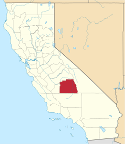
| County | Tulare |
| Elevation | 344 ft (105 m) |
| Time zone | Pacific (PST) (UTC-8) |
| • Summer (DST) | PDT (UTC-7) |
| Area code(s) | 559 |
| GNIS feature ID | 1660412[1] |
Calgro is an unincorporated community in Tulare County, California, United States. Calgro is located on California State Route 63 and California State Route 201 11 miles (18 km) north of Visalia. The name of the community comes from an acronym for the California Growers Wineries.[2][3]
References
- ↑ U.S. Geological Survey Geographic Names Information System: Calgro, California
- ↑ Durham, David L. (1998). California's Geographic Names: A Gazetteer of Historic and Modern Names of the State. Quill Driver Books. p. 1010. ISBN 1-884995-14-4.
- ↑ Temple, Robert D. Edge Effects: The Border-Name Places, (2nd edition, 2009), iUniverse, page 324.
This article is issued from Wikipedia - version of the 10/27/2016. The text is available under the Creative Commons Attribution/Share Alike but additional terms may apply for the media files.