Calera de Víctor Rosales
| Municipality of Calera de Víctor Rosales Calera | |
|---|---|
| Municipality | |
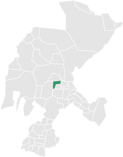 Location of Calera within Zacatecas and Mexico | |
|
Municipality of Calera de Víctor Rosales Location of Calera within Zacatecas and Mexico | |
| Coordinates: 23°26′02″N 102°55′10″W / 23.43389°N 102.91944°W | |
| Country |
|
| State | Zacatecas |
| Municipal seat | Víctor Rosales |
| Largest city | Víctor Rosales |
| Municipality | 1868 |
| Government | |
| • Municipal President | L. C. Rodrigo Saucedo Ramirez, PRI |
| Area | |
| • Total | 389 km2 (150 sq mi) |
| Elevation | 2,174 m (7,133 ft) |
| Population (2005)[1] | |
| • Total | 36,106 |
| • Largest city | 29,626 Víctor Rosales |
| Time zone | CST (UTC-6) |
| Postal Code | 98500-98508, 98510, 98515, 98520 |
| Area code(s) | 478 |
| Website | http://www.calera.gob.mx/ |
Calera is one of the 58 municipalities in the Mexican state of Zacatecas. It is located on the central part of the state of Zacatecas and it is bounded by the municipalities of General Enrique Estrada, Fresnillo, Villa de Cos, Pánuco, Morelos and Zacatecas. The municipality covers a total surface area of 389 square kilometers (150 sq mi).[2] The municipality makes up for 0.5% of the area of the state of Zacatecas.
History
Calera was born as a point of pass from Fresnillo and Zacatecas. It was named in honor of the hero of independence Víctor Rosales.
Climate
| Climate data for Victor Rosales (1951–2010) | |||||||||||||
|---|---|---|---|---|---|---|---|---|---|---|---|---|---|
| Month | Jan | Feb | Mar | Apr | May | Jun | Jul | Aug | Sep | Oct | Nov | Dec | Year |
| Record high °C (°F) | 30.5 (86.9) |
29.0 (84.2) |
32.5 (90.5) |
33.0 (91.4) |
37.5 (99.5) |
36.0 (96.8) |
33.0 (91.4) |
34.5 (94.1) |
30.5 (86.9) |
31.5 (88.7) |
29.5 (85.1) |
29.0 (84.2) |
37.5 (99.5) |
| Average high °C (°F) | 19.6 (67.3) |
21.1 (70) |
24.0 (75.2) |
26.4 (79.5) |
28.2 (82.8) |
27.3 (81.1) |
25.1 (77.2) |
24.7 (76.5) |
23.7 (74.7) |
23.4 (74.1) |
22.1 (71.8) |
19.9 (67.8) |
23.8 (74.8) |
| Daily mean °C (°F) | 10.4 (50.7) |
11.7 (53.1) |
14.4 (57.9) |
16.8 (62.2) |
19.2 (66.6) |
19.8 (67.6) |
18.6 (65.5) |
18.3 (64.9) |
17.4 (63.3) |
15.6 (60.1) |
13.1 (55.6) |
11.0 (51.8) |
15.5 (59.9) |
| Average low °C (°F) | 1.3 (34.3) |
2.4 (36.3) |
4.9 (40.8) |
7.2 (45) |
10.2 (50.4) |
12.3 (54.1) |
12.1 (53.8) |
11.9 (53.4) |
11.0 (51.8) |
7.8 (46) |
4.0 (39.2) |
2.1 (35.8) |
7.3 (45.1) |
| Record low °C (°F) | −11.0 (12.2) |
−8.5 (16.7) |
−7.5 (18.5) |
−6.0 (21.2) |
2.0 (35.6) |
4.0 (39.2) |
6.0 (42.8) |
7.0 (44.6) |
0.5 (32.9) |
−2.5 (27.5) |
−6.5 (20.3) |
−11.0 (12.2) |
−11.0 (12.2) |
| Average precipitation mm (inches) | 15.2 (0.598) |
9.6 (0.378) |
4.3 (0.169) |
8.3 (0.327) |
15.9 (0.626) |
65.1 (2.563) |
92.6 (3.646) |
90.8 (3.575) |
69.3 (2.728) |
34.1 (1.343) |
11.2 (0.441) |
11.7 (0.461) |
428.1 (16.854) |
| Average precipitation days (≥ 0.1 mm) | 2.4 | 1.4 | 0.8 | 1.5 | 3.4 | 8.0 | 10.5 | 10.4 | 9.1 | 5.3 | 1.6 | 2.6 | 57.0 |
| Source: Servicio Meteorologico Nacional[3][4] | |||||||||||||
General information
Calera is one of the fastest growing cities in Zacatecas Mx., with more than 38,189 people. It is the only municipality in Zacatecas that has an International Airport, Freeway and Railroad. Calera is the most important industrial area in Zacatecas, making floors. wood furniture, juice, purified water, dry chili processing and seeds. Calera is also home to Corona, the largest brewer in Latin America. 97% of Calera's population is Roman Catholic and 3% being Protestant.
Calera was decreed as a municipality by the recommendation of Benito Juárez; he went through these lands when he was fighting for the Republic. It was in Calera, where Pancho Villa slept and planned the taking of Zacatecas (Toma de Zacatecas).
Population
In the 2005 census, Apulco reported a population of 36,106.[1] Of these, 29,626 lived in the municipal seat and the remainder lived in surrounding rural communities.
References
- 1 2 Link to tables of population data from Census of 2005 Archived 2010-01-18 at WebCite Instituto Nacional de Estadística, Geografía e Informática (INEGI)
- ↑ "Calera", Encyclopedia de Municipios
- ↑ "Estado de Zacatecas-Estacion: Calera". Normales Climatologicas 1951–2010 (in Spanish). Servicio Meteorologico Nacional. Retrieved 22 April 2015.
- ↑ "Extreme Temperatures and Precipitation for Victor Rosales, Calera 1957–2010" (in Spanish). Servicio Meteorológico Nacional. Retrieved 22 April 2015.
http://www.calera.mx/s/239 Coordinates: 22°57′N 102°42′W / 22.950°N 102.700°W
Zacatecas (capital) | ||
| Municipalities and (municipal seats) |
|  |