Calera, Oklahoma
| Calera, Oklahoma | |
|---|---|
| Town | |
|
Calera, Oklahoma City Hall | |
 Location of Calera, Oklahoma | |
| Coordinates: 33°56′3″N 96°25′42″W / 33.93417°N 96.42833°WCoordinates: 33°56′3″N 96°25′42″W / 33.93417°N 96.42833°W | |
| Country | United States |
| State | Oklahoma |
| County | Bryan |
| Area | |
| • Total | 2.6 sq mi (6.6 km2) |
| • Land | 2.6 sq mi (6.6 km2) |
| • Water | 0.0 sq mi (0.0 km2) |
| Elevation | 712 ft (217 m) |
| Population (2010) | |
| • Total | 2,164 |
| • Density | 678.6/sq mi (262.0/km2) |
| Time zone | Central (CST) (UTC-6) |
| • Summer (DST) | CDT (UTC-5) |
| ZIP code | 74730 |
| Area code(s) | 580 |
| FIPS code | 40-10950[1] |
| GNIS feature ID | 1090807[2] |

Calera is a town in Bryan County, Oklahoma, United States, only 5 miles south of Durant and 10 miles north of the Oklahoma-Texas stateline. The population was 2,164 at the 2010 census, an increase of 24.4 percent from 1,739 at the 2000 census.[3] It is part of the Durant Micropolitan Area. It is also part of the Texoma region.
Geography
Calera is located at 33°56′3″N 96°25′42″W / 33.93417°N 96.42833°W (33.934260, -96.428392).[4]
According to the United States Census Bureau, the town has a total area of 2.6 square miles (6.7 km2), all of it land.
The Calera town limits borders the Durant city limits to the south, but the actual downtowns of Calera and Durant are 5 miles apart.
History
When the Missouri, Kansas and Texas Railway built a line through the Choctaw Nation in 1872, the community of Cale was established on the east side of the tracks. It was named after the railroad official George W. Cale. In 1889, the first post office was established.[5]
In 1889, the town was christened as Sterrett but Katy railroad officials refused to accept the name change, and referred to the site as Cale Switch or Cale. The conflict continued until 1910, when the town accepted the name Calera as a compromise.[5]
Demographics
| Historical population | |||
|---|---|---|---|
| Census | Pop. | %± | |
| 1900 | 575 | — | |
| 1910 | 575 | 0.0% | |
| 1920 | 703 | 22.3% | |
| 1930 | 503 | −28.4% | |
| 1940 | 597 | 18.7% | |
| 1950 | 643 | 7.7% | |
| 1960 | 592 | −7.9% | |
| 1970 | 1,063 | 79.6% | |
| 1980 | 1,390 | 30.8% | |
| 1990 | 1,536 | 10.5% | |
| 2000 | 1,739 | 13.2% | |
| 2010 | 2,164 | 24.4% | |
| Est. 2015 | 2,247 | [6] | 3.8% |
As of the census[1] of 2000, there were 1,739 people, 676 households, and 469 families residing in the town. The population density was 678.6 per square mile (262.3/km²). There were 742 housing units at an average density of 289.5 per square mile (111.9/km²). The racial makeup of the town was 81.31% White, 0.12% African American, 11.67% Native American, 0.12% Asian, 2.07% from other races, and 4.72% from two or more races. Hispanic or Latino of any race were 2.99% of the population.
There were 676 households out of which 32.8% had children under the age of 18 living with them, 54.7% were married couples living together, 11.7% had a female householder with no husband present, and 30.6% were non-families. 28.7% of all households were made up of individuals and 14.9% had someone living alone who was 65 years of age or older. The average household size was 2.48 and the average family size was 2.99.
In the town the population was spread out with 27.1% under the age of 18, 7.8% from 18 to 24, 26.6% from 25 to 44, 21.0% from 45 to 64, and 17.5% who were 65 years of age or older. The median age was 35 years. For every 100 females there were 88.2 males. For every 100 females age 18 and over, there were 82.3 males.
The median income for a household in the town was $27,766, and the median income for a family was $31,140. Males had a median income of $26,793 versus $18,688 for females. The per capita income for the town was $13,850. About 12.2% of families and 15.8% of the population were below the poverty line, including 17.5% of those under age 18 and 21.3% of those age 65 or over.
Economy
Thanks to the influx of travellers and tourists visiting the Choctaw Casino & Resort, which is north of town, Calera has seen tremendous economic growth within the past few years. More eating establishments such as Sonic Drive-In, Subway, & Taco Casa, have opened in recent years, and the town even has a new hotel, Best Express Inn & Suites.
Transportation
Calera is situated along U.S. 69/75, the second busiest north-south route in Oklahoma, after Interstate 35. The Union Pacific Rail Road Runs through Calera on the East Side of US 69/75
Educational system
Calera is home to Calera Public Schools. The average enrollment is approximately 700 students. The school mascot is the Calera Bulldogs and Lady Bulldogs. The current classification is 2A, according to the OSSAA (Oklahoma Secondary Schools Athletic Association). Although small, Calera has experienced tremendous success in academics and extra-curricular activities. In 1995, Calera High School's Academic Team won the OSSAA State Championship. The Calera basketball program has advanced to the state tournament seven times, and is home to the 1956 Class B Boys State Champions. Calera is also home to three individual cross-country state championships, as well as three 1600m state championships, won by former East Central University cross-country runner, Cale Eidson. The local FFA Chapter was named Three Star National FFA Chapter at the National FFA Convention from 2007 through 2011, and has experienced major success in Career Development Events at the State and National levels.
Notable people
Famous Calera residents include:
- Jason Meadows, Country music artist and Nashville Star runner-Up
References
- 1 2 "American FactFinder". United States Census Bureau. Archived from the original on 2013-09-11. Retrieved 2008-01-31.
- ↑ "US Board on Geographic Names". United States Geological Survey. 2007-10-25. Retrieved 2008-01-31.
- ↑ CensusViewer:Calera, Oklahoma Population
- ↑ "US Gazetteer files: 2010, 2000, and 1990". United States Census Bureau. 2011-02-12. Retrieved 2011-04-23.
- 1 2 Milligan, James C. "Calera," Encyclopedia of Oklahoma History and Culture, Oklahoma Historical Society, 2009. Accessed April 15, 2015.
- ↑ "Annual Estimates of the Resident Population for Incorporated Places: April 1, 2010 to July 1, 2015". Retrieved July 2, 2016.
- ↑ "Census of Population and Housing". Census.gov. Archived from the original on May 11, 2015. Retrieved June 4, 2015.
External links
Municipalities and communities of Bryan County, Oklahoma, United States | ||
|---|---|---|
| City | 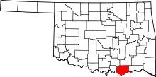 | |
| Towns | ||
| CDPs | ||
| Other unincorporated communities | ||
| Ghost towns | ||