Calanogas, Lanao del Sur
| Calanogas | |
|---|---|
| Municipality | |
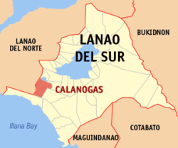 Map of Lanao del Sur with Calanogas highlighted | |
.svg.png) Calanogas Location within the Philippines | |
| Coordinates: 07°45′N 124°06′E / 7.750°N 124.100°ECoordinates: 07°45′N 124°06′E / 7.750°N 124.100°E | |
| Country | Philippines |
| Region | Autonomous Region in Muslim Mindanao (ARMM) |
| Province | Lanao del Sur |
| Barangays | 17 |
| Government[1] | |
| • Mayor | Macapado Benito Sr. |
| Area | |
| • Total | 195.00 km2 (75.29 sq mi) |
| Population (2010)[2] | |
| • Total | 11,988 |
| • Density | 61/km2 (160/sq mi) |
| Time zone | PST (UTC+8) |
| ZIP code | 9319 |
| Dialing code | +63 (0)63 |
| Income class | 3rd |
Calanogas is a 5th class municipality in the province of Lanao del Sur, Philippines. According to the 2010 census, it has a population of 11,988 people.[2]
Barangays
Calanogas is politically subdivided into 17 barangays.
- Bubonga Ranao
- Calalaoan (poblacion)
- Gas
- Inudaran
- Inoma
- Luguna
- Mimbalawag
- Ngingir
- Pagalongan
- Panggawalupa
- Pantaon
- Piksan
- Pindolonan
- Punud
- Tagoranao
- Taliboboka
- Tambac
Demographics
| Population census of Calanogas | ||
|---|---|---|
| Year | Pop. | ±% p.a. |
| 1990 | 7,559 | — |
| 1995 | 8,577 | +2.40% |
| 2000 | 9,989 | +3.32% |
| 2007 | 21,847 | +11.40% |
| 2010 | 11,988 | −19.62% |
| Source: National Statistics Office[2] | ||
References
- ↑ "Official City/Municipal 2013 Election Results". Intramuros, Manila, Philippines: Commission on Elections (COMELEC). 1 July 2013. Retrieved 5 September 2013.
- 1 2 3 "Total Population by Province, City, Municipality and Barangay: as of May 1, 2010" (PDF). 2010 Census of Population and Housing. National Statistics Office. Archived from the original (PDF) on 2 April 2016. Retrieved 20 June 2014.
External links
- Philippine Standard Geographic Code
- Philippine Census Information
- Local Governance Performance Management System
 |
Pualas Lake Dapao |
| ||
| Nunungan, Lanao del Norte | |
Pagayawan Tubaran | ||
| ||||
| | ||||
| Picong |
This article is issued from Wikipedia - version of the 11/12/2016. The text is available under the Creative Commons Attribution/Share Alike but additional terms may apply for the media files.