Calanasan, Apayao
| Calanasan | |
|---|---|
| Municipality | |
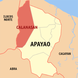 Location within Apayao province | |
.svg.png) Calanasan Location within the Philippines | |
| Coordinates: 18°15′N 121°02′E / 18.25°N 121.03°ECoordinates: 18°15′N 121°02′E / 18.25°N 121.03°E | |
| Country | Philippines |
| Region | Cordillera Administrative Region (CAR) |
| Province | Apayao |
| District | Lone District |
| Founded | June 25, 1963 |
| Barangays | 20 (see Barangays) |
| Government [1] | |
| • Type | Sangguniang Bayan |
| • Mayor | Elias K. Bulut Sr. (Nacionalista Party) |
| • Vice Mayor | Martin Lucero B. Lawat (Nacionalista Party) |
| Area[2] | |
| • Total | 1,256.15 km2 (485.00 sq mi) |
| Population (2015 census)[3] | |
| • Total | 12,604 |
| • Density | 10/km2 (26/sq mi) |
| • Voter (2016)[4] | 7,296 |
| Time zone | PST (UTC+8) |
| ZIP code | 3814 |
| IDD : area code | +63 (0)74 |
| Income class | 1st class |
| PSGC | 148101000 |
Calanasan, officially the Municipality of Calanasan (Filipino: Bayan ng Calanasan), (formerly known as Bayag,[5] meaning "slow"), is a municipality in the province of Apayao in the Cordillera Administrative Region (CAR) of the Philippines. The population was 12,604 at the 2015 census.[3] In the 2016 election, it had 7,296 registered voters.[4]
Its land area is 1,256.15 square kilometres (485.00 sq mi), making it the largest municipality in the province. Calanasan is the source of the Apayao River which empties into the South China Sea and is the only navigable river in Apayao.
Geography
Calanasan is located at 18°15′N 121°02′E / 18.25°N 121.03°E.
According to the Philippine Statistics Authority, the municipality has a land area of 1,256.15 square kilometres (485.00 sq mi)[2] constituting 28.46% of the 4,413.35-square-kilometre- (1,704.00 sq mi) total area of Apayao.
Calanasan is 607 kilometres (377 mi) north from Manila and located in the north-western section of Apayao bordering Santa Praxedes and Claveria in the north, Adams and Carasi in the west, Solsona in the south-west, Kabugao on the south, and Luna and some parts of Kabugao on the east.
The town’s topography or slope is predominantly rugged and mountainous with sporadic flood plains and plateaus. The municipality cradles the larger part of the Apayao-Abulog watershed area as the main source of streams that fills the mighty river which originates from the municipality.
Calanasan has two pronounced seasons, the dry and the wet seasons. The dry season starts in the latest part of December and ends in the middle part of June. The wet season starts in July and ends in the middle part of December. The hottest month is May and rainfall is heaviest in August while strong typhoons usually occur within the period of August to October and the December used to be the coolest month.
Barangays
Calanasan is politically subdivided into 20 barangays.[6]
| PSGC | Barangay | Population | ±% p.a. | ||
|---|---|---|---|---|---|
| 2015[3] | 2010[7] | ||||
| 148101001 | Butao | 6.6% | 832 | 672 | +4.15% |
| 148101002 | Cadaclan | 5.0% | 629 | 437 | +7.18% |
| 148101013 | Don Roque Ablan Sr. | 1.9% | 239 | 273 | −2.50% |
| 148101014 | Eleazar | 1.1% | 139 | 121 | +2.68% |
| 148101015 | Eva Puzon | 9.9% | 1,254 | 1,072 | +3.03% |
| 148101016 | Kabugawan | 4.1% | 519 | 484 | +1.34% |
| 148101003 | Langnao | 1.8% | 229 | 164 | +6.56% |
| 148101004 | Lubong | 3.9% | 494 | 612 | −4.00% |
| 148101017 | Macalino | 2.8% | 348 | 265 | +5.32% |
| 148101005 | Naguilian | 2.6% | 332 | 389 | −2.97% |
| 148101006 | Namaltugan | 7.3% | 918 | 924 | −0.12% |
| 148101007 | Poblacion | 15.9% | 2,008 | 1,939 | +0.67% |
| 148101008 | Sabangan | 3.6% | 454 | 379 | +3.50% |
| 148101018 | Santa Elena | 2.3% | 292 | 221 | +5.45% |
| 148101009 | Santa Filomena | 7.9% | 1,002 | 859 | +2.98% |
| 148101011 | Tanglagan | 16.0% | 2,018 | 1,951 | +0.64% |
| 148101012 | Tubang | 3.6% | 456 | 411 | +2.00% |
| 148101010 | Tubongan | 3.5% | 441 | 395 | +2.12% |
| Total | 12,604 | 11,568 | +1.65% | ||
Demographics
| Population census of Calanasan | |||||||||||||||||||||||||
|---|---|---|---|---|---|---|---|---|---|---|---|---|---|---|---|---|---|---|---|---|---|---|---|---|---|
|
| ||||||||||||||||||||||||
| Source: PSA[3][7][8] | |||||||||||||||||||||||||
In the 2015 census, Calanasan had a population of 12,604.[3] The population density was 10 inhabitants per square kilometre (26/sq mi).
In the 2016 election, it had 7,296 registered voters.[4]
Calanasan is dominated by Isnag Tribe, living with them are the Ilocanos, Igorots and Kalingas. The main dialects of the people are the Isnag and the Ilocano.
Economy
Economic activity in the municipality is based on agricultural production like farming and fishing and livelihood activities like basketry, soft broom making and furniture making.
The municipality has no level lands for extensive rice production except in the northern part of the municipality. The total land area devoted to agriculture is 45.316 hectares (111.98 acres) in which total land area irrigated is 2,347.49 hectares (5,800.8 acres). Its produce include coffee, corn, root crops, peanuts and other legumes, banana, pineapple and some vegetables.
Tourism
The town has vast variety of wild flora and fauna which contributes to its eco-tourism potential. The town is surrounded with virgin forests, cascading waterfalls, and clear rivers.
Potential tourist attractions include:
- Apayao River — Poblacion
- Girgirra’ Falls — Ninoy Aquino
- Ziwanan River — Cadaclan
- Maxibab Falls — Santa Filomena
- Carmella Falls — Eva
- Pisong Lake
- Danao Lake — Sitio Danao, Poblacion
- Purit Cave
- Bantay Malingudu — Poblacion
- Agamata National Park and Wildlife Sanctuary — near the Ilocos Norte boundary, was established in the remote area of sharp peaks and plateaus. This undeveloped area, with pine stands, lush vegetation and mossy forest, affords a panoramic view of Ilocos Norte and Laoag City on the west. It is ideal for hiking, camping, nature tripping and bird watching.
- Blue Haven
- Mount Kilang
Festivals
- Sinandila/Sinursor Festival and Pippiru' Festival (Boat Racing) — celebrated every third week of March
- Calanasan Town Fiesta — celebrated every March which is coming together of the people of Calanasan, The month-long activities highlights the Agro-Industrial and trade fair which showcase the different products of Calanasan and Highlights also the Sports fest, Calanasan got Talent and the Street Dance Competition together with most awaited part the "Search for Miss Dam-ag naya Calanasan".
- Say-Am Festival — is a feast featuring and ushering the traditional way of Isnag's thanksgiving to the Higher Supreme unseen being called "Alawagan" executed and commence through rituals spiced with pep songs, native chants and dances called the "Talip" and "Tad-do". The holding and celebration of Say-am in the older days connotes status - that the family is respectable and well-to-do. It is Celebrated every third week of March.
See also
References
- ↑ "Municipality". Quezon City, Philippines: Department of the Interior and Local Government. Retrieved 31 May 2013.
- 1 2 "Province: Apayao". PSGC Interactive. Makati City, Philippines: Philippine Statistics Authority. Retrieved 4 November 2016.
- 1 2 3 4 5 "CORDILLERA ADMINISTRATIVE REGION (CAR)". Census of Population (2015): Total Population by Province, City, Municipality and Barangay (Report). PSA. Retrieved 20 June 2016.
- 1 2 3 "2016 National and Local Elections Statistics". Commission on Elections. 2016.
- ↑ "Republic Act No. 4980 - An Act Changing the Name of the Municipality of Bayag, Mountain Province, to Calanasan". Chan Robles Virtual Law Library. 17 June 1967. Archived from the original on 4 March 2016. Retrieved 4 November 2016.
- ↑ "Municipal: Calanasan, Apayao". PSA. Philippines: National Statistical Coordination Board. Retrieved 8 January 2016.
- 1 2 "CORDILLERA ADMINISTRATIVE REGION (CAR)". Census of Population and Housing (2010): Total Population by Province, City, Municipality and Barangay (Report). NSO. Retrieved 29 June 2016.
- ↑ "CORDILLERA ADMINISTRATIVE REGION (CAR)". Census of Population (1995, 2000 and 2007): Total Population by Province, City and Municipality (Report). NSO. Archived from the original on 24 June 2011.
External links
| Wikimedia Commons has media related to Calanasan, Apayao. |
 |
Adams, Ilocos Norte | Santa Praxedes, Cagayan / Claveria, Cagayan | | |
| Vintar, Ilocos Norte Carasi, Ilocos Norte |
|
Luna | ||
| ||||
| | ||||
| Nueva Era, Ilocos Norte | |
Kabugao |