Caddo Parish, Louisiana
| Caddo Parish, Louisiana | |||
|---|---|---|---|
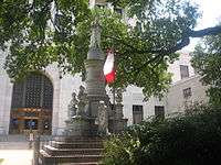
.jpg) Caddo Parish Courthouse, Shreveport | |||
| |||
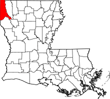 Location in the U.S. state of Louisiana | |||
 Louisiana's location in the U.S. | |||
| Founded | January 18, 1838 | ||
| Named for | Caddo Native Americans | ||
| Seat | Shreveport | ||
| Largest city | Shreveport | ||
| Area | |||
| • Total | 937 sq mi (2,427 km2) | ||
| • Land | 879 sq mi (2,277 km2) | ||
| • Water | 58 sq mi (150 km2), 6.2% | ||
| Population | |||
| • (2010) | 254,969 | ||
| • Density | 290/sq mi (112/km²) | ||
| Congressional district | 4th | ||
| Time zone | Central: UTC-6/-5 | ||
| Website |
www | ||


.jpg)

Caddo Parish (French: Paroisse de Caddo) is a parish located in the U.S. state of Louisiana. As of the 2010 census, the population was 254,969,[1] making it the fourth-most populous parish in Louisiana. The parish seat is Shreveport.[2]
Caddo Parish is included in the Shreveport–Bossier City Metropolitan Statistical Area.
History
In 1838, Caddo Parish was carved from Natchitoches Parish; the legislature named it for the indigenous Caddo Indians.[3]
Law and government
As county seat, Shreveport is the site of the parish courthouse. Caddo Parish comprises the 1st Judicial District. Located downtown on Texas Street, the courthouse contains both civil and criminal courts. The current elected judges are: Ramon Lafitte, Craig O. Marcotte, Michael A. Pitman, Karelia R. Stewart, Robert P. Waddell, Erin Leigh W. Garrett, Katherine C. Dorroh, John Mosely, Jr., Brady O'Callaghan, Ramona Emanuel, and Charles G. Tutt and Roy Brun. The Clerk of Court is Mike Spence.
In April 2015, The New Yorker published an article about the prosecution of Rodricus Crawford, including a claim that Caddo Parish sentenced a disproportionately large number of persons to death.[4]
Geography
According to the U.S. Census Bureau, the parish has a total area of 937 square miles (2,430 km2), of which 978 square miles (2,530 km2) is land and 58 square miles (150 km2) (6.2%) is water.[5]
Major highways
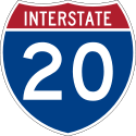 Interstate 20
 Interstate 220
 Interstate 49
 U.S. Highway 71
 U.S. Highway 79
 U.S. Highway 80
 U.S. Highway 171
Adjacent counties and parishes
- Miller County, Arkansas (north)
- Lafayette County, Arkansas (northeast)
- Bossier Parish (east)
- Red River Parish (southeast)
- De Soto Parish (south)
- Panola County, Texas (southwest)
- Harrison County (west)
- Marion County, Texas (west)
- Cass County, Texas (northwest)
National protected area
Demographics
| Historical population | |||
|---|---|---|---|
| Census | Pop. | %± | |
| 1840 | 5,282 | — | |
| 1850 | 8,884 | 68.2% | |
| 1860 | 12,140 | 36.7% | |
| 1870 | 21,714 | 78.9% | |
| 1880 | 26,296 | 21.1% | |
| 1890 | 31,555 | 20.0% | |
| 1900 | 44,499 | 41.0% | |
| 1910 | 58,200 | 30.8% | |
| 1920 | 83,265 | 43.1% | |
| 1930 | 124,670 | 49.7% | |
| 1940 | 150,203 | 20.5% | |
| 1950 | 176,547 | 17.5% | |
| 1960 | 223,859 | 26.8% | |
| 1970 | 230,184 | 2.8% | |
| 1980 | 252,358 | 9.6% | |
| 1990 | 248,253 | −1.6% | |
| 2000 | 252,161 | 1.6% | |
| 2010 | 254,969 | 1.1% | |
| Est. 2015 | 251,460 | [6] | −1.4% |
| U.S. Decennial Census[7] 1790-1960[8] 1900-1990[9] 1990-2000[10] 2010-2013[1] | |||
As of the census of 2010, there were 254,969 people, 119,502 households, and 68,900 families residing in the parish. According to 2012 U.S. Census Bureau estimates, Caddo Parish population was 257,093. The population density was 286 people per square mile (110/km²). There were 108,296 housing units at an average density of 123 per square mile (47/km²). The racial makeup of the parish was 49.1% White, 40.0% Black or African American, 1.2% Native American, 1.8% Asian, 0.1% Pacific Islander, 0.82% from other races, and 1.8% from two or more races. 5.4% of the population were Hispanic or Latino.
There were 119,502 households out of which 30.90% had children under the age of 18 living with them, 42.20% were married couples living together, 19.80% had a female householder with no husband present, and 33.70% were non-families. 28.90% of all households were made up of individuals and 10.50% had someone living alone who was 65 years of age or older. The average household size was 2.51 and the average family size was 3.11.
In the parish the population was spread out with 26.80% under the age of 18, 10.20% from 18 to 24, 27.40% from 25 to 44, 22.00% from 45 to 64, and 13.70% who were 65 years of age or older. The median age was 35 years. For every 100 females there were 89.70 males. For every 100 females age 18 and over, there were 84.90 males.
The median income for a household in the parish was $31,467, and the median income for a family was $38,872. Males had a median income of $31,664 versus $22,074 for females. The per capita income for the parish was $17,839. About 17.10% of families and 21.10% of the population were below the poverty line, including 30.80% of those under age 18 and 16.10% of those age 65 or over.
Politics
Although Republican John McCain carried the state of Louisiana overall, he did not carry Caddo Parish in the 2008 presidential election. Democrat Barack Obama won 51% of the vote and 55,536 votes. John McCain trailed with 48% and 52,228 votes. Other candidates received about 1% of the vote. In the U.S. Senate election, Democrat Mary Landrieu, who survived a hard challenge from Republican John Neely Kennedy, received 58% of the vote in Caddo Parish and 60,558 votes. John Kennedy won 40% of the vote and 41,348 votes. Other candidates received 2% of the vote. In the 2004 presidential election, Republican George W. Bush won Caddo Parish. He received 51% of the vote and 54,292 votes. Democrat John F. Kerry received 48% of the vote and 51,739 votes.[11]
| Year | Democrats | Republicans |
|---|---|---|
| 2012 | 51.9% 58,042 | 46.9% 52,459 |
| 2008 | 51.1% 55,536 | 48.1% 52,228 |
| 2004 | 48.5% 51,739 | 50.9% 54,292 |
| 2000 | 49.7% 47,530 | 48.9% 46,807 |
| 1996 | 55.9% 55,543 | 38.7% 38,445 |
| 1992 | 46.5% 47,733 | 41.5% 42,665 |
| 1988 | 41.5% 39,204 | 57.7% 54,498 |
Education
The Caddo Parish School Board operates public schools.
Correction center
The Louisiana Department of Public Safety and Corrections operated the Forcht-Wade Correctional Center in Keithville, an unincorporated section of Caddo Parish.[13] It closed in July 2012.[14]
The Caddo Correctional Center is a full-service jail rated at a capacity of 1500 beds. Constructed in 1994, this facility was designed to successfully manage a large number of inmates with a minimum of personnel, the Caddo Correctional Center is the largest jail in the Ark-La-Tex and the only "direct supervision" facility in the State of Louisiana.
National Guard
The 2nd Squadron of the 108th Cavalry Regiment (formerly 1-156 Armor Battalion until September 2006) is headquartered in Shreveport at the intersection of Stoner Avenue and Youree Drive. Since the Civil War, this armory has been known by locals as "Fort Humbug"; Shreveport served as the state capital after Union forces had seized Baton Rouge. This site was designated as "Fort Turnball" by the Daughters of the Confederacy in 1920 and served as a mobilization site during World War II. This unit has served two tours of duty in Iraq (2004-05 & 2010) as part of the 256th Infantry Brigade of the Louisiana National Guard.
Communities
-
.jpg)
Shreveport is the largest incorporated area
-

Vivian is the second-largest incorporated area
City
- Shreveport (parish seat and largest city)
Towns
Villages
Census-designated place
- Lakeview (suburb and neighborhood of Shreveport)
Unincorporated communities
- Conn
- Dixie
- Forbing
- Keithville (suburb of Shreveport)
Prison
County
| Header text | Header text | Header text | Aged |
|---|---|---|---|
| Caddo Parish Jail | Example | Example | 13+ |
See also
- National Register of Historic Places listings in Caddo Parish, Louisiana
- USS Caddo Parish (LST-515)
- Steve Prator, sheriff of Caddo Parish since 2000
- Charles R. Scott, district attorney for Caddo Parish from 2009 until his death in office on April 22, 2015
- Jasper K. Smith, former member of the Louisiana House of Representatives 1944-1948 and 1952-1964, and former city attorney of Vivian
References
- 1 2 "State & County QuickFacts". United States Census Bureau. Retrieved August 20, 2013.
- ↑ "Find a County". National Association of Counties. Archived from the original on 2011-05-31. Retrieved 2011-06-07.
- ↑ "History of Caddo Parish". Parish of Caddo. 2004. Retrieved September 3, 2014.
- ↑ Rachel Aviv (July 6, 2015). "Revenge Killing, Race and the death penalty in a Louisiana parish". The New Yorker.
- ↑ "2010 Census Gazetteer Files". United States Census Bureau. August 22, 2012. Retrieved August 27, 2014.
- ↑ "County Totals Dataset: Population, Population Change and Estimated Components of Population Change: April 1, 2010 to July 1, 2015". Retrieved July 2, 2016.
- ↑ "U.S. Decennial Census". United States Census Bureau. Archived from the original on May 11, 2015. Retrieved August 27, 2014.
- ↑ "Historical Census Browser". University of Virginia Library. Retrieved August 27, 2014.
- ↑ "Population of Counties by Decennial Census: 1900 to 1990". United States Census Bureau. Retrieved August 27, 2014.
- ↑ "Census 2000 PHC-T-4. Ranking Tables for Counties: 1990 and 2000" (PDF). United States Census Bureau. Retrieved August 27, 2014.
- ↑
- ↑ Louisiana Secretary of State
- ↑ "Forcht-Wade Corr. Center." Louisiana Department of Public Safety and Corrections. Accessed September 14, 2008.
- ↑ "Forcht-Wade Correctional Center." (Archive) Louisiana Department of Public Safety & Corrections. Retrieved on October 23, 2012.
External links

Municipalities and communities of Caddo Parish, Louisiana, United States | ||
|---|---|---|
| Cities | | |
| Towns | ||
| Villages | ||
| CDP | ||
| Other unincorporated communities | ||
| Ghost town | ||
| Footnotes | ‡This populated place also has portions in an adjacent parish or parishes | |
|
Coordinates: 32°35′N 93°53′W / 32.58°N 93.88°W