Cache, Oklahoma
| Cache, Oklahoma | |
|---|---|
| City | |
 | |
 Location of Cache, Oklahoma | |
| Coordinates: 34°38′03″N 98°37′19″W / 34.634098°N 98.621937°WCoordinates: 34°38′03″N 98°37′19″W / 34.634098°N 98.621937°W | |
| Country | United States |
| State | Oklahoma |
| County | Comanche |
| Government | |
| • Type | Aldermanic |
| • Mayor | Shawn Komahcheet |
| Area | |
| • Total | 3.527807 sq mi (9.136978 km2) |
| • Land | 3.513250 sq mi (9.099276 km2) |
| • Water | 0.014557 sq mi (0.037702 km2) |
| Elevation | 1,272 ft (388 m) |
| Population (2010) | |
| • Total | 2,796 |
| • Density | 790/sq mi (310/km2) |
| Time zone | Central (CST) (UTC-6) |
| • Summer (DST) | CDT (UTC-5) |
| ZIP code | 73527 |
| Area code(s) | 580 |
| FIPS code | 40-10700[1] |
| GNIS feature ID | 1090785[2] |
| Website | http://cachegov.com/ |
Cache is a city in Comanche County, Oklahoma, United States. The population was 2,796 at the 2010 census. It is an exurb included in the Lawton, Oklahoma Metropolitan Statistical Area. It is the location of Star House, the home of the Comanche chief Quanah Parker, the major leader of the Quahadi Comanche in the years of Indian Wars and transition to reservation life.
Geography
According to the United States Census Bureau, Cache has a total area of 3.4 square miles (8.8 km2), of which 3.4 square miles (8.8 km2) is land and 0.29% is water.
Demographics
| Historical population | |||
|---|---|---|---|
| Census | Pop. | %± | |
| 1910 | 317 | — | |
| 1920 | 382 | 20.5% | |
| 1930 | 425 | 11.3% | |
| 1940 | 620 | 45.9% | |
| 1950 | 677 | 9.2% | |
| 1960 | 1,003 | 48.2% | |
| 1970 | 1,106 | 10.3% | |
| 1980 | 1,661 | 50.2% | |
| 1990 | 2,251 | 35.5% | |
| 2000 | 2,371 | 5.3% | |
| 2010 | 2,796 | 17.9% | |
| Est. 2015 | 2,925 | [3] | 4.6% |
As of the census of 2010, there were 2,796 people, 1,037 households, and 780 families residing in the city. The population density was 795.9 people per square mile (307.3/km²). There were 1,140 housing units at an average density of 324.5 per square mile (125.3/km²). The racial makeup of the city was 70.8% White, 2.5% African American, 18.6% Native American (13.45% Comanche),[5] 0.4% Asian, 0.3% Pacific Islander, 0.09% from other races, and 6.5% from two or more races. Hispanic or Latino of any race were 6.1% of the population.
There were 1,037 households out of which 42.3% had children under the age of 18 living with them, 52.1% were married couples living together, 16.0% had a female householder with no husband present, and 24.8% were non-families. 21.5% of all households were made up of individuals and 8.0% had someone living alone who was 65 years of age or older. The average household size was 2.70 and the average family size was 3.10.
In the city the population was spread out with 28.1% under the age of 18, 9.0% from 18 to 24, 26.5% from 25 to 44, 24.0% from 45 to 64, and 11.3% who were 65 years of age or older. The median age was 33.2 years. For every 100 females there were 95.8 males. For every 100 females age 18 and over, there were 92.6 males.
The median income for a household in the city was $41,220, and the median income for a family was $51,840. Males had a median income of $48,672 versus $33,051 for females. The per capita income for the city was $19,299. About 10.0% of families and 17.1% of the population were below the poverty line, including 19.5% of those under age 18 and 18.1% of those age 65 or over.
Government
Cache uses the Aldermanic model of municipal government.[6] The city's primary authority resides in the City Council which approves ordinances, resolutions, and contracts.[7] The city is divided into four wards with each ward electing a single city council representative for a four-year term.[8][9] The mayor, who is elected every four years, presides and sets the agenda over the City Council is primarily ceremonial as a head of government.[10] The mayor is the chief executive officer of the executive branch and has the power to prepare an annual budget, appoint heads of departments with city council confirmation, remove or suspend city employees, enforce city ordinances, and grant pardons for city violations with council approval.[11]
At the federal level, Cache lies in Oklahoma 4th Congressional district, represented by Tom Cole.[12] In the State Senate, Cache is in District 32 represented by Randy Bass.[13] In the House, District 63 represented by Don Armes covers the city.[14]
See also
References
- ↑ "American FactFinder". United States Census Bureau. Archived from the original on 2013-09-11. Retrieved 2008-01-31.
- ↑ "US Board on Geographic Names". United States Geological Survey. 2007-10-25. Retrieved 2008-01-31.
- ↑ "Annual Estimates of the Resident Population for Incorporated Places: April 1, 2010 to July 1, 2015". Retrieved July 2, 2016.
- ↑ "Census of Population and Housing". Census.gov. Archived from the original on May 11, 2015. Retrieved June 4, 2015.
- ↑ http://www.epodunk.com/ancestry/Comanche.html
- ↑ Oklahoma Department of Libraries. "Oklahoma Municipal Government" (pdf). p. 544.
- ↑ Cache, Oklahoma, Municipal Code §1-22(accessed 2011-11-08)
- ↑ Cache, Oklahoma, Municipal Code §20-1(accessed 2011-11-08)
- ↑ Cache, Oklahoma, Municipal Code §1-20.2(accessed 2011-11-08)
- ↑ Cache, Oklahoma, Municipal Code §1-40.3,40.5(accessed 2011-11-08)
- ↑ Okla. Stat. tit. 11, § 9-105
- ↑ "2002 Congressional Districts". Oklahoma House of Senate. Archived from the original on 2010-05-28. Retrieved 2010-05-14.
- ↑ "Senate District 32" (pdf). Oklahoma Senate. Retrieved 2010-05-14.
- ↑ "Districts by Municipality Report" (pdf). Oklahoma House of Representatives. p. 5. Retrieved 2011-11-08.
External links
- Cache Chamber of Commerce
- "Cache", Encyclopedia of Oklahoma History and Culture
Municipalities and communities of Comanche County, Oklahoma, United States | ||
|---|---|---|
| Cities | 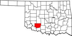 | |
| Towns | ||
| Unincorporated communities | ||
| Footnotes | ‡This populated place also has portions in an adjacent county or counties | |