Côte de La Redoute
Coordinates: 50°29′26″N 5°42′19″E / 50.49056°N 5.70528°E
| Côte de La Redoute | |
|---|---|
|
Lower slopes of the climb of La Reoute | |
| Elevation | 161 m (528 ft) |
| Location |
|
| Start | Remouchamps, Aywaille |
| Altitude | 292 m (958 ft) |
| Length | 1,650 m (5,410 ft) |
| Average gradient | 9.5 % |
| Maximum gradient | 22 % |
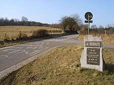

Monument at the top in memory of the French-Austrian War of 1792
The Côte de La Redoute is a climb, often included in the Liège–Bastogne–Liège cycle route. It is located in the municipality of Aywaille and its incline is 2.3 km at 7.4%. It is named after a redoubt in the battle of Sprimont, which occurred at the village of Fontin, which is located on it, in the municipality of Esneux. It also runs along an access route to autoroute E25 level with the town of Remouchamps. The region is the birthplace of cyclist Philippe Gilbert.
| Wikimedia Commons has media related to Côte de la Redoute. |
This article is issued from Wikipedia - version of the 5/19/2016. The text is available under the Creative Commons Attribution/Share Alike but additional terms may apply for the media files.