Bylong Valley

The Bylong Valley is a winding but relatively flat valley that crosses the Great Dividing Range between the Goulburn River National Park and Wollemi National Park, west of the upper Hunter Region in New South Wales, Australia.
The picturesque countryside was the site of Aboriginal and early European settlements. Traveling in this scenic valley reveals its cultural heritage as well as springing up surprises like sightings of wombats, wallabies and kangaroos—sometimes in front of your car![1]
The valley is split by a short ridge roughly one third of the way from its western end. The path across this ridge is steep and winding, and is known as Coxs Gap.
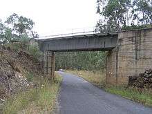
The Bylong Valley carries the Sandy Hollow railway line, which passes under Coxs Gap with a tunnel, and the Bylong Valley Way, which climbs over the ridge through the gap.
The boundary between Muswellbrook shire and the Mid-Western Regional Council area is right on the crest of Coxs Gap.
See also
References
- ↑ "The Bylong Valley Way". Muswellbrook Chamber of Commerce & Industry. Retrieved 2 March 2013.