Byaduk
| Byaduk Victoria | |
|---|---|
_-_Byaduk_-_Victoria_-_Australia.JPG) Tumuli - lava blisters | |
 Byaduk | |
| Coordinates | 37°57′S 141°58′E / 37.950°S 141.967°ECoordinates: 37°57′S 141°58′E / 37.950°S 141.967°E |
| Postcode(s) | 3301 |
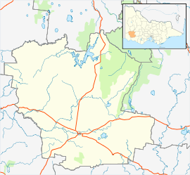
| Location | |
| LGA(s) | Shire of Southern Grampians |
| State electorate(s) | Lowan |
| Federal Division(s) | Wannon |
Byaduk is a township in the Shire of Southern Grampians in the Western District of Victoria, Australia. European settlement began around 1853 by Wendish or Sorbian Lutheran immigrants who gave it the name Neukirch after the town in Saxony.[1]
The township was settled in the early 1860s, and named Byaduk, an aboriginal word apparently meaning "stone tomahawk". The Post Office opened on 1 August 1863.[2]
The Byaduk Caves, lava tubes from the volcanic eruption of Mount Napier, are nearby. You can also see extensive views of the lava flow at Harmans Valley and the tumuli lava blisters off Old Crushers Road.
.JPG)
Sergeant Simon Fraser, 57th Battalion, (a farmer from Byaduk) is honoured by a 1998 sculpture by Peter Corlett in the Australian Memorial Park in Fromelles, France[3] and a 2008 replica at the Shrine of Remembrance in Melbourne[4] depicting him rescuing a wounded compatriot from no man's land after the Battle of Fromelles in 1916.
External links
![]() Media related to Byaduk at Wikimedia Commons
Media related to Byaduk at Wikimedia Commons
References
- ↑ Andy Falkenberg, Byaduk, archived from the original on 2009-08-06, retrieved 2008-05-23
- ↑ Premier Postal History, Post Office List, retrieved 2008-04-11
- ↑ Department of Veteran's Affairs and Board of Studies NSW - Fromelles
- ↑ McMullin, Ross (16 July 2007). "After 92 years, cobbers stand tall at the Shrine". The Age. Retrieved 2007-07-17.